Good morning. We have a couple of more days with the potential for storms across Houston, but we’re not expecting anything like the widespread, long-duration showers and thunderstorms we experienced on Wednesday. This weekend still looks quite hot and sunny, especially Sunday.
Thursday
A line of storms has fired up early this morning, but it is weakening as it moves toward the Houston metro area. Unfortunately, however, these thunderstorms could bring another quick 0.5-1 inch of rain to hard hit parts of southern Fort Bend, Matagorda, and Wharton counties. After these morning showers, the region should see a break until later this afternoon or early evening. By this point another line of storms moving out of central Texas should approach the Houston area.
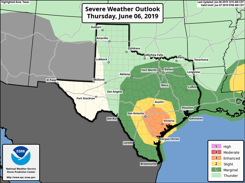
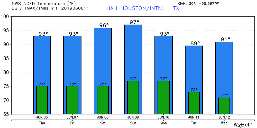
These storms may (hopefully) weaken again as they approach Houston, and NOAA’s Storm Prediction Center has highlighted an area well to the southwest of Houston as seeing an “enhanced” chance of storms. Even so, in Houston we’ll need to be on the lookout for potentially severe thunderstorms late this afternoon and into the evening hours—right around the evening commute. The biggest threat will be damaging winds and possibly some hail. Since the storms will move through fairly quickly, we don’t anticipate any significant flooding, despite our sodden soils. Highs today will be in the low 90s.

Friday
The primary atmospheric forcing for Thursday’s storms will be gone on Friday, but yet another, weaker disturbance will bring the potential for some showers and thunderstorms. With an atmosphere that’s still moist, we’ll see about a 40 percent chance of rain. Accumulations, for the most part, should be under 0.5 inches for pretty much everyone. Highs will be in the low 90s, otherwise.
Saturday and Sunday
The weekend still looks hot and sunny for Houston, as high pressure settles into the region. We are going to see high temperatures between 95 and 100 degrees, so please take care during the hottest part of the day when outdoors. It will feel a lot like August, frankly.
Monday and beyond
An upper-level system with what can be best described as a weak cool front at the surface will drag into Houston late Sunday or early Monday, and this will bring a few days of rare offshore winds during the summer months in Houston. (Typically, this only happens when the region is on the back-side of a large tropical system moving away from the area). In any case, this weak June front will moderate our temperatures, pushing highs back into the low 90s, and overnight lows in the low 70s. Days will be partly to mostly sunny, with perhaps some slight rain chances each day. Most of next week, in fact, looks quite nice for mid-June.
After following this site for the last 18 months or so, I only wish that our local news sites were as unbiased, thoughtful and accurate as Eric and Matt. I am thankful for the job you guys do so well.
“Ughust” (8th month) in early June. UGH ! ! ! ! !
For some reason, today so far the skies are unusually clear and free of clouds as if a cool front has passed, even though its summer. Any explanation of why this is happening