After a weekend of record-setting high temperatures—85 degrees on Saturday and 86 on Sunday—the region will cool down a little today, and a lot on Tuesday. The big concern, as noted my Matt, is the possibility of storms and severe weather on Tuesday afternoon.
Today
A very weak front will slowly move southward through Houston, and likely get hung up near the coast. This will create mostly cloudy conditions, and bring a chance of sprinkles to the area, but no major rainfall accumulations are likely. An easterly wind should help limit high temperatures to the mid-70s. Lows tonight will be in the mid-60s.
Tuesday
On Tuesday a stronger front will move through Houston, and with a deep source of moisture streaming in from the Gulf of Mexico we’ll likely see some rain showers and possibly some severe thunderstorms with the front. Given the setup it’s likely that most areas see 1 to 2 inches of rains from storms as the front passes through—probably between about 11am CT and 4pm CT on Tuesday. A few areas might see as much as 3 to 5 inches of rain, which could cause some street flooding problems.
(Space City Weather is sponsored this month by Darrell Lee’s The Gravitational Leap)
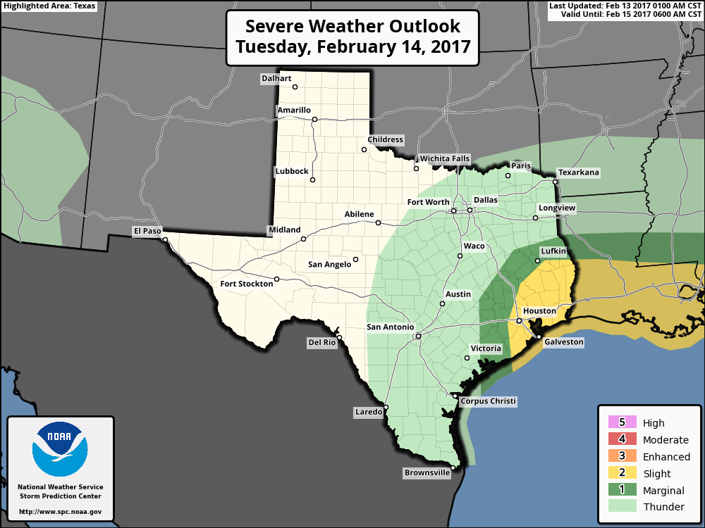
Another concern is severe weather. NOAA’s Storm Prediction Center has placed much of the central and eastern Houston metro area under a “slight” risk of severe weather on Tuesday, and this includes the possibility of damaging winds, a few weak tornadoes and perhaps even a little hail. I expect most areas will simply see a couple of hours of darkening skies, heavy rains and blowing winds, but we’ll need to keep an eye on this severe weather threat. After the front moves through storms should end during the late afternoon or early evening hours, and Houston will cool down, with temperatures falling into the upper 40s on Wednesday morning.
Wednesday and Thursday
Oh, hello, February. This is what it’s supposed to feel like at this time of year. Highs will only rise into the 60s, and overnight lows should be in the 40s for most areas, except along the coast. Skies will be mostly sunny.
Friday through the weekend
A southerly flow returns by Friday, allowing highs to gradually warm from about 70 degrees on Friday to perhaps as high as 80 degrees on Sunday. Friday and Saturday should be mostly sunny, while Sunday sees the return of clouds and decent rain chances.
Never have I had to run my A/C so often during a winter.
So, it appears this year’s winter is practically over by this Thursday once the front pass by ?
At last!! Two WHOLE DAYS of winter!!
Eric, the fact that we are in an enhanced risk zone proves I was RIGHT that we should get ready for this front just like we did for Hurricane Ike. The damage WILL be similar to a hurricane. Everyone will see some form of wind damage. And most of the city will probably be without electricity by the time the front’s through. My advice for anyone who doesn’t have to stay here—-GET OUT NOW!!!!