After a weekend which has seen two record high temperatures broken in Houston, we turn our attention to thunderstorms and the possibility of severe weather on Tuesday. There’s been some “noise” about that being a possibility, so we want to give you a quick synopsis. Eric will have the latest in the morning.
Cooler Weather to Come
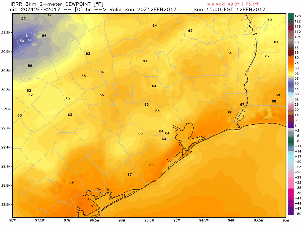
We hit 85° on Saturday, breaking the record of 82° from 1999. We exceeded that Sunday, hitting 86° and breaking the 95 year old record high of 84° from 1922. A weak cold front will push through tonight, and that will end the record warmth. This is evident when you look at dewpoints. The HRRR model below shows the higher dews getting blunted back southward as the front rolls through.
So tomorrow is a transition day. We’ll see a mix of clouds and sun, maybe a shower, and temperatures peaking in the low 70s. Meanwhile, an area of low pressure will develop in West Texas, bringing places like Lubbock (that hit 91° yesterday) a chance of snow. That becomes our weather-maker for Tuesday, bringing us rain & thunderstorms.
(Space City Weather is sponsored this month by Darrell Lee’s The Gravitational Leap)
Tuesday Severe Weather: Possible, but details still in flux
As the storm develops in West Texas tomorrow and slides eastward Tuesday, we’ll see a pretty widespread area of showers and thunderstorms come with it. Showers and perhaps some storms will be possible all morning, but they should be pretty sporadic and isolated. Not everyone will get rain. The main line of storms should get to the region by about Noon, sliding through the Greater Houston from about 12 through 4 PM.
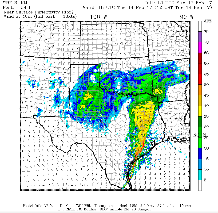
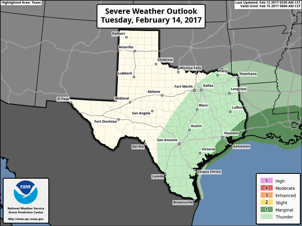
As this line of storms moves through, it will tap into near record levels of moisture and a modest amount of instability. We’ve seen setups that have looked far nastier than this one will for severe weather. But we’ve also seen setups more mediocre than this end up producing severe thunderstorms. So at this point, there is likely to be a severe weather *possibility* in and around Houston on Tuesday. It appears that the best odds will be with the best instability, which will be mainly south of about I-10. Still, there could be changes between now and then that either increase or decrease our severe weather risk. It’s nothing to worry over at this point, but you’ll want to stay weather aware on Tuesday.
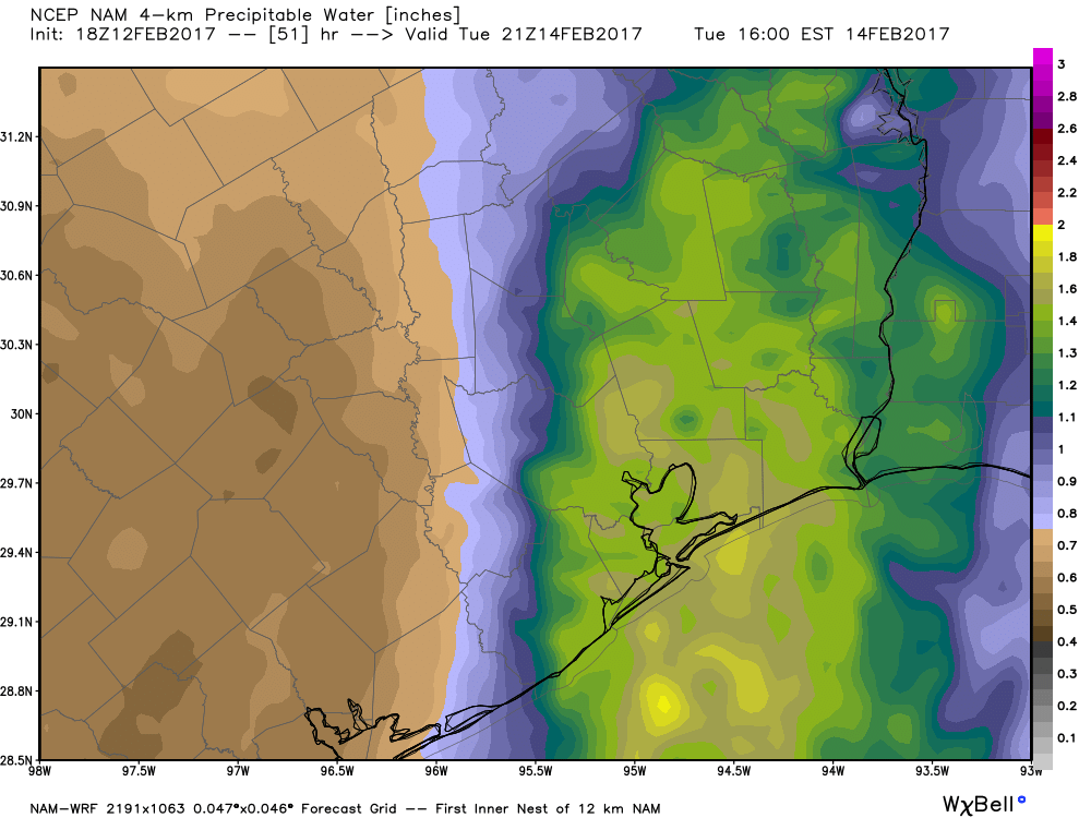
In addition to the potential for severe weather, the near record atmospheric moisture will allow for storms to be generous rain producers. While big totals aren’t likely (I’d expect 1-2″, with isolated 2-4″ totals), the rate at which the rain falls could lead to pockets of street flooding Tuesday afternoon.
The Bottom Line?
Tuesday looks like a fairly active weather day, particularly from about 11 AM through 4 PM. While widespread severe weather isn’t expected, there will certainly be the chance for some localized severe thunderstorms. Details are still a bit sketchy, so stay tuned. Areas of street flooding will be possible as storms will be able to produce torrential rainfall. Fortunately, this storm system is moving at breakneck speed, so we will see rapid improvement Tuesday evening. Eric will have the latest for you in the morning!
Posted at 5 PM Sunday by Matt
Really felt the heat on my afternoon walk this afternoon (my el-cheapo weather station said it was 87F around Ellington today). Also bad Saturday night in the gym doing interval training on the bike. I don’t think they bothered to run the A/C in the gym this weekend and the humidity was stifling even at 7 PM. I need to move somewhere where winter actually happens in moderation. This weekend was mid-summer back home.
Dallas.
Houstonians, prepare for this front same as you did for Hurricane Ike! The damage will likely be similar!
Ummm, no.
Chuckling.