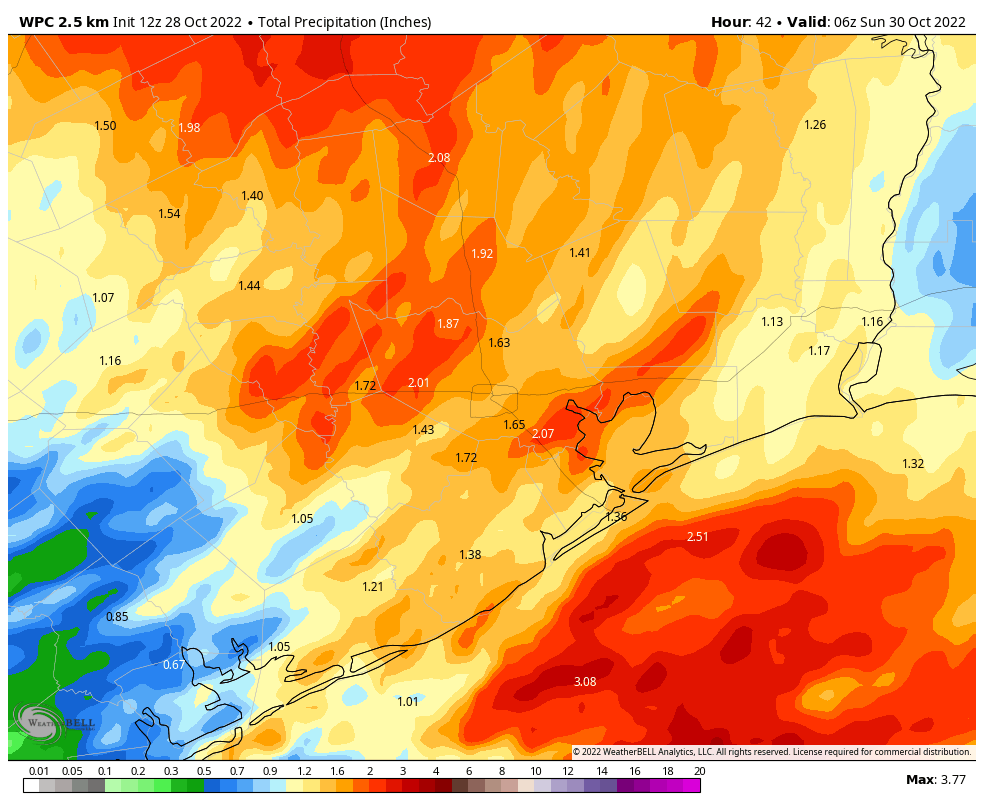
Good morning. If you live in the southern half of the Houston region, roughly along or south of Interstate 10, you already picked up about one-half inch of rain overnight. A storm system will bring a few additional waves of rain today, with the main belt of showers moving through this afternoon and early evening. The ensuing front will set the stage for several cooler and drier days. In short, after getting some much needed rainfall, fall-like weather will prevail for a while. Hard to complain about that!
Friday
This morning most (but not all) of the storm activity is offshore, and based on radar trends it looks as though these showers will remain so for now. However, the main driver of storm activity, a low pressure system in the atmosphere, is still moving toward the area so I don’t expect the largest chunk of showers and thunderstorms, some possibly severe, until late this morning and into the afternoon hours.
These storms will move from west to east across the area, with the heaviest rains likely exiting to the east by around sunset if not before. What should your expectations be? I still think most of the area will see 1 to 2 inches of rainfall, but there is still some uncertainty in that. Within stronger thunderstorms, there will be the potential for damaging winds, and a lesser chance of hail or possibly a tornado. High temperatures today are unlikely to rise above the mid-70s, with mostly cloudy skies.
If you’re traveling to the Astros game this evening, you should anticipate the possibility of some slowdowns due to weather on the way to the game, but afterward the weather should be fine except for the possibility of some lingering, light showers.
Saturday
While the showers should end on Saturday, it now looks like we’ll see cloud cover linger over the area for much of the day. This should help to limit high temperatures to about 70 degrees to go along with northwesterly winds gusting up to 20 mph. Lows on Saturday night should drop into the 50s, with partly cloudy skies.
Sunday
This will be a fine, fall weekend day with highs in the mid-70s and partly to mostly sunny skies. Winds will be light, generally from the northeast. Temperatures on Sunday night should be a degree or cooler than Saturday night.
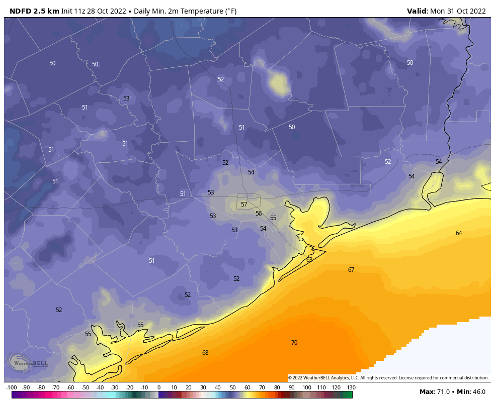
Monday
Halloween will definitely bring treats rather than tricks this year. Look for highs in the mid- to upper-70s with partly sunny skies. Expect mild conditions on Monday evening. While the potential for some rain will return during the early part of next week, at this point I think it holds off until Tuesday morning.
Next week
The rest of the week should see a warming trend, with highs getting to about 80 degrees by Friday or so. As mentioned, some light showers are possible on Tuesday and Wednesday. Some sort of front is likely to arrive by, or during the weekend, but the details of this are yet to be determined.
Hoping it passes through earlier so we can have Friday night football.
You said there was uncertainty in getting 1 to 2 inches of rain today. What does that mean no rain or more rain than predicted?
Hard to predict which areas will get more rain, hence the term uncertainty.
Thanks Eric. Go Astros!
Stop eating Meat. God Bless!
Thanks for the great forecast info…2nd to none!
What does eating meat have anything to do with weather? Wild.
Lol. Flatulent cows 🙄
lol no.
Got 1.2″ last night around 11:30 PM. Heavy rain and thunder woke me up. Surprise!
It already rained last night and in the wee hours of the morning. Scream on the Green cancelled due to the rain or threat of rain, so this is not so wonderful. And the winds that have been going every day are punishing. Less than 140 days until spring.
Just started raining hard around Ellington.
Getting dark to the North in Clear Lake.
Hopefully clearing out of the area and the system does not bring many follow up “trains”
We got 0.5″ right at about 1:00 am here in Sienna. Then another 1.7″ between 1:20 and 3:30 pm. So 2.2″ total. The second wave had a peak rate of 3″ per hour. BUT NO WIND. I will take that any day! Still getting a few dribbles. but for the most part it is past us.
That ominous blob in the Caribbean is now red on the NOAA map. Sigh……. But the weather forecasts for where we are headed say okay weather on the days we will be in port. I hope so. If not, I guess we will cruise in a big circle.