Good morning. It’s going to be a stormy day for parts of the metro region, so let’s get right to it.
This morning
A number of showers and thunderstorms have developed along a warm front that’s moved in from the coast, and this will serve as a focus of showers and thunderstorms during the morning hours for the Houston area. These storms are developing primarily to the north of Interstate 10 (along the warm front) and bringing some heavy rainfall and severe weather to Waller and Montgomery counties, and points north.
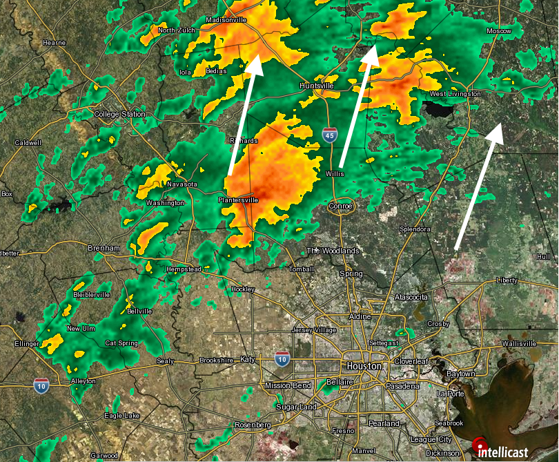
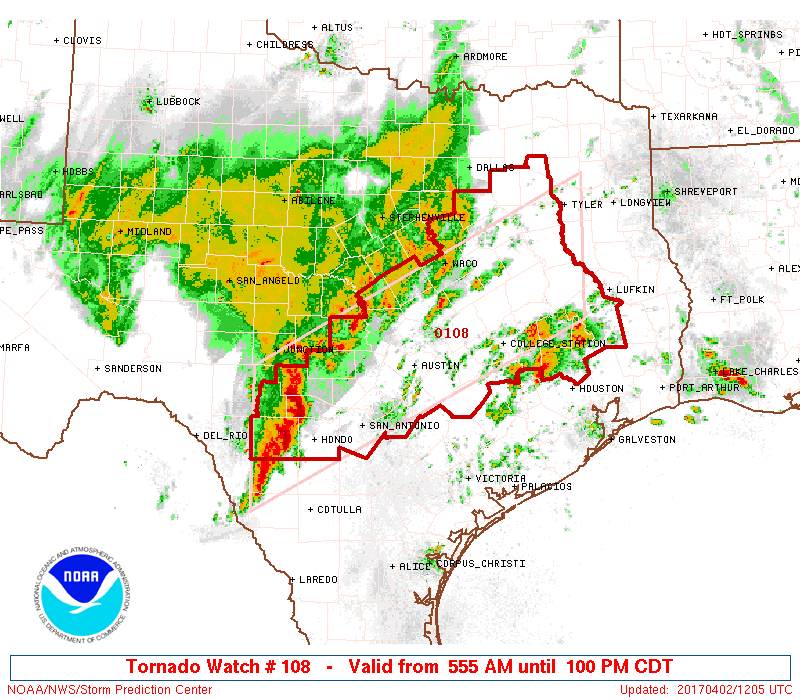
The biggest concern is instability and rotation in the atmosphere, which is favorable for the development of tornadoes. Several tornado warnings have already been issued this morning—and a tornado watch is in effect through 1pm for the northern half of the Houston metro area, as well as much of central Texas.
It is possible that most areas south of, and along Interstate 10 don’t see much rainfall this morning.
This afternoon
Meanwhile, a large cluster of storms has developed across west Texas and is now (6:55am CT) moving eastward toward Interstate 35. These storms have formed along a cold front, and this mess will move into the Houston area this afternoon. Again, it seems likely the dynamics for severe weather and heavy rains will be most favorable north of Interstate 10 later today, but we’re going to have to watch the evolution of the system closely.
We’ll update again later this morning.
Posted at 7:05am CT on Sunday by Eric
(Space City Weather is sponsored this month by The Mole, a Jonathon Price novel.)
I’m flying in from NY. Due about 9:45 pm. Will the system have moved through by then or should I reschedule?
Moved through, most likely.
In Round Rock, system just passed through 9:45 – 10:00am. Lots of wind, rain, but no hail. Big boomers but fading. Light rain. Apparently lots of power outages. Look out folks in the places Eric has warned. Sure wish I didn’t have to drive back to Houston in a few hours.
If you leave later this afternoon you’ll probably be OK. Thanks for the on-the-ground update.
Any idea of what tomorrow looks like particularly south of 1-10 in the Meyerland area? I know it’s not a perfect science, just thought I’d ask. Thank you in advance and for all you do! Lori
Tomorrow looks fine — no issues.