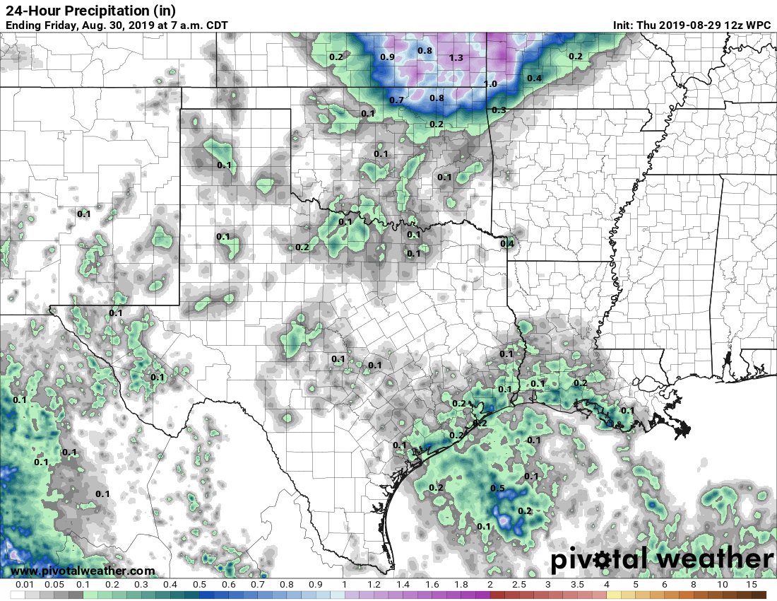
On Wednesday, for Houston’s now-daily game of rainfall roulette, the Inner Loop area of the city generally “won” the contest with 2 to 3 inches of rainfall. Meanwhile, most of the suburbs were dry, or saw only a few raindrops. This pattern will likely continue through the work week, although the intensity of storms today and Friday hopefully won’t be quite so high.
Thursday
Today will be hot and mostly sunny, with high temperatures in the mid-90s. We’ll see our usual ramp up in storm activity this afternoon, but high-resolution models indicate that storms won’t be as widespread or as intense as Wednesday. As usual, storms should wane with the loss of daytime heating, and nighttime temperatures probably won’t fall much below 80.
Friday
Another day like Thursday, although rain chances may take another step backward, with perhaps only 20 percent coverage during the afternoon and early evening hours.
Saturday and Sunday
Drier air from a dying front should make for a pretty nice—all things considered—Labor Day Weekend. Expect high temperatures in the mid-90s, with mostly sunny skies. Lows at night may get into the mid-70s for central and northern parts of the metro area, so mornings and evenings may be a smidge more pleasant than we’ve seen. Finally, rain chances will be very low.

Labor Day
Moisture levels start nudging back up, so I’m a little more bullish on Labor Day’s rain chances now, as they’re probably about 30 percent.
Later next week
Our overall weather pattern next week will be determined by the “unnamed feature” I mentioned yesterday, an atmospheric low pressure system that will be drifting westward across the Gulf of Mexico. Right now the preponderance of the models drag it southwest, toward Mexico, rather than Texas. This is due to higher pressure building over Texas. Frankly, the second half of next week looks like pick-your-poison: Potentially heavy rain from the Gulf of Mexico, or stultifying high pressure that drives temperatures back up to near 100 degrees with plenty of humidity.
Hurricane Dorian
Matt did a fine wrap-up of Hurricane Dorian on Wednesday evening, and we remain concerned about the storm’s potential to bring very severe weather to Florida, and potentially other parts of the Southeastern United States. Right now the storm is fighting some drier air to its east, but over the next two to three days it should find ideal conditions near the Bahamas to strengthen, with warm water, low wind shear, and a favorable upper atmosphere pattern. The National Hurricane Center forecasts that a strong Category 3 Hurricane will strike Florida on Monday, but frankly it could be even stronger than that.
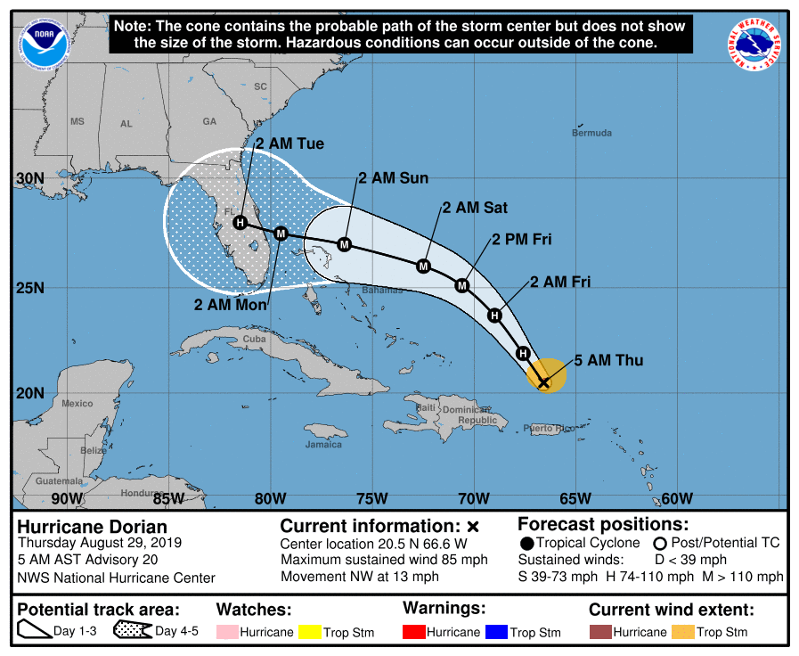
Frustratingly, there remains a wide spread in landfall locations along the Florida coast, and this is due to questions about the strength of high pressure over the Southeastern United States. Our best guess is somewhere between Fort Lauderdale and Titusville.
If you live in Florida please pay close attention to the storm, and heed any evacuation warnings. At this point, we have every reason to believe the state is going to get hit very hard by Dorian. We’ll have a Dorian-specific update this afternoon.
We’re supposed to go to Charleston Saturday and now we’re trying to decide if that’s the best idea ugh. it did not even cross my mind that our trip could be impacted by a hurricane! I should have known considering we live in Houston. Thanks for the write up!!
I have plans with a group traveling to Orlando Friday morning and driving to Princeton, FL on Saturday. Visiting Everglades National Park leaving Monday evening from Miami. I wasn’t really concerned as of yesterday afternoon, but now I am!!
I would cancel. this doesnt look good.
Thanks guys. Looks like my red roulette ball landed in black again.
Agreed with defiant Dorian. Any odds on if he hits Cat 4 or even 5? If I was in Vegas I would at least put some of my money on yes.
Is there any forseen chance that Dorian will be strong enough to pass through Florida in build back up in the gulf?
Yes, I was wondering about this to? Or will high pressure keep it away from TX?
It will not hit Texas. It is supposed to take a turn north after it makes landfall along Florida’s east coast and most models keep it inland not going into the Gulf. A few models do re-emerge over the gulf and strengthen, but they all have it quickly landing again along Florida’s west coast. Yes the models can be wrong, especially this early, but they have a better track record with stronger storms and this one appears to be one.
The latest prediction of the GFS model is that Dorian will hit Florida near Daytona beach then head north through Florida and Georgia, then head NNE along the U.S. east coast. The other good model, the ECMWF, has Dorian hitting farther south near Boca Raton, but again it’s predicted to head north through Florida and then hug the east coast.
But like Matt said in last night’s post, it’s not a bad idea to tune in once a day or so and see how these forecasts change.
What kind of rain might the low pressure system bring?
Does peak hurricane season equate to the mid-point or is there a frequency element to the term as well?
I would be interested in knowing which “model” keeps one path hitting Texas – every run……..(on the GFS ensemble – one “string” is headed straight for us!)