Good morning. As I walked outside last night it seemed like I could feel the last dry parcel of air leaving the region. I’m not sure whether Houston has experienced its last front of the spring of 2020, but we’re now in a pattern where humidity will rule the day, as it does in summer in Houston. We’ll have a couple of warm, partly sunny days before clouds and then rain chances return for Memorial Day Weekend. If you’re heading to the beach, Saturday may be your best bet.
Wednesday
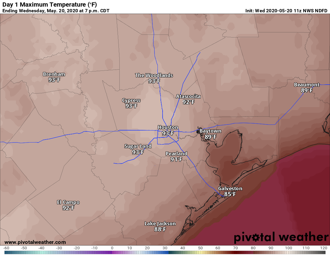
Some clouds have developed this morning across the region as moisture pools beneath a capping inversion, but skies should still clear out by around noon or shortly thereafter. This, combined with light southerly winds, should allow temperatures to reach up into the low- to mid-90s. Cloud cover will increase again overnight, preventing lows from dropping below the mid-70s for most of the Houston region.
Thursday
As high pressure moves away from the region, our weather will begin to slowly change on Thursday. This will likely mean partly sunny instead of mostly sunny skies, and high temperatures should back off slightly to perhaps around 90 degrees. We can’t entirely preclude the possibility of light showers to the northwest of Houston, but it seems unlikely to me. Clouds build again Thursday evening, making for another warm and humid night.

Friday
This should be another similar day to Thursday, with a mix of sunshine and clouds, however as the atmosphere continues to turn more unstable we may see a few scattered thunderstorms cross the region. Right now we don’t anticipate rain chances above 30 percent, so most of the region will likely remain dry.
Saturday and Sunday
Right now the model guidance remains split on the extent of rain chances for Saturday and Sunday, but the trend appears to be toward lesser accumulations below one-half inch. Effectively this likely means a pair of partly to mostly cloudy days with highs in the upper 80s to 90 degrees, with passing light to moderate showers. If you have outdoor plans, especially on Saturday, you might be in luck in terms of avoiding rainfall.
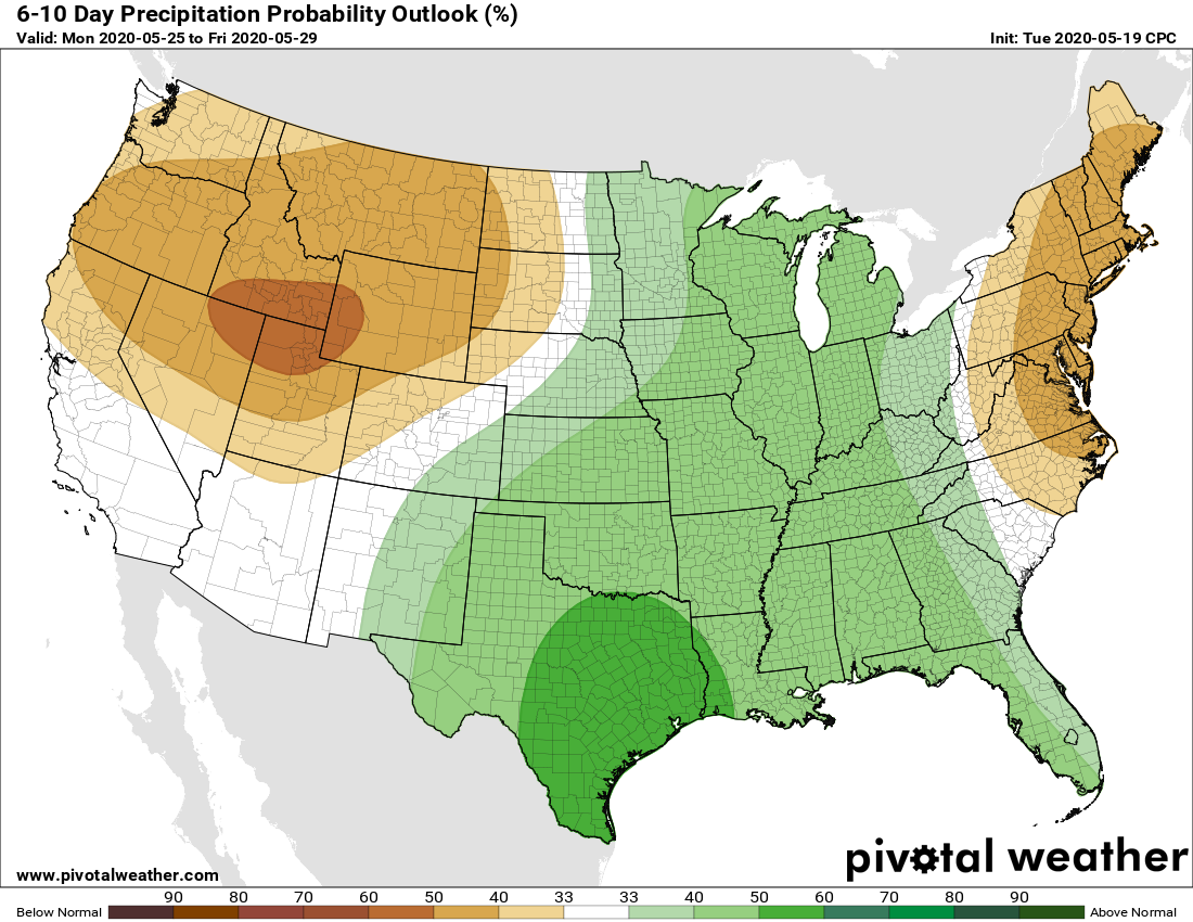
Memorial Day and beyond
Rain chances likely peak on Monday and Monday night as an upper-level low pressure system moves into Texas. We still have questions about the location of this low, so I’m not prepared to say whether higher accumulations will be over Central Texas or the Greater Houston region. The bottom line is that it’s probably going to rain in much of Texas on Memorial Day, with some areas getting perhaps 0.5 inch and others getting 2 or 3 inches. Lesser rain chances will likely linger through much of next week, although confidence in the details is low.
Is it my imagination or does it rain (and sometimes severely) every Memorial weekend?!?!
Where have you guys been all my life? I’m obsessed with all things weather and a o grateful to an equally weather obsessed friend for recommending your blog. It is outstanding! Thank you for your content.
Any possibility of a repeat of the Memorial Day floods back in 2015?
Did you read the article?