The story of this week’s weather continues to be the heat. On Monday, Houston had its warmest day in eight months. The official high of 94 degrees at Bush Intercontinental Airport was the hottest temperature since September 16, 2019. Last year, the first day of temperatures reaching 94 degrees or higher came on June 1. In any case, summer has arrived in Houston.
Tuesday
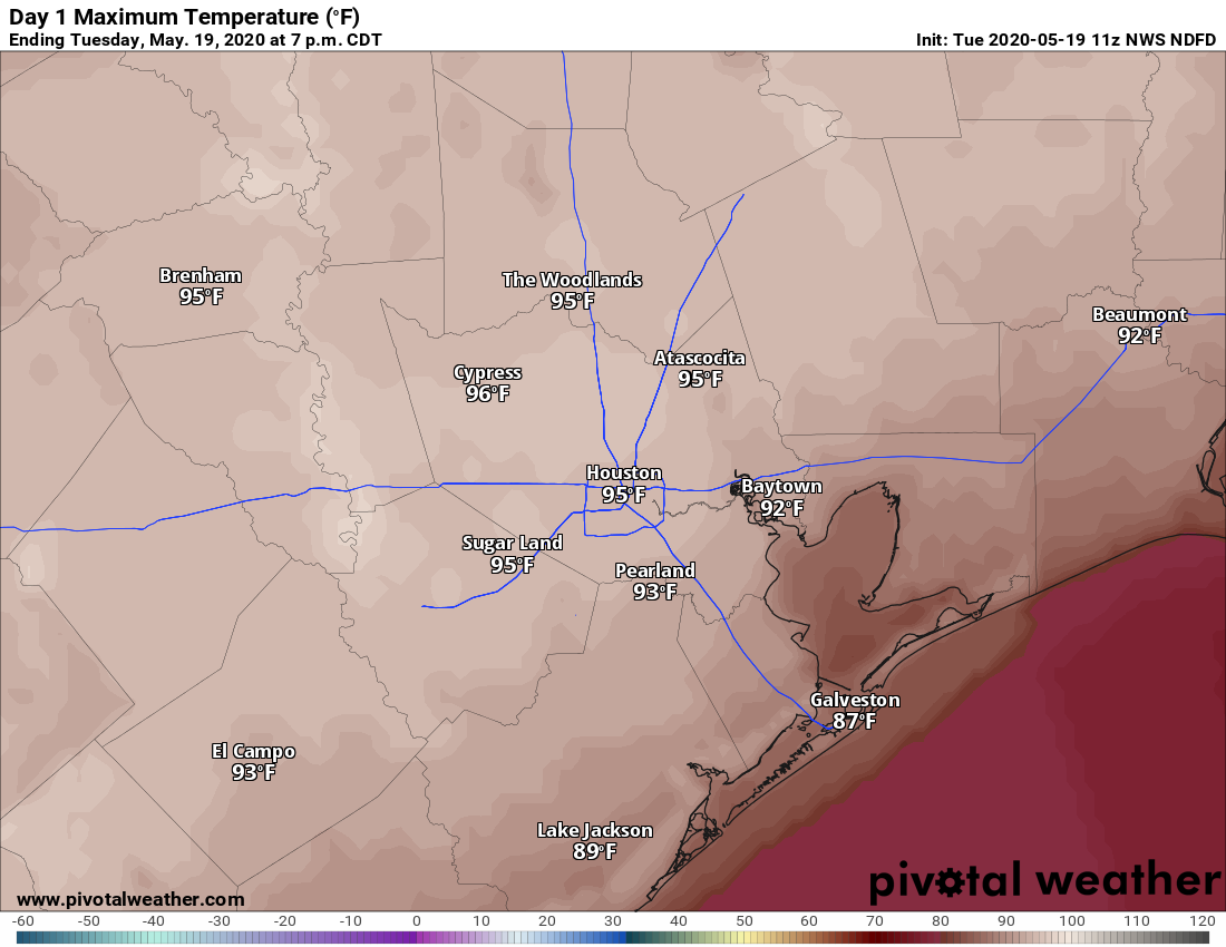
If you liked Monday’s heat you’ll love today. With high pressure still firmly in place, and mostly sunny skies, we can expect highs to top Monday by a few degrees. ( The record high temperature for May 19 in Houston is 95 degrees.) Humidity levels remain a bit lower than normal, and while this will help the air heat up faster, the slightly drier air will also help rein in the heat index this afternoon.
As hot as temperatures will be today—and we’ll be running a good 8 to 10 degrees above “normal” highs on Tuesday—there should be just enough dry air hanging around to make for a pleasant evening as the sun goes down. Low temperatures tonight should drop into the low 70s.
Wednesday
As winds shift from the southwest to the south, we’re going to see the formation of some clouds on Tuesday night, and some of these should linger into Wednesday. This will also mark the return of more characteristic humidity for Houston, and this in turn should limit highs into the low- to mid-90s.

Thursday
This probably will be the last of our partly to mostly sunny weather for the week, with another warm day allowing highs to climb at least into the low 90s. However, change will be on the way with high pressure moving away from the area and a potentially wetter pattern setting up for Memorial Day Weekend.
Friday and Saturday
Both of these days should see a mix of sunshine and clouds, and this will allow high temperatures to reach around 90 degrees. Decent rain chances move into the region later on Friday (probably around 40 percent) and will linger into Saturday. Right now, these storms look to be scattered and not too intense. Overnight lows will be steamy, in the mid-70s.

Sunday and Monday
The second half of Memorial Day weekend will probably see somewhat better rain chances as a low pressure system gets cut off from the jet stream over Texas. This probably will lead to several days of partly to mostly cloudy weather, with the potential for some heavier rainfall. However, right now odds are that these storms will not be as intense as those the region experienced last Friday and Saturday. In any case, if you’re planning outdoor activities for Sunday and Monday, be prepared for the possibility of showers and thunderstorms.