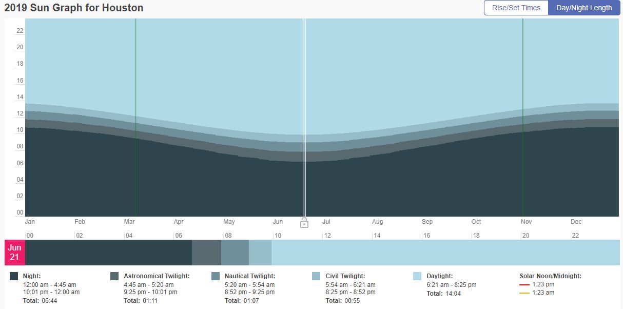
Congratulations, Houston. We’ve reached the longest day of the year—14 hours, 3 minutes, and 30 seconds. From this point on, days will very slowly get shorter as the Northern Hemisphere begins to tilt away from the Sun. In six months, our day length will be just 10 hours, 14 minutes, and 3 seconds.
Of course Houston doesn’t reach the peak of summer for another five weeks, with the warmest period typically coming from late July through the first half of August. This is due in large part to weather patterns, and a lag in heating of the Gulf of Mexico, which always modifies our region’s weather when the winds are blowing onshore (cooling us during this time of year, and warming us in the winter). Bottom line? We’ve begun the march toward fall, but it’s still a long, long ways away.
Friday
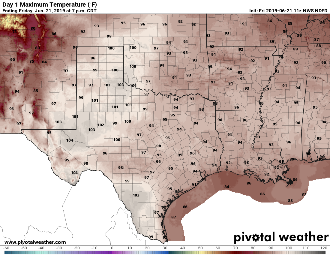
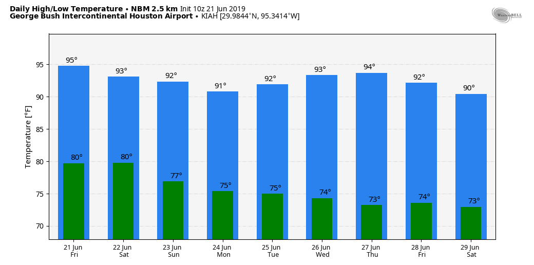
Speaking of summer, we’ll feel it today, with highs in the mid-90s and high humidity pushing the heat index into “heat advisory” levels out there. With partly sunny skies, please avoid being outdoors during the middle of the day if possible. Temperatures tonight will not cool much, only falling to around 80 degrees.

Saturday
This day should be a lot like Friday, albeit perhaps just slightly cooler. Effectively, that won’t mean much with more partly sunny skies. Rain chances aren’t zero, but they’re probably only 10 to 20 percent, and any showers that do develop will likely be fleeting.
Sunday, Monday, and Tuesday
A reprieve from the really hot weather should arrive by Sunday, as high pressure retreats and moisture levels rise high enough such that it won’t take too much a spark to generate showers. Rain chances—at least the potential for heavy rain—will probably peak from Sunday night through Monday, but overall I’m not particularly concerned about this period from a flooding perspective. Most of the region will probably get 0.25 to 0.75 inches of rain (with a full bullseyes of 1-2 inches, probably) through Tuesday. Rain chances are probably a bit better for inland areas north of Interstate 10. Clouds and intermittent rain showers should limit highs to the 90 to 93 degree range, for the most part.
Wednesday and beyond
The middle of next week should see the return of mostly sunny days, and highs in the mid-90s.
🙂 Since “UGHust” seems to have arrived early, what will we be dealing with 5-6 weeks from now?
Yikes! 🙂
The 90 day grind until the autumnal equinox. Arguably, the worst time of year here from a runner’s standpoint and with regards to tropical storm season. I’ll take fewer daylight hours knowing that it brings us ever closer to some modicum of relief in time. Summer lovers, have at it…and you can take my share as well. Now onward as the earth fulfills its obligation of obliquity.
Taking a walk this morning was like slogging through water. Awful. The plants sure look good though.
This morning’s walk was rough.
I agree, this morning’s walk was rough..
“Autumn is coming….”
This is great, Eric. I really appreciate the time and effort you and Matt put into providing context around our daily forecasts. Thank you!
(Also note a typo above under Friday: “head” advisory.)
That’s not a typo. “Head advisory”: you should have your head examined if you venture into the high heat and higher humidity without a very good reason.
Well, for those of us losing our hair, there definitely is a head advisory in this sun as well.
Nah…. that’s what he meant. You’d be out of your head to go outside. 😂
Lows in the 80s should be illegal. I’m writing my congressman.
It’s also no fun for those of us who need to don a hard hat and flame-retardant overalls and head outside for work. You think those things would have some sort of glycol cooling system by now…
Agreed – we really need to get to work on addressing climate change, or lows will eventually be in the 90s.
Please let’s not make this a “political” discussion. There’s enough of that on the web already.
I am interested in being informed of potential weather threats RIGHT NOW, such as heat and freeze advisories, tropical storms and hurricanes in the Gulf, 3+ inch per hour thunderstorms, etc., all of which have been occurring well before the deadly Galveston hurricane in 1900 that killed 6,000 to 8,000 in a few hours, because there was NO tracking system back then,
very depressing to see that everyone is already starting autumn. No matter what people say, there will be more people out when it is 95 vs when it is 45 or even 55.
Which I’ll never understand, but good for them…
I’m definitely not out in this weather. Give me 45-55 any day.
Agreed. I’ll take 45 over 95 any day. You can always put on a jacket. There are legal and (even sooner) aesthetic limits to what you can take off.
🙂 So what you’re saying is the refineries and petrochem complexes have rules against a
Gene Kelly-esque “I’m singing in the rain” (cooling tower mist) in one’s “birthday suit?” 🙂
“warmest period typically coming from late July through the first half of August”
Wait, just the first half of August? I’d have guessed that the ‘warmest period’ would’ve run through the beginning of September at least.
Eric,
Can I get your opinion on the African dust cloud situation? How big of an impact is it having on our area currently? My 9 year old son has had pneumonia for about a week and someone mentioned that it could be due to particles being blown in. Just curious if our area is currently experiencing the effects of this.
I have not seen an updates since Friday. Did something change?