After taking a look at some the latest model guidance here’s an updated look at what to expect on Tuesday and Wednesday, which likely will be the worst times for storm activity in the greater Houston metro area.
TUESDAY
Right now I anticipate light to moderate rainfall on Tuesday afternoon, with most areas seeing between 0 and 1 inch of rain. There should not be too much trouble with the commute home on Tuesday evening. At some point between 6 p.m. and midnight we’ll see an increase in rain showers. Here’s why:
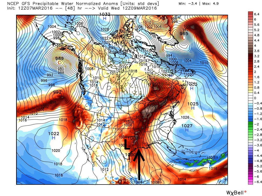
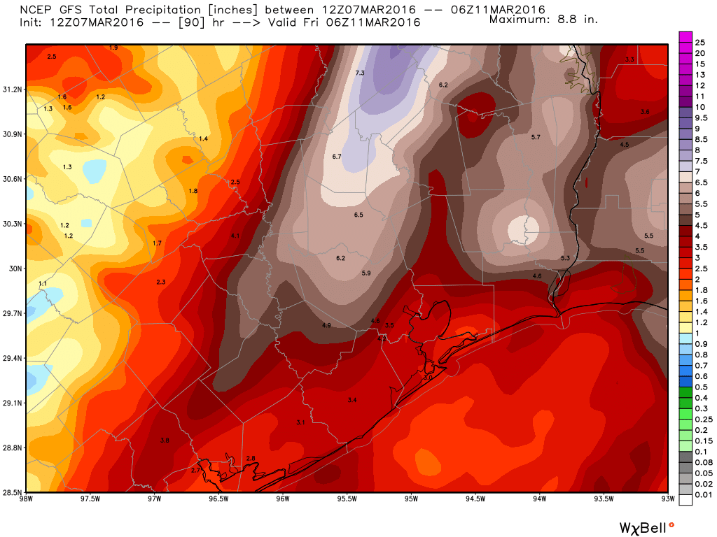
The bottom line is that the Houston area will see near record moisture levels beginning Tuesday evening. I still think the heaviest rain will come between just before midnight on Tuesday night, running through at least the mid-morning hours on Wednesday. Some models are suggesting a few parts of the region could see as much as 4 to 8 inches of rain during this time frame, with lesser amounts for widespread areas. At this time I do not see these rain storms matching the intensity of the Memorial Day rain event in Houston, but with these kinds of moisture levels we can’t be certain of that.
The other concern is the potential for damaging winds and even tornadoes. However it looks like the most favorable conditions for this severe weather will be to the west of Houston. I continue to believe our biggest threat will come from heavy rains.
WEDNESDAY
By the middle of Wednesday some of the forecast models show a worked over atmosphere beginning to dry out, but the European model keeps the rain train going through Thursday morning. This is something we’ll have to watch closely because of the potential for flooding once Tuesday night’s rains soak the ground.
Matt and I will continue to remain on top of this.
Posted at 1:15 pm CT on Monday.
Excellent thanks for the update.
Da’ best!
Thanks!
The best weather reports in Houston… Thank you so much and so glad I found this site.
Tell a friend!
Thanks Eric. The best weather report in Houston!
When I talk about the weather in Houston, the odds are very high that I will refer to this site.