In brief: Tropical Storm Bertha is slowly beginning to weaken this morning, with most of the modest rain from it likely to occur well south of Houston. In the meantime, heat is the story with 100s likely in Houston today, followed by scattered evening thunderstorms (not associated with Bertha). Rain chances are mainly south and near the coast tomorrow and diminish over the weekend, along with less hot weather.
Tropical Storm Bertha
Bertha is struggling this morning.
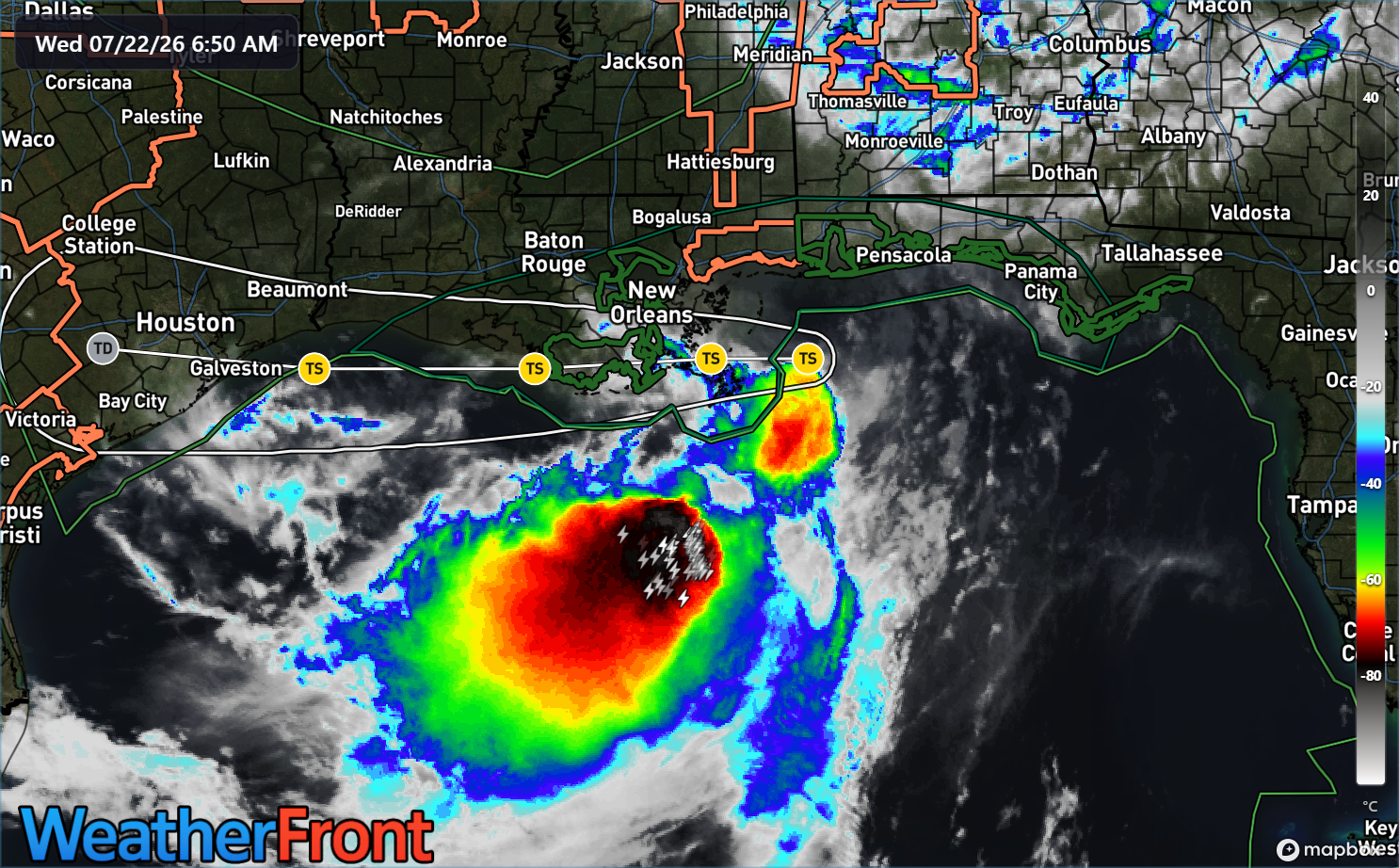
The maximum winds have dropped back from 60 to 50 mph. The center is very close to the Louisiana coast, and all of Bertha’s thunderstorms remain offshore. Over the next couple days, Bertha should hug the coast and weaken further. Tropical Storm Watches are now posted on the immediate coast, which is what you would expect in this situation. Models are a bit split on Bertha’s future track, which ranges from the coastal hug to perhaps 100-200 miles offshore.
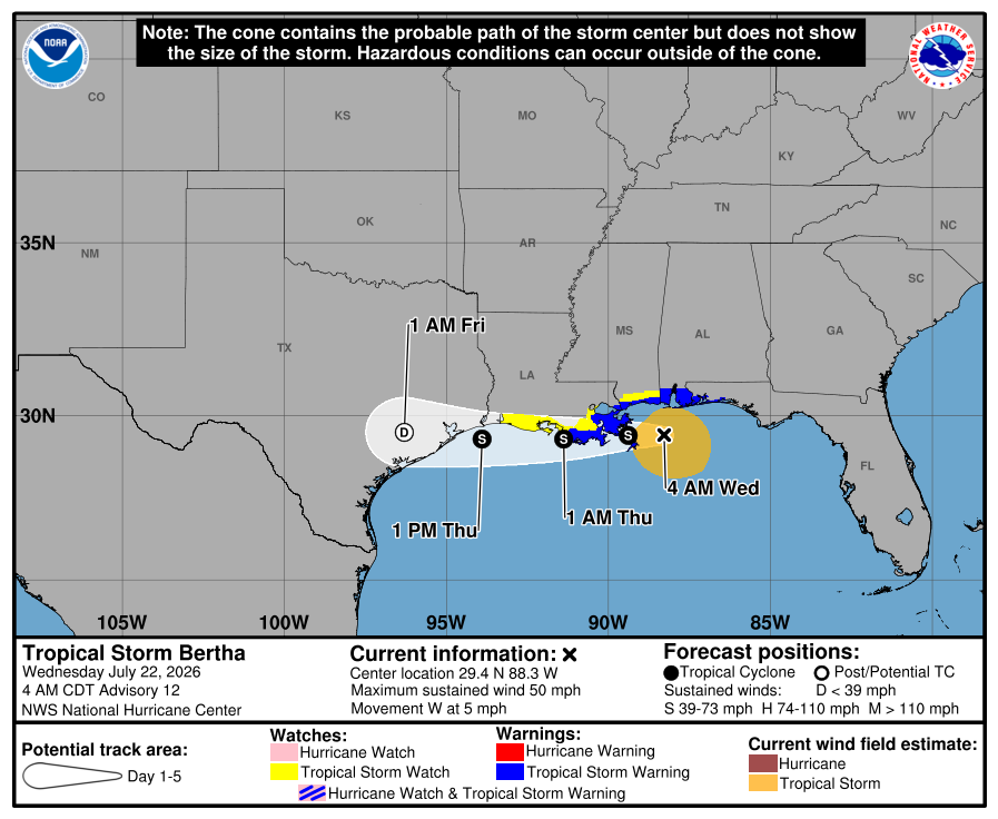
The models are in very good agreement, however on Bertha continuing to weaken, regardless of whether the track is nearshore or offshore.
So wind is not a concern for us. The next question becomes rain. Most of the “core” rain from Bertha is displaced south of the storm’s center, so if you assume the track roughly follows I-10 or just south, most of that rain should continue to press toward the middle or lower Texas coast, or from about Freeport through Corpus Christi. That would actually be a good thing for the most part, as those areas have seen relatively less rain than other parts of the state.
For Houston, it will mean scattered thunderstorms at times, which we will discuss below.
Just as a note, I’ve seen comments on social media about, “Well, Allison. And Harvey was downplayed!” This is neither of those storms. Bertha will have neither the environment, the time, or the space to organize as Harvey did. And unlike an Allison or an Imelda, Bertha’s core is going to end up on the Pacific side of Mexico by later this weekend. In other words, it keeps moving. And for those concerned about Hill Country, there is currently no rain forecast over the next 5 days there. We get the anxiety, but we also want you to understand that this is not expected to cause significant problems.
The heat!
Houston fell a tick short of our first 100 degree day yesterday, topping out at 99 degrees. A few isolated spots in the area did trip the 100 wire. Today should be the day, however. Temperatures are 3 degrees warmer this morning than they were yesterday. Northeasterly flow on the west side of Bertha will help give temperatures a jolt as well.
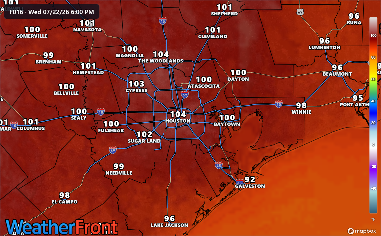
Today is one of those days where it’s highly recommended to take it easy during the peak heat parts of the day. Temperatures should ease back a little bit tomorrow. Today has “hottest day of summer” vibes, though August is still to come so I won’t make a bold prediction. As always, our partners at Reliant have some good energy usage tips today.
A Message from Reliant
With Houston hitting 100 degrees, Reliant is sharing simple, cost-conscious tips to help Texans manage their energy use efficiently without sacrificing comfort. Here are the top three actionable tips to cut costs, stay cool and conserve energy:
- Follow the “four-by-four” principle. Set your thermostat four degrees higher when you’re away from home for more than four hours to reduce electricity usage and costs.
- Avoid using heat-producing appliances like the clothes dryer, dishwasher or oven during the hottest times of day. The most ideal time to run those is in the early morning.
- Close blinds and shades on sunny days to prevent heat buildup and get the most out of the cool air coming from the AC.
More energy-saving and conservation tips from Reliant can be found here!
As always, thank you to Reliant for sponsoring our site and being such good partners with us over the years.
Temperatures will be in the mid to upper 90s tomorrow through Sunday (much cooler near the coast tomorrow) and then perhaps push 100 degrees again next week.
Rain chances
Let’s jump into storm chances real quick, with Bertha approaching.
Today
First off, today’s storm chances will not be from the outer bands of Bertha. With northeast flow kicking up, there is a weak “backdoor” boundary coming out of Louisiana and into southeast Texas. As this encounters the extremely hot weather over the area, it is likely a smattering of thunderstorms will bulk up, moving northeast to southwest across the Houston area this evening.
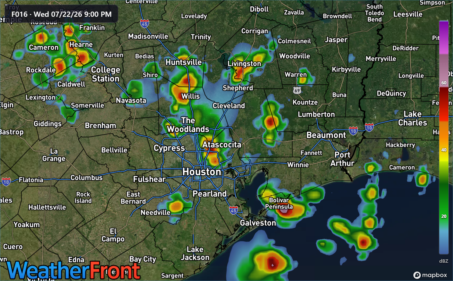
Northeast to southwest moving storms like this in the Houston area have a bit of a unique “personality” to them. They tend to be later bloomers. They tend to hold their intensity into the evening hours after sunset. And they can be locally strong. Storms may continue past midnight along the coast or well south of Houston.
Thursday
Tomorrow’s storm chances will probably be near the coast mostly, as Bertha’s southern flank approaches. This is where we could see some locally heavy downpours or just a steady rain, from Galveston through Matagorda Bay. The heaviest rain tomorrow and tomorrow night may go in south of Freeport. Rain totals are expected to be perhaps up to an inch on the coast, less inland and 1 to 3 inches south of Freeport.
Friday through Sunday
At this point, nothing worse than a few isolated storms are possible Friday into the weekend.
At this point, we don’t believe we’ll issue a Stage 1 or 2 flood alert, but we’ll keep an eye on things and adjust that posture if need be.
