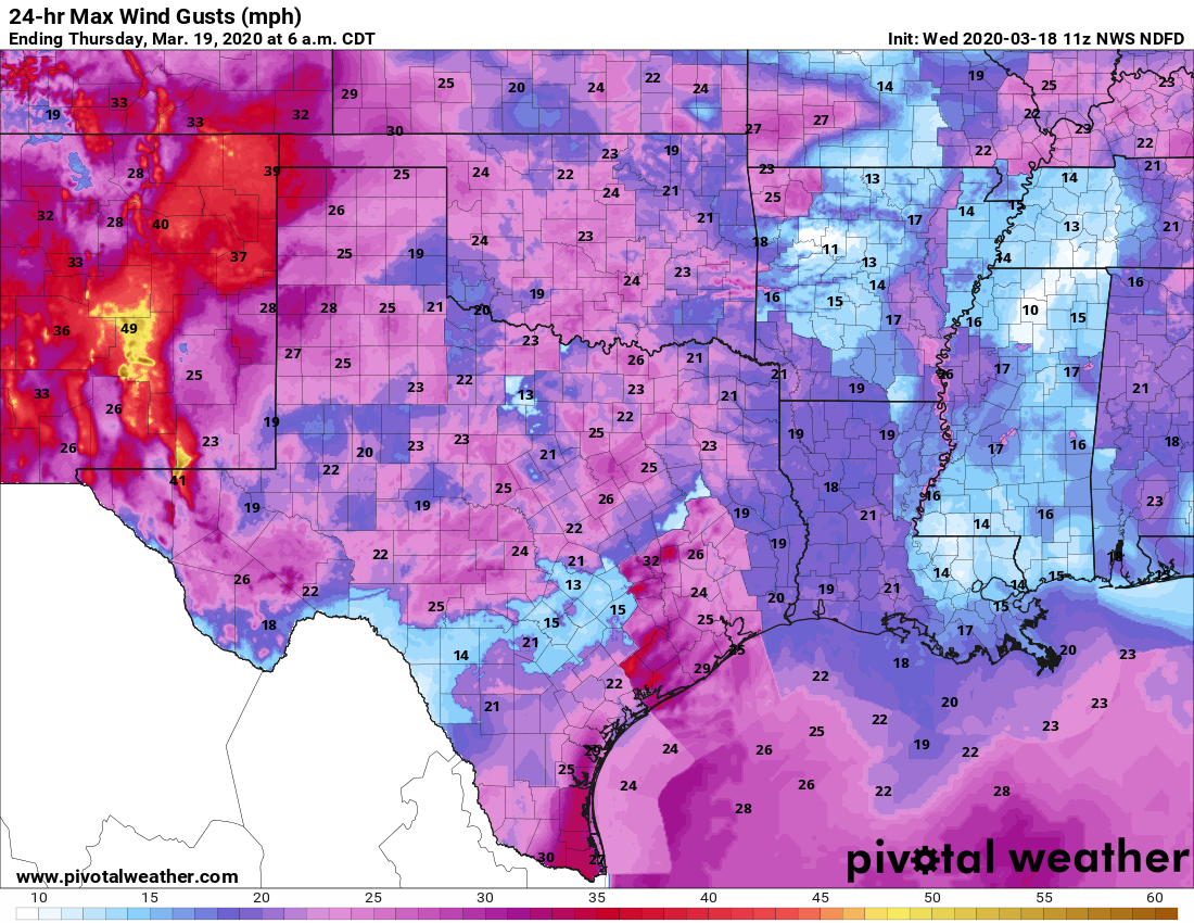
Oh, hey, look at this—another warm and humid morning in the middle of March. Temperatures across much of the region on Wednesday morning have not fallen below 70 degrees. We’ll have a couple more days in this pattern before a front arrives to bring some cooler weather along with some much needed rainfall. This rain, along with some wind gusts of 30 mph or higher on Friday, should help with the region’s still extremely high tree pollen.
Wednesday
Highs will go back up to about 80 degrees today, although afternoon temperatures will depend upon the extent of sunshine. Like on Tuesday, when we saw some welcome breaks in the clouds, we may see some sun amidst the gray skies today. One noticeable difference will be winds, which may gust up to 25 mph this afternoon. There will be a slight chance of overnight showers as temperatures fall to around 70 degrees.
Thursday
In all honesty, Thursday’s forecast is pretty much a carbon copy of Wednesday. A capping inversion should again act to limit any showers and thunderstorms as highs again reach about 80 degrees for the region.

Friday
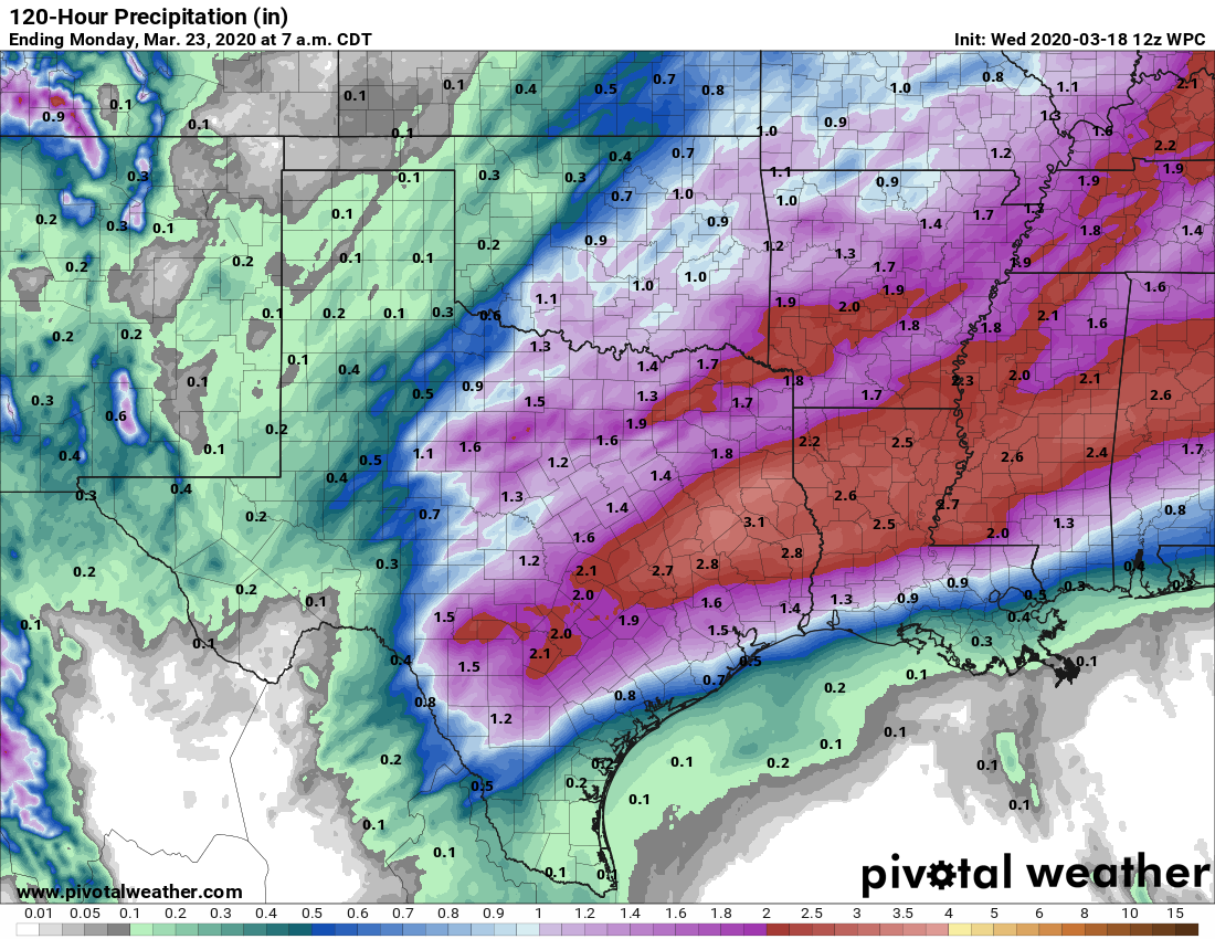
This day begins a lot like Thursday, but a cold front should reach Houston by the afternoon hours, and push off the coast during the evening hours. Much of the rainfall is likely to occur out ahead of the front, especially in places like Waller and Montgomery counties where some locations should see 1 to 2 inches of rain on Friday during the morning and early afternoon hours. In any case, the higher rainfall totals will almost certainly come north of Interstate 10.
Saturday and Sunday
The front should knock lows on Saturday morning into the 50s, and keep highs in the 60s. Some rainfall is possible during the daytime Saturday, but at this point I think the better rain chances will probably comes Saturday night and Sunday, when an atmospheric disturbance brings another shot of precipitation. This time areas south of Interstate 10 should get in on the action as well (see map above). Highs Sunday will get up to around 70.
Next week
After this weekend’s front, temperatures will be back on the upswing, with highs well into the 80s next week and perhaps some sunnier skies. Rainfall chances fall way back after Monday—at least that’s the way it looks for now.
So what you’re saying is that spring has been cancelled and replaced with Summer: The Prequel, yeah?
Yes!!! Rain!! Please, please and pretty Please!!!
I for one have grown quite weary of all the capping inversions that have deprived most of the area of much needed rain.
Will the winds gusting today serve to help get rid of the really bad pollen we have right now, or spread it and make it even worse?
Two words for the rain…bring it
Rain, please rain…we need it!
Hot. Muggy. No rain. Tree knotty discharge stuff everywhere. Welcome to hell