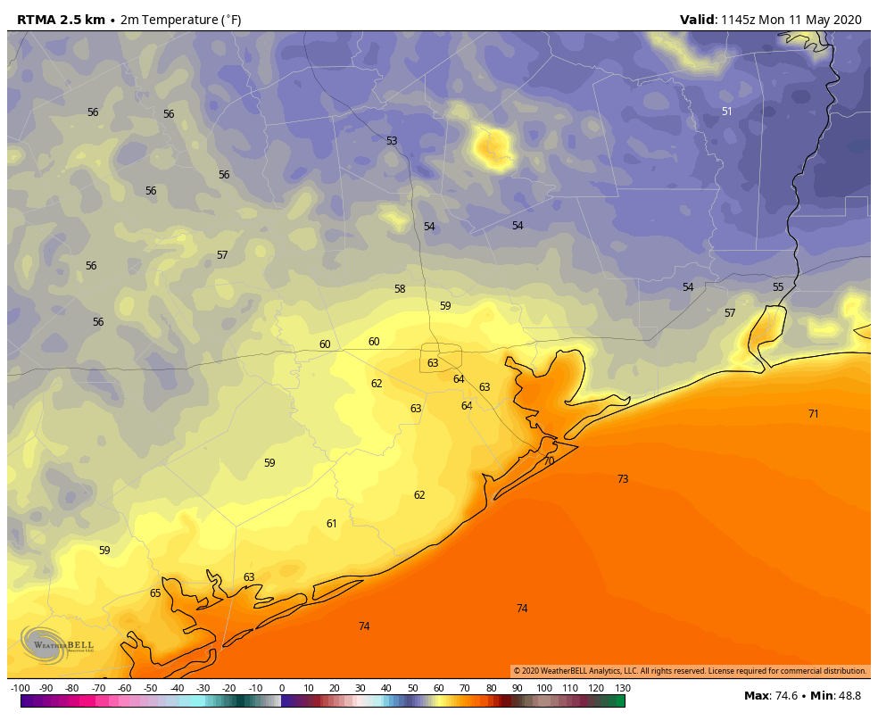
Good morning. It’s another cool start to the day—for May, at least—with lows dropping into the upper 50s for the northern half of the region. I hate to write this, but this is probably much of the region’s last flirtation with the 50s for at least four months. After this weekend’s sublime weather we’re not going to jump into full-blown summer this week, but we definitely will see humidity, warmer days, and warmer nights. In short, it will feel a lot like May.
Monday
As high pressure moves away from the region today, winds will shift to come from offshore, and this will begin the process of raising humidity levels and temperatures this week. Even so, Monday should still be quite a nice day, with highs limited to the low- to mid-80s and partly to mostly sunny skies. Rain chances are near zero. Winds should remain light as they come from the southeast. Clouds will build later this afternoon, or during the evening, making for a mostly cloudy night. Lows in the coastal area probably won’t drop below 70 degrees, but inland areas should see the 60s.
Tuesday
We should see a mix of clouds and sunshine on Tuesday, as high temperatures nudge up into the mid-80s. An atmospheric disturbance will traverse the area from west to east later on Tuesday, bringing a slight chance of showers and thunderstorms during the afternoon. But mostly this should be a typical late-spring day with highs in the mid-80s, and lows dropping to around 70 degrees.

Wednesday
Skies should be partly to mostly sunny on Wednesday, with high temperatures pushing up into the mid- to upper-80s. Lows will be in the 70s.
Thursday and Friday
These two days will start to feel more like summer, with partly sunny skies, and highs in the upper 80s to possibly 90 degrees. As we often seen during the summer months, the sea breeze may initiate some showers during the afternoon or early evening hours. But for now rain chances appear to fall somewhere in the 20 to 30 percent range.
Next weekend and beyond
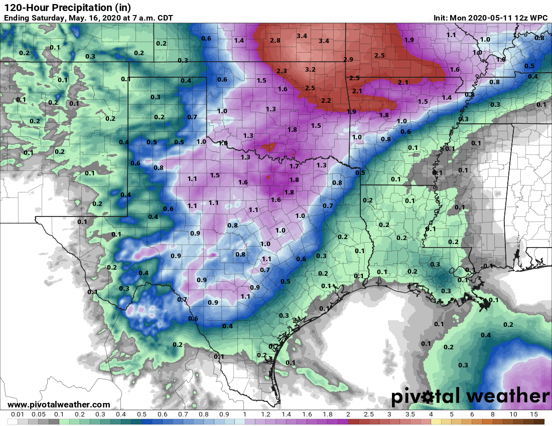
Sorry to say, but the forecast for next weekend is not yet clear. Some potentially unsettled weather will likely be rolling off the Rocky Mountains and headed for the central or southern United States, but the extent to which is will affect our region is hard to pin down. For now the safest forecast is probably to predict highs in the upper 80s with moderately better chances of rain. But the model guidance is pretty split as to whether the higher likelihood of rain will come on Saturday, Sunday, or Monday. Bottom line? Some rain is more likely than not on at least one day, but we can’t say how much.
Mother’s Day was spectacular. Nature surely gave our mothers a treat.
But I wouldn’t mind some rain in my little patch of Texas. I’m fairly certain that you have mentioned that some of us are in a drought already.
One of our local stations – not naming, but it was a single digit one – send out a message this aft warning about potentially HEAVY RAIN on Friday, with areas up north maybe getting 6”. Said was due to us being between two jet streams.
What say you?