Good morning. Temperatures this morning have only fallen to around 70 degrees, markedly warmer than recent days. However, the ascent of our daytime temperatures will be slowed this week—we should stay comfortably in the 80s rather than going up to 90 degrees—by decent rain chances and the possibility of storms. A fairly potent upper-level low pressure system could bring heavy rainfall to the region this weekend, but unfortunately we’re lacking details for a more precise forecast.
Tuesday
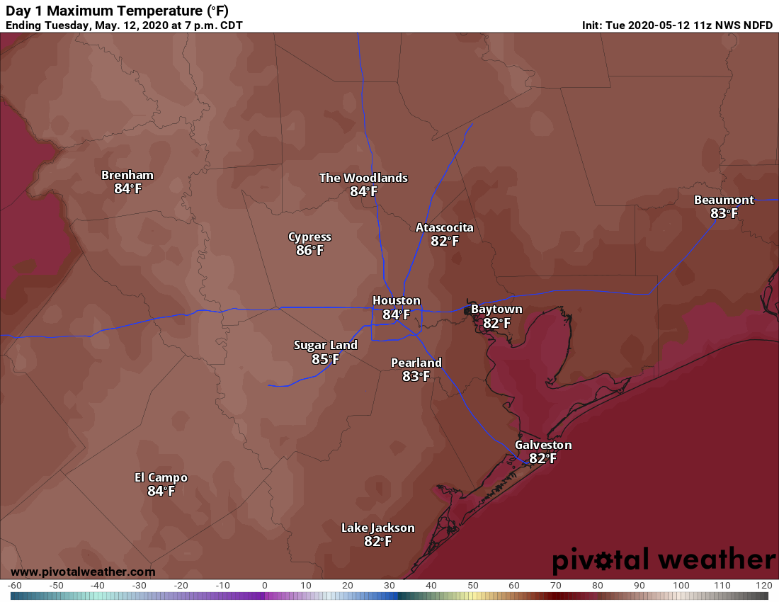
A line of storms just west of Interstate 35 this morning should steadily move west toward Houston today. The question is how much moisture they will have to work with as they move into our region. Rain chances this afternoon appear best to the west and northwest of Houston, in areas such as Sealy, College Station, and Brenham. But I think it’s definitely possible that some of these storms hold together as they move into the Houston area later this afternoon or during the evening. Briefly heavy rain and strong wind gusts will be possible. Rain chances for the region will be on the order of 20 to 30 percent. High temperatures should climb into the mid-80s under partly to mostly sunny skies.
Wednesday
Right now Wednesday appears to be similar in nature to Tuesday, although any afternoon storms that fire up will likely be less organized. Expect highs in the mid-80s, with partly to mostly sunny skies.

Thursday and Friday
Both of these days should see partly sunny skies, with highs in the mid- to upper-80s. With pretty healthy moisture levels both days should produce at least a 30 percent chance of rain as the sea breeze migrates inland during the afternoon hours.
Saturday and Sunday
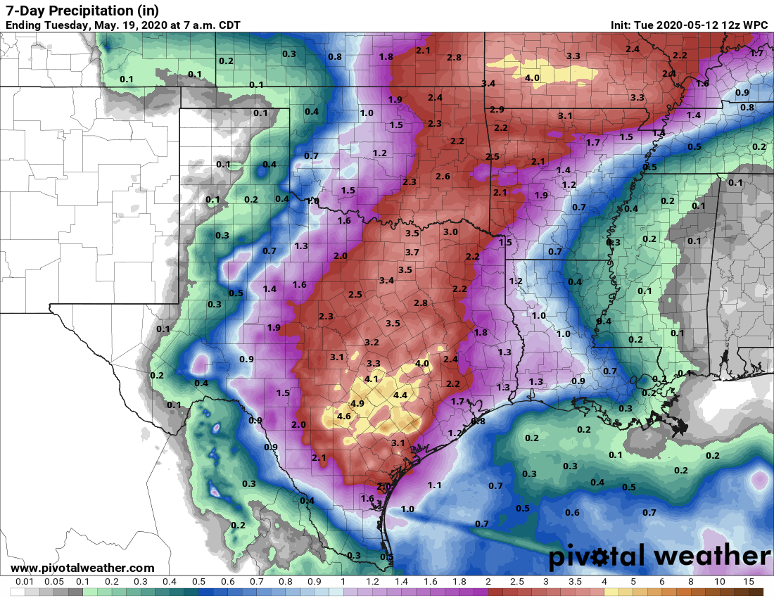
By this weekend some forecast models are forecasting a pattern more favorable for heavy rainfall as an upper-level low pressure system sinks down into Texas and sort of wanders around. Right now the axis for heavier rain appears to be centered over Central Texas rather than the Houston region, but that could change, and even on the periphery we’re still likely to see some pretty healthy rain chances. Bottom line: Saturday and Sunday should produce plenty of clouds, keeping highs in the low- to mid-80s. At this point I’d say the region has a chance to pick up anywhere from 1 inch to 5 inches of rainfall. Obviously we’ll try to refine this the closer we get to the weekend.
Next week
After the upper low exits the region, we will probably see more typical weather for May next week, with highs in the upper 80s and sea breeze driven showers. We shall see.
From a daily reader……..just checking my geography, a line of storms West of I35 moving West toward Houston. How can that be.
Since the earth’s (roughly) a sphere, heading west from I-35 means the storms would get to Houston eventually. It’s just the long way around!
I think we all saw the error but knew what he meant, so I’ll point that out since y’all did
Will we be impacted by that tropical disturbance off the coast of Florida? And can we start getting those updates?