In brief: We are issuing a Stage 1 flood alert for Saturday due to the possibility of slow moving storms capable of producing rainfall rates of 1 to 2 inches per hour. Activity should wane this evening, with less coverage on Sunday.
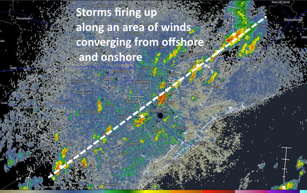
After a fairly quiet start to the day, we are seeing storms firing up along an area of convergent winds near the coast. At 11 am CT these storms have formed roughly along a line from Bay City to Pearland to Clear lake to Baytown. The heaviest of these storms may briefly produce rainfall rates of 1 to 2 inches per hour.
So what will happen during the rest of today? Our high resolution modeling guidance has not been, to put it politely, great. But given the high levels of precipitable water (well above 2 inches for most of the region) we are now leaning toward a fairly active day today in terms of showers and thunderstorms. Some parts of the metro area will get hit, while others just hear distant thunder. Because some of this activity may be slow-moving, we are going to issue a Stage 1 flood alert through this evening, which indicates the possibility of street flooding.
Creeks and bayous across the Houston region are generally in good condition, so we don’t expect more than nuisance flooding (that is, streets, feeder roads, etc) for today. But this activity could definitely put a damper on outdoor activities. Beyond heavy rainfall there is the threat of thunder and lightning, but no real indication of severe weather such as damaging winds or hail.
Our expectation is that storm activity will begin to wane this evening and then should die off overnight. Rain chances should be lower on Sunday, probably in the vicinity of 20 percent. Rain chances next week will be near zero, with sunny skies and highs in the mid-90s (at least) as high pressure asserts control. So if you’re tired of the rain, its end is at hand. Just not quite yet.
