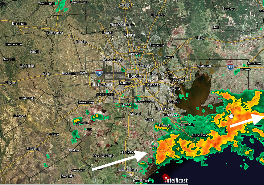
Good morning. For part of the Houston area it’s been a stormy night, from Conroe northward late Sunday night, and from Pearland southward to Galveston early this morning (a coastal flood advisory is in effect until 11am CT). More than 2 inches of rain have fallen on the island during the overnight hours. Fortunately for most of Harris County, including the western parts of the metro region, we’ve seen scant rain during the overnight hours.
TODAY
Change is on the way. For the rest of the morning, with a moist airmass in place, we’ll see the continued threat of showers and thunderstorms across the area. However a merciful cold front should finally move through later today, and we should see an end to the heavy rain threat by around noon or shortly thereafter. Between sunrise and around noon there isn’t the potential for more than some minor street flooding to occur in Houston, and since the showers have generally remained to the south and north of the city of Houston, we can probably expect that trend to continue. The bottom line: This moist airmass is departing soon.
As our reward for all of this we’re about to see some glorious weather.
TUESDAY
Who is ready for some drier air? Under the influence of high pressure we’re going to see just that later this afternoon and tonight, with a northerly breeze. Expect morning lows on Tuesday morning to fall into the upper 50s for northern parts of Houston, around 60 in the city, and lower 60s closer to the coast. Highs may only reach the upper 70s under full sunshine. There won’t be many (any?) more sunny days this cool until perhaps mid-October.
WEDNESDAY through FRIDAY
High pressure will remain more or less dominant during the work week, although we’ll be a bit warmer during the daytime during the second half. Highs should be in the low- to mid-80s under partly to mostly sunny skies.
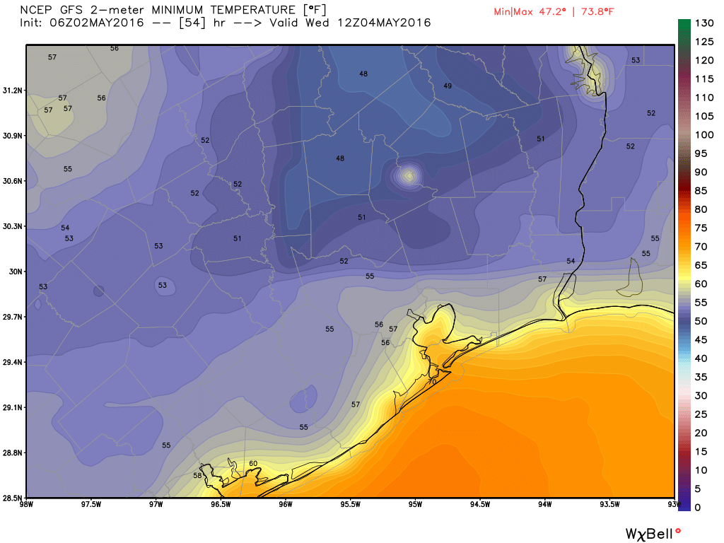
Lows on Wednesday through Friday morning will generally remain the same as Tuesday, with upper 50s for the northern and central parts of the region, and lower 60s near the Gulf of Mexico.
SATURDAY and SUNDAY
We’ll see the resumption of an onshore flow from the Gulf of Mexico by Friday or Saturday, which will bring a few clouds back, increase humidity levels and raise nighttime temperatures into the upper 60s. But rain remains unlikely, at least from this vantage point. Highs perhaps in the mid-80s.
NEXT WEEK
All good things must come to an end, and with the onshore flow acting to increase moisture levels over Houston we probably will see an increasing chance of storms and rainfall beginning Monday night and Tuesday. Nothing extreme, and after a week without rain we might very well welcome some precipitation by then.
Posted at 6:25am CT Monday
Many thanks for the good news of beautiful weather for the rest of this week! Looking forward to Sunshine! Even if only a week is a relief from gloomy skies. Have a good day Eric!
Eric, love the posts and sight. No offense but where do u live where u can post by next week we might welcome precipitation? I know down in Angleton we would prefer not to see rain for a month as we use boats in the pastures. Lol. Have a great one
After a week of dry weather and sunny days with highs around 80 most yards will be dry.
Hello Eric,
I just saw your FB post graphic showing the lightning strikes. My question is how are these measured?
Thanks,
Matt
Here’s more detail than you probably want: http://www.opc.ncep.noaa.gov/lightning/lightning_pdd.php
In short, the data is derived from a cloud to ground detection network. This one: http://go.vaisala.com/gld360animation/