Have yourself a weekend, Houston

Is anyone ready for a cold front? It’s not here yet, but it remains on the way. And golly I am ready.

Today

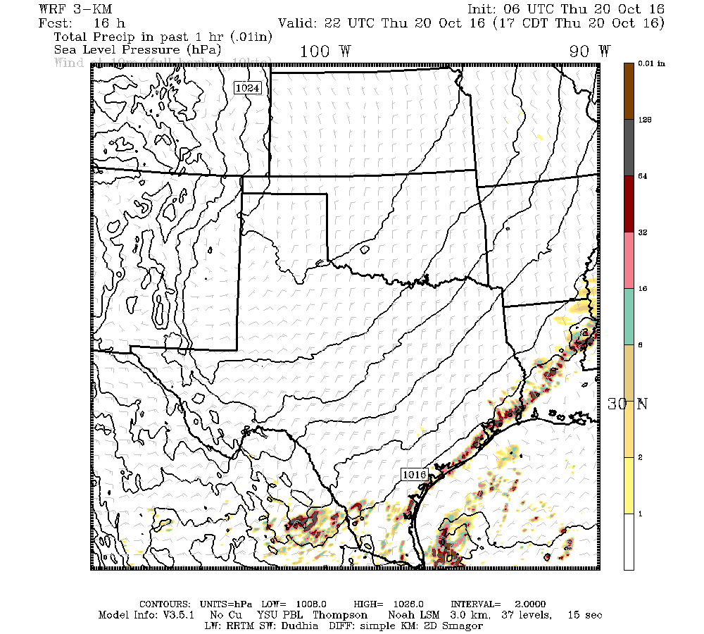
Some showers have developed along the coast this morning from Brazosport to Galveston, and this rain should remain largely confined to the coastal counties, possibly bringing 1 inch or more to some areas.

Meanwhile, a broken line of storms just ahead of the cold front is moving steadily to the southeast, toward Houston. It should reach northern areas of the region late this morning, and likely will move through Houston this afternoon and off the coast this evening. Expect a chance of storms with the front’s passage, but nothing too threatening. Conditions will be breezy in the front’s wake, especially close to the coast.

The Texas Tech model shows a line of broken storms nearing the coast at 5pm CT today.
The Texas Tech model shows a line of broken storms nearing the coast at 5pm CT today, with the cold front just behind it. The storms will exit the area along with the front.

See full post

Must. Get. Through. One. More. Day. Of. Summer.

We’re almost to fall, folks. Almost. We just have to get through today and Thursday morning before a cool front arrives.

Today

Fog, especially in rural areas, may be a problem until about 9 a.m. The National Weather Service has issued a dense fog advisory through then for most of the metro areas, so be sure and take care when driving. Otherwise, we’re in for one more summer-like day. The difference between today and Monday and Tuesday, however, is that with high pressure moving east we’re going to see more clouds (especially along the coast) and possibly some scattered showers later today. I still expect to see highs around 90 degrees.

Thursday

The big day. As moisture pools ahead of the front we should see some fairly widespread, although likely brief, showers during the middle of the day. The front itself should move into northern parts of the region by around noon, and likely will be off the coast by or before sunset. Any rain should end with the front’s passage, and breezy conditions will follow in its wake, and drier, cooler air will move in Thursday night and Friday.

Saturday morning's forecast low temperatures per the GFS model. (Weather Bell)
Saturday morning’s forecast low temperatures per the GFS model. (Weather Bell)

See full post

Two more days of excessive October heat for Houston

Monday saw record, and near-record heat across the Houston area. Hobby Airport set a record with a high temperature of 92 degrees, and College Station tied a record by reaching the same temperatures. We need to get through a couple more days of anomalous October heat before finally seeing some relief.

Today

High pressure remains in place over Texas, and so conditions on Tuesday will be a lot like those on Monday—which is to say hot, mostly sunny, humid and rain-free.

Houston will remain under an early September-like ridge of high pressure for one more day. (Weather Bell)
Houston remains under an early September-like ridge of high pressure for one more day. (Weather Bell)

See full post

Houston just shattered its rainfall record for an 18-month period

This post summarizes the historically wet period from the spring of 2015 through the summer of 2016 for the greater Houston area. Not only did the region set a record for total rainfall, it also experienced an astounding six significant rainfall events in just a little more than 12 months. Read on for a full analysis.

Based upon data from the National Weather Service, the 18-month period from March 1, 2015, through August 31, 2016, ranks as the wettest 18-month period on record for the city of Houston. In fact, the table below shows that each of the top-five wettest 18 month periods in Houston came during the last two years. Prior to 2015, Houston’s wettest consecutive 18 months had yielded a total of 106.68 inches. The March 1, 2015, through August 31, 2016 period annihilated that record by more than a foot of rain, with a total of 119.77 inches.

Here’s the data:

Wettest 18-month periods on record in Houston. (Paul Lewis/National Weather Service)

See full post