Three more days of heat before some relief comes to Houston

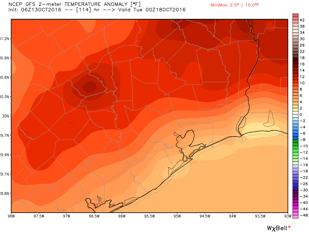
Three more days of heat. That’s how much of this late-summer like weather remains for Houston before some relief arrives to rescue us with some more fall-like weather. And after Sunday’s 91-degree high temperature I am certainly ready.

Monday and Tuesday

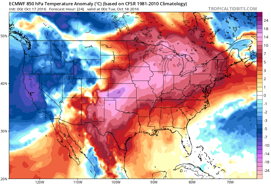
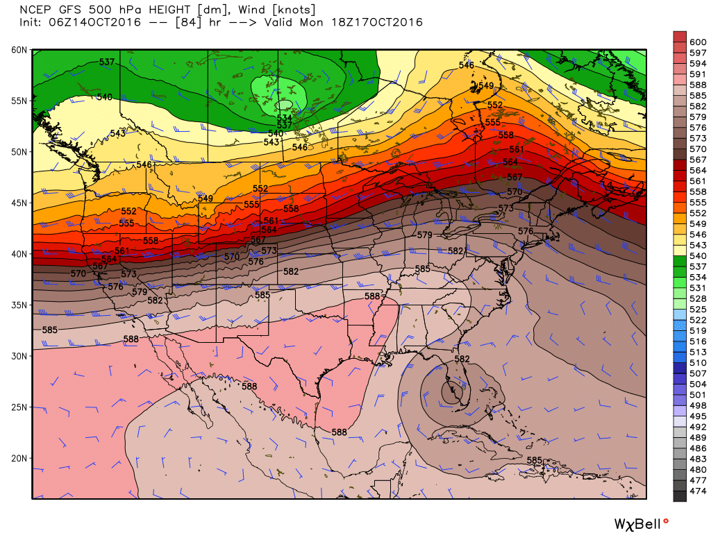
High pressure should dominate our weather for the next two days, and this will allow temperatures to rise to about 90 degrees, or even into the low 90s for inland areas, along with mostly sunny skies. (Today’s record high of 93 degrees for Houston, set back in 1895, is not out of reach). Rain chances are near zero.

Much of Texas and the Midwest is under high pressure that is creating record warm weather for mid-October. (Tropical Tidbits)

See full post

Rain possible today, still on track for much cooler weather next week

A cold front is stalling across north Texas this morning, but it may provide enough instability today to lead to the development of some scattered showers across the Houston region. This will offer our best chance of rain for awhile. Cooler weather really does lie ahead.

Today

The stalling front, combined with Gulf moisture, could produce some scattered showers and thunderstorms in Houston today, especially after noon for inland areas. Some parts of Houston may pick up a quick half inch of rain or so, but other areas aren’t likely to see any rain. Highs in the upper 80s.

Saturday through Tuesday

And so we come to summer’s last breath. As higher pressure settles over Houston we can expect temperatures to rise toward 90 degrees, and possibly even reach that mark. Lows should fall into the low 70s. Higher pressure also means mostly sunny days with rain chances near zero.

The GFS model shows high pressure dominating Houston's weather early next week. (Weather Bell)
The GFS model shows high pressure dominating Houston’s weather early next week. (Weather Bell)

See full post

Summer-lite returns to Houston for the next week or so

Temperatures reached 89 degrees on Wednesday, and there’s more anomalously warm weather ahead for the region as a stagnant, late-summer pattern holds sway.

Thursday and Friday

A front moving into north Texas will stall well to the northwest of Houston, but some of the associated instability could work its way into the region today and tomorrow. This should result in some slight rain chances on both days, especially to the northwest of the metro area in places like College Station, although we’re probably not looking at widespread rain. Highs in the upper 80s, lows in the low 70s.

Saturday through Tuesday

Hello, summer. A higher pressure moves back into the area look for several days of partly to mostly sunny skies with highs near 90 degrees, and lows in the lower 70s. Rain chances should be near zero. These temperatures will be a good 8 to 10 degrees above normal for mid-October.

Temperatures on Monday may be as much as 15 degrees above normal. (Weather Bell)

See full post

Houston’s weather: Warm, humid and basically blah

The good news is that Houston finally received a bit of rain on Tuesday. It certainly wasn’t an overwhelming amount, but for some areas 0.5 inch of rain or more is nothing to sneeze at. The bad news is that this is probably all the rain the region is going to get for awhile. And meanwhile, the humid air isn’t going anywhere.

Some areas of Harris and Galveston counties received in excess of 0.5 inch of rain on Tuesday. (National Weather Service)

See full post