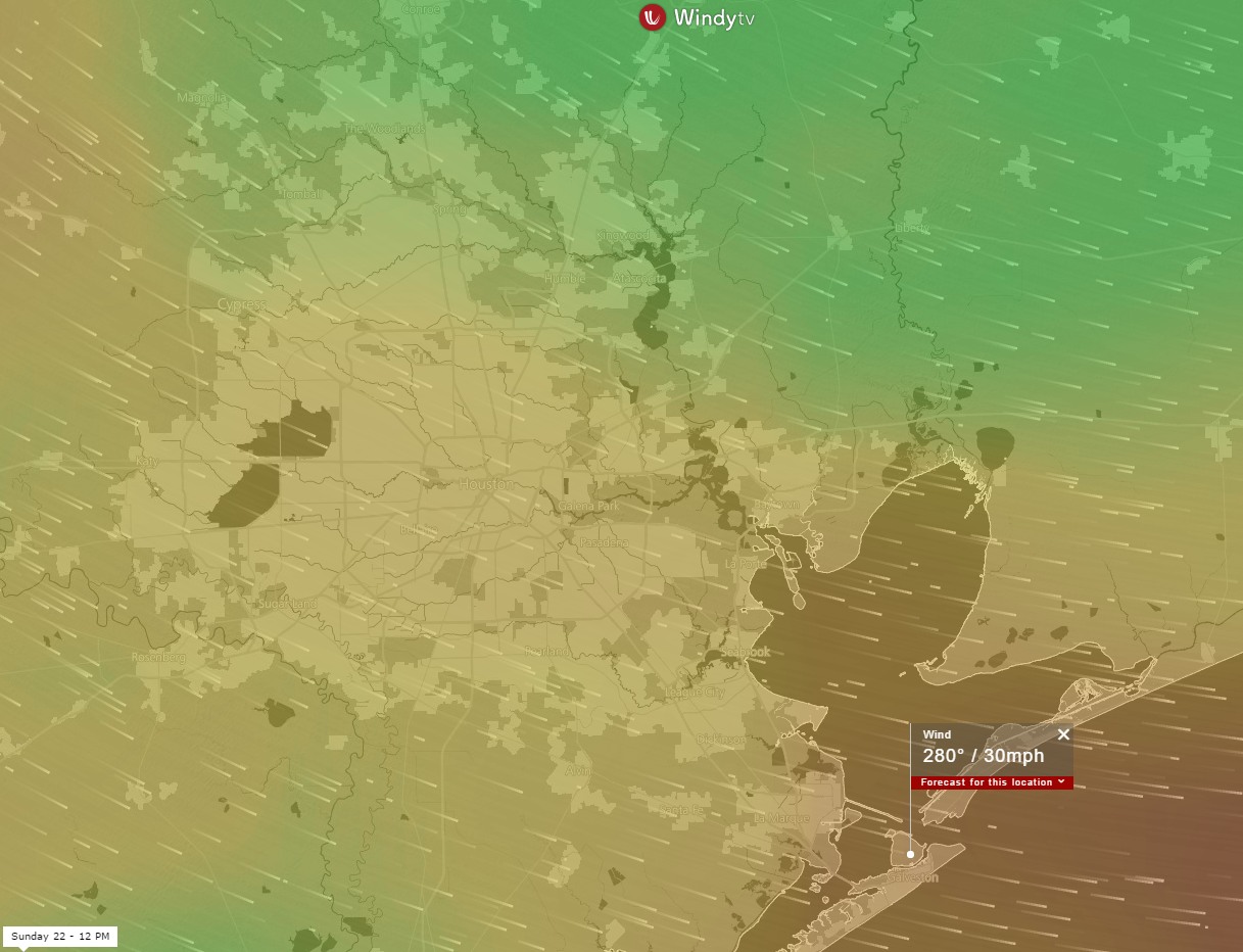
If you’re planning outdoor activities on Sunday please take the potential for strong wind gusts into account. As pressures fall on Saturday night and Sunday morning, and a front moves through the Houston area, the region will likely see sustained winds from 20 to 30 mph for most of the day.
Sustained wind forecast for noon on Sunday. (windy.tv)
Gusts in Houston may reach into the low 40s, and 45 mph or higher right along the coast. This will drive temperatures and humidity levels down, and most of next week will finally feel more like winter than fall.
Also, after a series of major rain events have raked Houston during the last week, the region will also enter into a much drier period, with low rain chances for at least the next week or 10 days. For those fretting about the “end” of winter, it also seems likely that we’ll see some significantly colder weather by the end of this month, but the details still aren’t entirely clear. In any case, winter isn’t over yet.
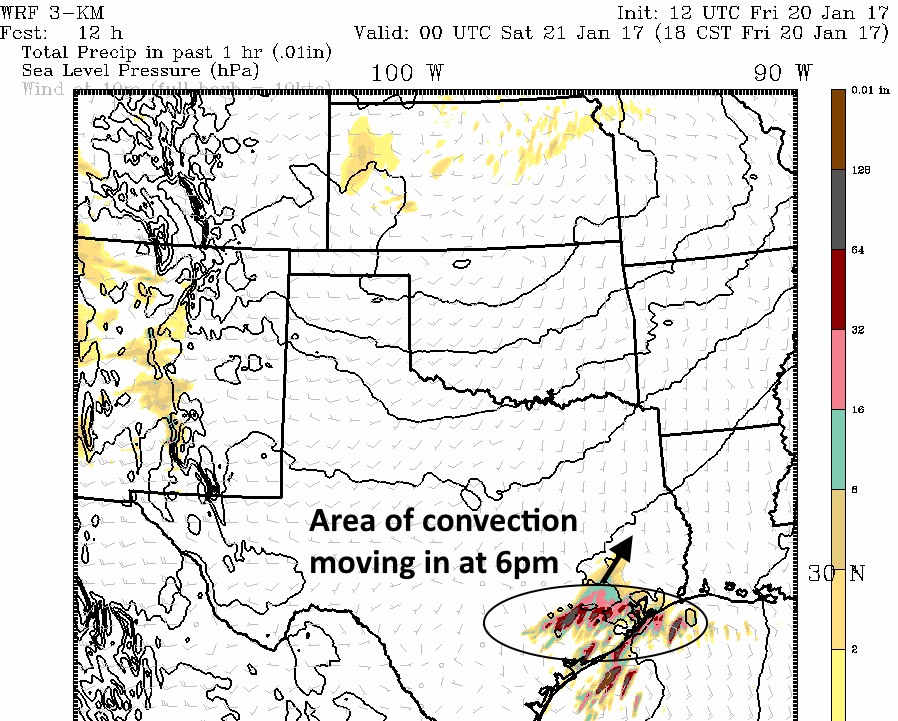
As expected some thunderstorms have develop near, and south of Victoria this afternoon along a warm front stretching across coastal Texas. As these storms migrate to the northeast toward the Houston metro area, it appears likely that a weak disturbance in the upper atmosphere will add an additional impetus to strengthen them this evening over Houston.
Thunderstorms are likely in Houston this evening. (Texas Tech)
Practically, this means the region will see a pretty healthy chance of showers sometime between 4 and 8pm this evening, and a decent chance of thunderstorms. Tornadoes appear unlikely to form with this system, but some hail is possible due to vertical wind shear. Most areas will likely see 1 inch of rain or less, but a few areas might see more rain where the heaviest storms set up. Any lingering showers should exit the area by about 9pm.
Saturday should be mostly sunny, with a high in the upper 70s, and a slight chance of rain toward the evening hours. Sunday still looks sunny, but quite blustery as a front moves in. Look for gusts in the 30s, which could play havoc with outdoor activities.
After a chaotic week of weather, Houston will face gradually face somewhat more benign conditions as we head through the weekend. First, we have to get through the potential for showers & storms today and possibly Saturday. That will be followed by quite a breezy day on Sunday.
Today & Saturday
Fog this morning is pretty dense over most of the region, and dense fog advisories are posted basically along and south of Highway 105. Use a lot of caution out there this morning.
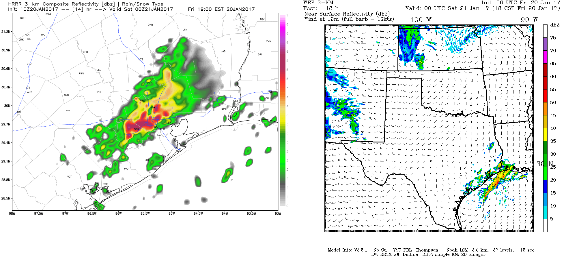
The fog will lift later this morning, so we should see a little sunshine. Clouds sneak back in this afternoon. The big question then becomes where showers or storms develop. I want to show you two pieces of data that we’re looking at. This is a forecast radar for 6 PM this evening. The HRRR model is on the left, and a model run by Texas Tech is on the right. Click to enlarge.
Weather models are out of sync this evening, leading to a somewhat lower confidence forecast. (Weather Bell/Texas Tech)
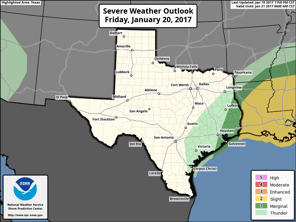
The HRRR (left) indicates the warm front in the Gulf may get all the way to I-10, helping to fire up thunderstorms this evening. The WRF (right) has the front falling just short and keeps most storms near the coast or over the Gulf. Given the uncertainty, the SPC has the eastern part of the region in a “marginal” risk for severe thunderstorms.
Best severe weather risk should stay east of the area today, but it will be a somewhat close call. (NWS SPC)
My feeling is that the HRRR may be overdoing things a bit, but it’s a close call. I am apt to prefer this SPC map and say the best chance for storms remains south and east of Houston later today. We will update you if that changes, but definitely have an umbrella handy today to be safe.
On Saturday, it actually looks fairly quiet. With a strong system developing to our northwest, we could see a few showers or storms, but any legitimate severe weather risk looks to stay well east of the Houston area, in Louisiana. Temps will peak in the mid 70s both days, with lows in the low 60s tonight.
Good morning. Houston will face one more soggy morning before the widespread rain chances die down.
Today
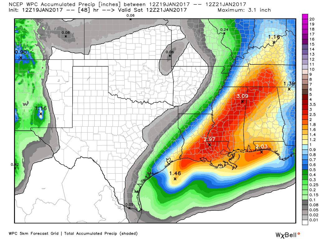
Although the heaviest rain has moved well east of Houston, between Beaumont and Baton Rouge, an upper-level low pressure system moving into the region from the southwest will provide one final round of widespread showers—with a few thunderstorms—this morning. Accumulations for most areas should be 1 inch or less, which is more than manageable for area roadways and bayous. As rain chances fall off late this morning and early afternoon, look for high temperatures in the upper 60s.
Rain accumulations during the next 48 hours will be greatest well to the east of Houston. (Weather Bell)
Friday and Saturday
More unseasonably warm weather arrives to kick off the weekend, with partly sunny skies and highs in the upper 70s to about 80 degrees. Some rain chances may briefly return on Friday evening and into Saturday morning, but I wouldn’t expect anything too widespread or heavy.