Worst of Houston’s rain over

Just a brief update for you for the late afternoon and evening.

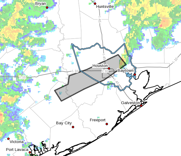
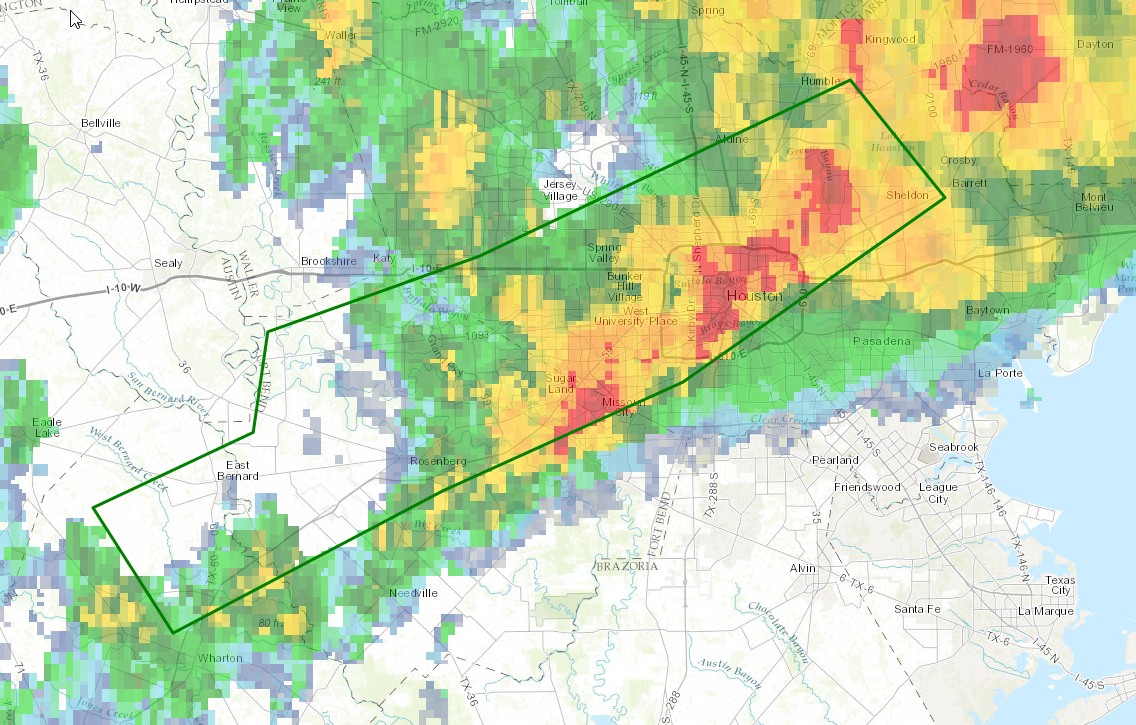
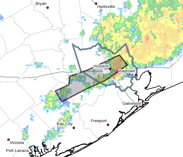
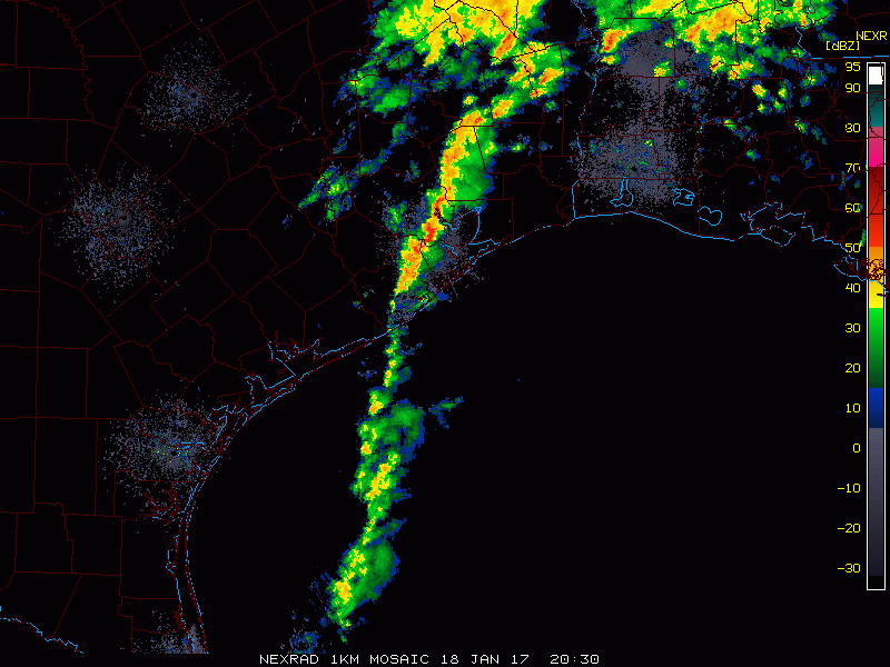
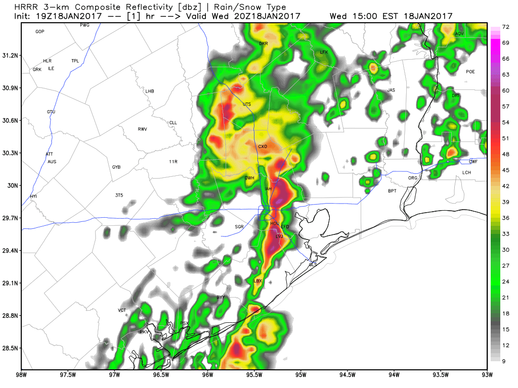
We have good news: The heaviest rain this afternoon organized a bit too late to hit the areas hardest hit this morning. Instead, heavy rain is now sliding off to the east of Houston.

Narrow band of heavy rain has moved east of Baytown and extends south to about League City as of 3:30 PM. (College of DuPage)


Most rain will exit east of the city for the evening commute. You will want to continue to watch for areas of high water around the area. The Flood Warning remains in effect for the western Harris, northern Fort Bend, and northeast Wharton Counties until 4:15 PM. Additional minor flooding is possible along Little Cypress Creek, but serious flooding in northern Harris County is not expected.

For tonight and tomorrow morning, I do expect showers to re-organize, but with the front now off to the east of most of Houston, the heavy rainfall threat will shift toward Beaumont or (more likely) Lake Charles. In Houston, just expect some showers, maybe a rumble of thunder, but no severe weather and likely no serious flooding issues.

HRRR model forecast shows the idea of rain redeveloping tonight, with the heaviest off to the east of Houston. (Weather Bell)


By tomorrow, this will all be history. We should see gradual clearing and a nice break from rain.

Posted at 3:35 PM by Matt

(Space City Weather is sponsored by Westbury Christian School for this month)

Round two of storms now approaching Houston from the west

A second round of rain showers is en route to Houston as another upper-level disturbance is approaching the Houston region from the west. They should affect the region from about 11:30 am to 3 pm CT). With some clearing skies now (11 am) across Houston this is allowing daytime temperatures to climb into the upper 70s, and combined with this heating and high moisture levels would could see an additional 1 to 3 inches of rain with these storms.

It is not clear where the heaviest rains will fall, but areas of most concern include southwest and northwest Houston. The 12-hour rainfall rain totals are impressive, including the following high-water marks in Harris County:

  • 2 NE West University Place 6.50 in
  • White Oak Bay Heights Blvd 6.44 in
  • 1 NE Houston 6.38 in
  • Buffalo Bayou @ Milam 6.19 in
  • Little White Oak Bayou @ Tri 6.12 in
  • Brays Bayou Gessner Dr 6.08 in

The National Weather Service has issued a flood warning for a large chunk of Fort Bend and Harris County through 4:15 pm today. The good news is such that the storms moving in later this morning and afternoon are flying along at a pretty good clip to the east, about 30 mph, so I’m less concerned about their flooding potential than those that accompanied the overnight rains. However, for areas hit hard early this morning, it won’t take too much precipitation to push swollen bayous back to near the tops of their banks.

Area of flood warning in effect until 4:15 pm CT. (National Weather Service)


After this afternoon’s storms I think we’ll see some clearing for the late afternoon and evening hours, but we could be looking at another round of storms by Thursday morning. We’ll update you on that later today.

Posted at 11:10am CT on Wednesday by Eric

(Space City Weather is sponsored by Westbury Christian School for this month)

Flash flood warning extended through 10:15am CT for southwest Houston

The National Weather Service has extended the flash flood warning through 10:15am this morning after as much as 6 inches of rain fell across southwestern Houston this morning. An additional 0.5 to 1 inch is possible during the next couple of hours, and on top of what has already fallen this could put some bayous out of their banks.

Flash flood warning in effect until 10:15am CT. (National Weather Service)


Already this morning flash flooding is occurring along Highway 59 from Fort Bend County through to the northeast side of Downtown Houston, with some underpasses and surrounding streets under water.

According to the Harris County Flood Control District, here is an assessment of current bayou levels at or near flood level:

  • Keegans Bayou: overbanks at US 59/Beltway 8…numerous streets flooded
  • Brays Bayou: bayou is spilling into SH 288 mainlanes and lower homes in Meyerland may be close to flooding. Bayou appears near crest at US 59 and Gessner
  • Hunting Bayou: bayou is at bankfull at Lockwood (Kashmere Gardens)
  • South Mayde Creek: creek is at bankfull at Greenhouse
  • Upper Spring Creek: creek is nearing bankfull at Hegar Rd
  • Upper Cypress Creek: creek is rising toward bankfull
  • Lower White Oak Bayou: within banks, but high

As the heavier storms have moved out of the Houston, there is concern about additional development late this morning and early afternoon along a nearly stationary boundary.

Posted by Eric at 7:50am CT on Wednesday

(Space City Weather is sponsored by Westbury Christian School for this month)

Heavy overnight rains producing flooding in southwest Houston

Heavy rain fell during the overnight hours along a stalled front from Sugar Land through Bellaire, Houston and northeast through Atascocita. About 6 inches of rain fell for some locations along Brays Bayou, although waters thus far have remained within their banks. A flash flood warning remains in effect until 8:15am CT, although the worst of the storms have now lifted to the northeast, out of the area.

Area of flash flood warning in effect until 8:15am CT. (National Weather Service)


The storms have been driven by a nearly stationary cold front, which is providing lift for moist air at the surface, and very favorable conditions in the upper atmosphere that have allowed for the development of heavy showers. Temperatures this morning are in the low 70s to the southeast of this boundary, and 10 to 15 degrees cooler to the northwest of Houston. As of about 6:15am the heaviest rains have finally moved off to the northeast of downtown Houston.

The biggest concern for flooding is in southwest Houston. Although in the Meyerland area Brays Bayou is within its banks, Keegans Bayou has risen a few feet above its banks just to the north of Missouri City and Stafford. Keegans feeds into Brays Bayou, but it is a small amount of water compared to the total volume of Brays. Additional rains for either of these area later this morning would prove problematic, and unfortunately we can’t rule that out. Already there is considerable street flooding, including some lanes of 288, so if you live down there consider your driving routes very carefully this morning.

Some forecast models suggest a slackening of rain later this morning, but an additional bout of showers this afternoon. It seems likely the rain will be a little bit north of where it was this morning—the cold front should move back inland a bit further—but we’re going to have to watch this closely.

Posted at 6:40am CT by Eric on Wednesday