Severe thunderstorm watch for Houston, but effects should be brief

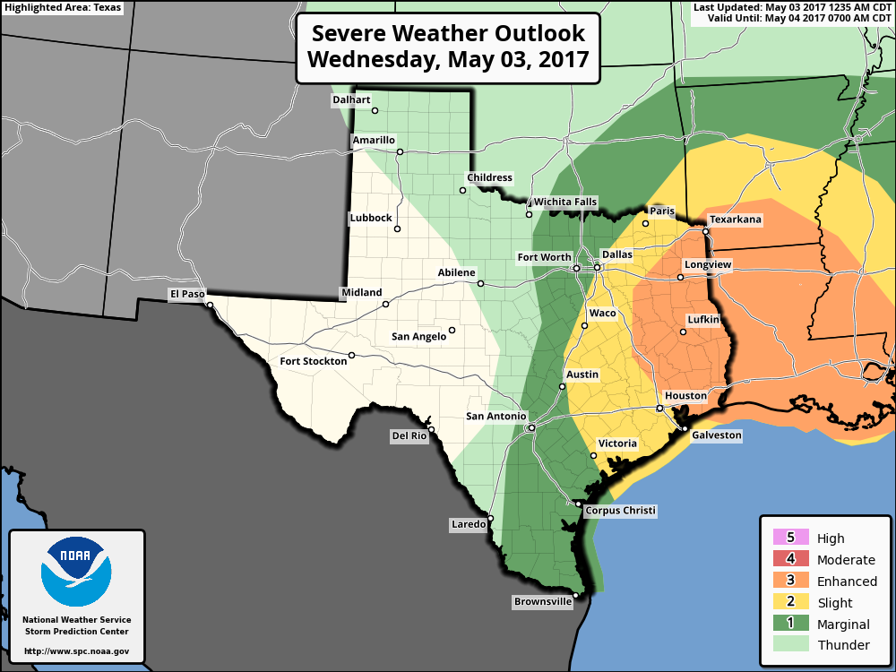
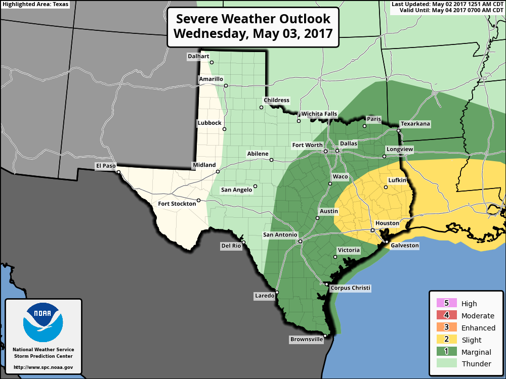
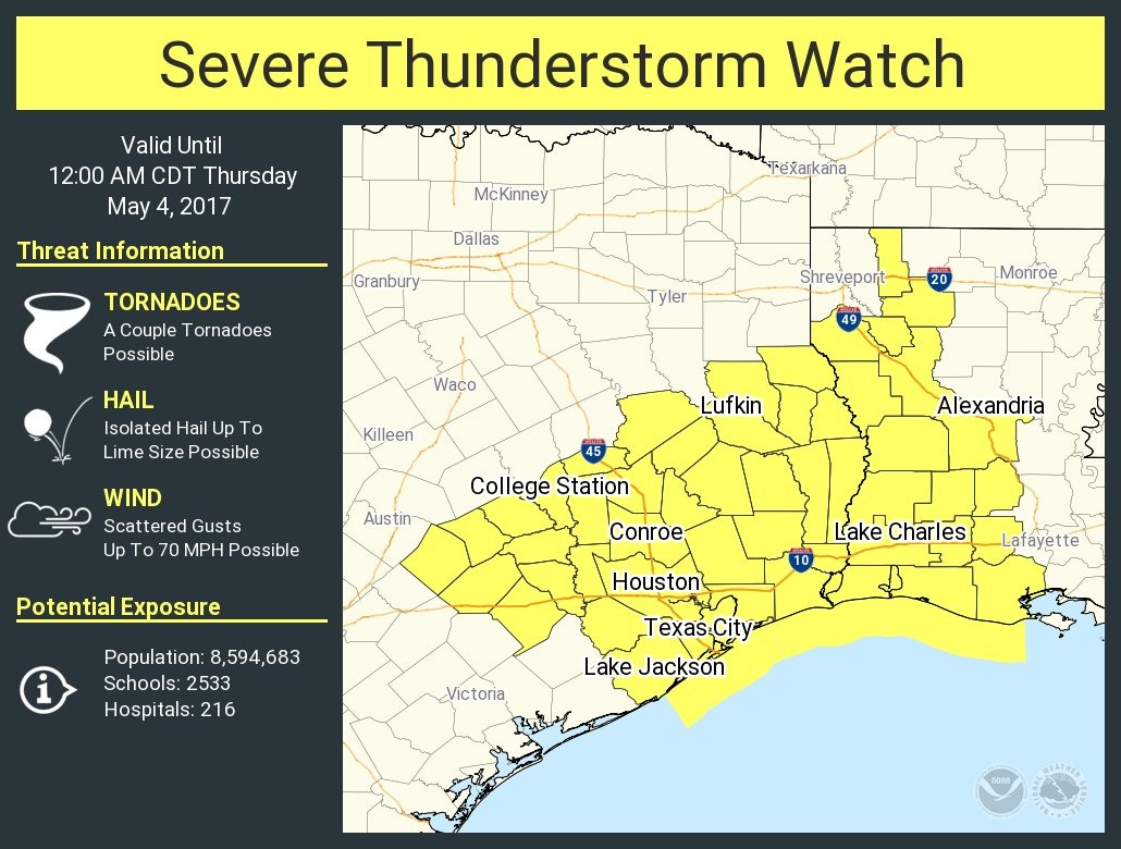
As a cold front approaches the Houston area, the National Weather Service has issued a severe thunderstorm watch for the metro region. The watch, in effect until midnight, calls attention to the possibility of hail, damaging winds, and possibly a tornado or two.

(National Weather Service)

Here’s what we know for sure. A capping inversion (warmer air aloft) has held firm throughout the day Wednesday, limiting shower activity while areas to our east, along the Texas-Louisiana border, have received heavy rain. As the front pushes south into Houston this evening that cap is going to weaken, and break in some places.

However, because the storms are moving southward at a pretty good clip, I think the showers and thunderstorms that do develop will be fairly brief. So expect a lot of thunder, lightning, and possibly some hail—this is more likely to the east and northeast of Houston—but then for the show to end pretty quickly. I’d expect the storms to hit Houston around sunset, earlier for areas up north, and later for areas closer to the coast. All over by midnight.

Posted at 5:20pm CT on Wednesday by Eric

(Space City Weather is sponsored this month by Jetco Delivery)

Severe weather possible today in Houston, glorious weather after

Good morning. Storms are possible this morning and evening in Houston, some possibly severe, before the region sees a great stretch of weather for late spring.

Wednesday

A warm front lifting into Houston from offshore has helped develop some scattered showers and thunderstorms across the area early this morning, and as this system moves off to the northeast it could serve as a focus for additional storms this morning. Most of this activity will probably occur over the eastern half of the Houston area and it should move off to the northeast by later this morning, if not before.

The eastern half of Houston faces an “enhanced” risk of severe weather today. (NOAA)


Round two will move into the Houston region later this afternoon and during the evening hours—possibly hitting the city around the evening commute—as a cold front approaches the area. Confidence is increasing in a solid line of showers and thunderstorms, some likely severe, sweeping from northwest to southeast through Houston and off the Gulf coast by around sunset or shortly afterward. Again we’re concerned about hail, winds, and relatively brief periods of heavy rain that may briefly flood low-lying streets. The bottom line is before you head out today, check the radar and any warnings. Fortunately it should all be over later tonight, as a cold front moves through the area, and dries us out pretty quickly.

(Space City Weather is sponsored this month by Jetco Delivery)

See full post

Storms possible Wednesday, then splendid weather for Houston

Good morning. We’ve basically got one day to worry about—Wednesday—in what will be a week of otherwise quite wonderful weather.

Today

Monday’s high temperature of 88 degrees was a bit warmer than anticipated for Houston, and I’m expecting conditions to be similar today with highs pushing into the upper 80s. We’ll see partly to mostly sunny skies, and winds picking up out of the south, piling up moisture. Lows tonight will only fall to around 70 degrees.

Wednesday

The region appears likely to have two chances of rain on Wednesday. During the morning hours, as warm, unstable air moves in from the Gulf of Mexico, we could see some showers and a few thunderstorms. The potential for more severe weather—and according to NOAA’s Storm Prediction Center the primary threat is hail—will probably come later in the day, after noon, and during the evening hours as a cold front approaches and moves through the metro area. Houston falls under the “slight” chance of severe weather in NOAA’s forecast, which means that while the potential for nasty weather exists, the overall likelihood of it affecting most people in Houston is relatively low. Nevertheless it’s something we’ll definitely keep an eye on for you.

Houston falls under a “slight” risk for severe weather on Wednesday and Wednesday night. (NOAA)

(Space City Weather is sponsored this month by Jetco Delivery)

See full post

After a gorgeous Sunday, chance of heavy rain later this week

It is quite cool the morning across Houston, with low temperatures generally from around 50 to 55 degrees across the region, and only a bit warmer along the coast, thanks to a cool front that moved through the region early on Sunday. This exceptionally pleasant weather will last another day, or so, before our concerns begin to turn again toward the possibility of some heavier rain.

Today

After a chilly start, a sunny day will allow afternoon temperatures to climb into the low- to mid-80s by this afternoon. Winds will be moderate as they shift to come out of the south later this morning, but humidity levels should remain fairly low. Look for another marvelous evening, with temperatures cooling as the sun sets. Overnight lows will be about 10 degrees warmer than on Monday morning, but still seasonably pleasant for late spring.

Tuesday

As southerly winds pick up a little bit, humidity will return to the area. This, in combination with a mostly sunny day, will make for warm conditions for Houston. Look for highs in the upper 80s.

Tuesday night and Wednesday

A combination of factors appear to be coming together that will produce a very healthy chance of storms during the middle of this week. Moisture return from the Gulf of Mexico really gets going later on Tuesday night, which will provide plenty of potential for rain to the area.

By Thursday afternoon atmospheric moisture levels may be about 200 percent of normal across Houston. (Weather Bell)

(Space City Weather is sponsored this month by Jetco Delivery)

See full post