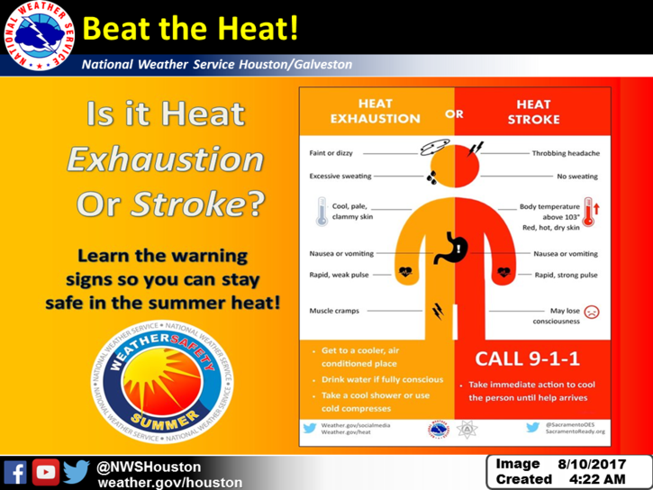
Locally, the weather this week will be pretty standard for mid-August. It’s going to be hot. There will be a few opportunities for storms, but the majority of the week will see the majority of Southeast Texas dry. More on this in a second. First, let’s talk solar eclipse.
Eclipse outlook
We’re one week from one of the most talked about astronomical events in the U.S. in a long time. It’s certainly exciting, and understandably, there’s demand for eclipse weather forecasts. So, we’ll be happy to offer up our opinions here. First, locally, I think we look pretty standard in terms of thunderstorm chances. Odds are it will be partly to mostly sunny with just a few developing showers, mainly south and east of downtown Houston.
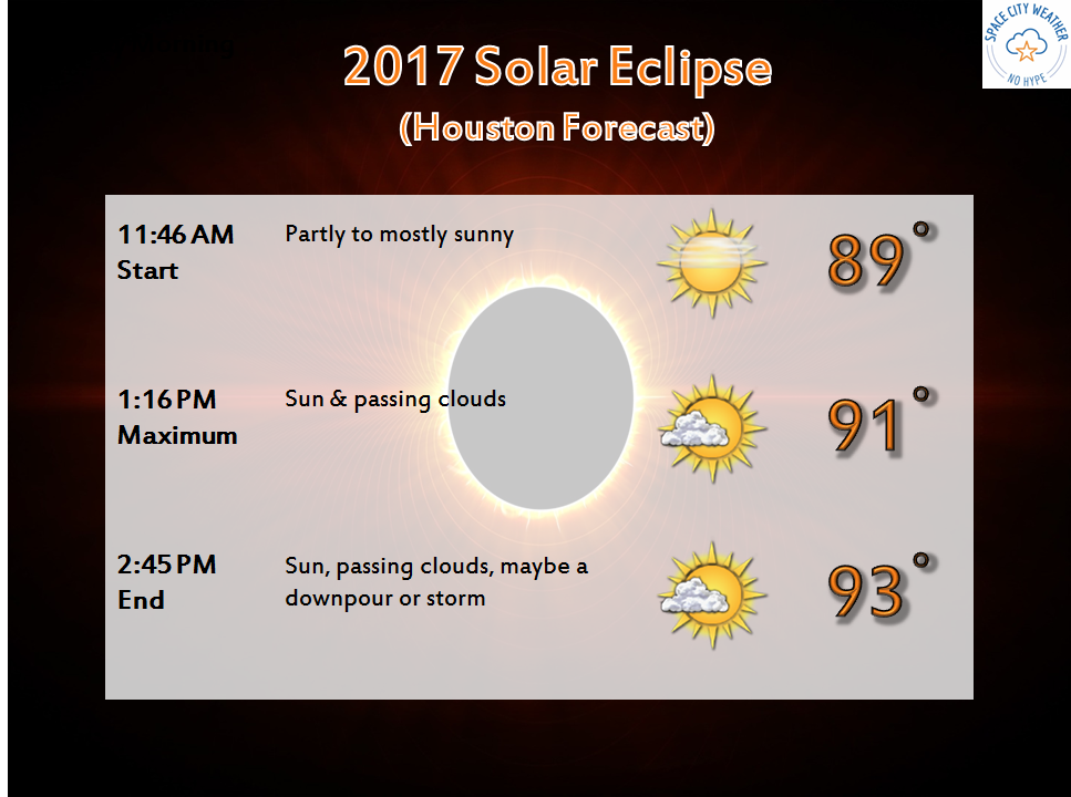
The good news is that, assuming standard summer weather here in Houston, you probably won’t have to drive very far to get out of a downpour and into sunshine. All in all, I’m optimistic on our weather for the eclipse right now. We’ll keep you posted.
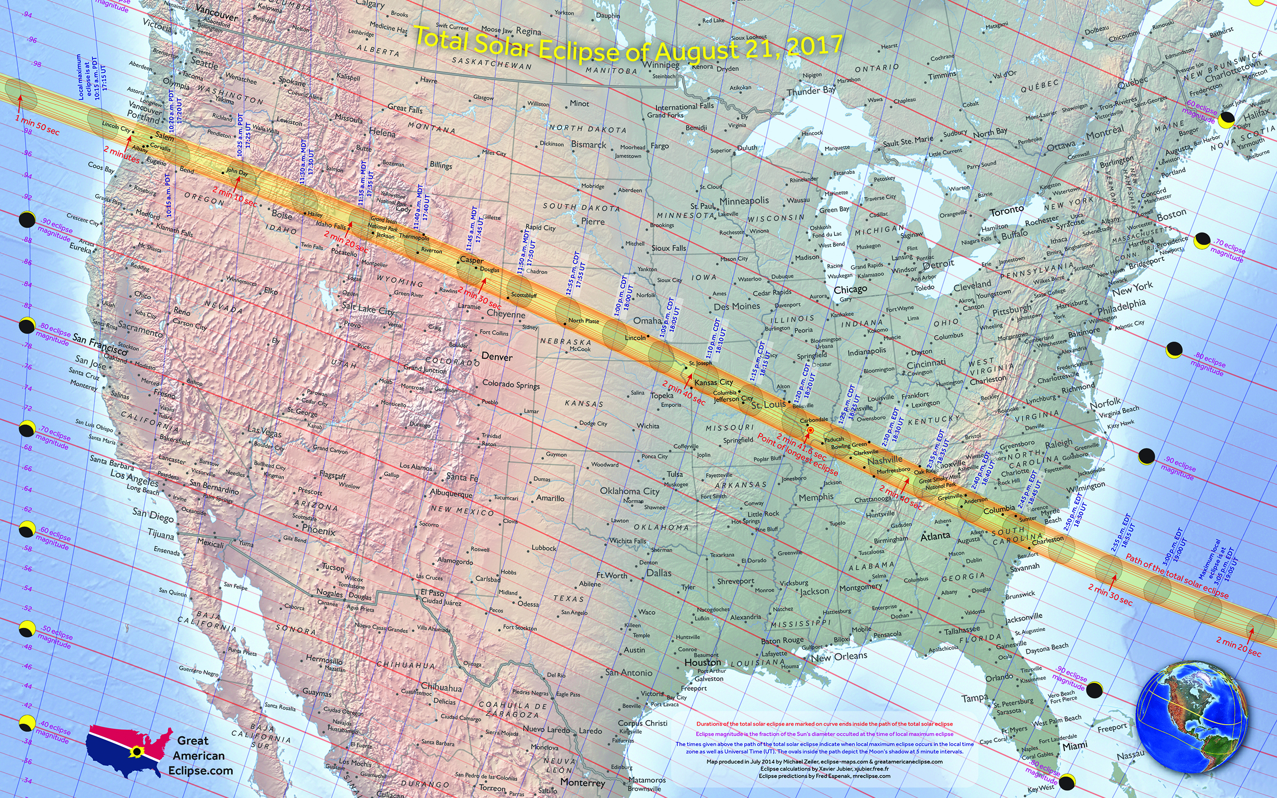
Some of you may be considering traveling into the path of totality of the eclipse, which stretches from Oregon into Wyoming across Missouri and offshore from South Carolina. We take a crack at things here, using some major cities along the path (Hopkinsville and Carbondale are the approximate locations of the greatest eclipse and longest duration of the eclipse respectively).
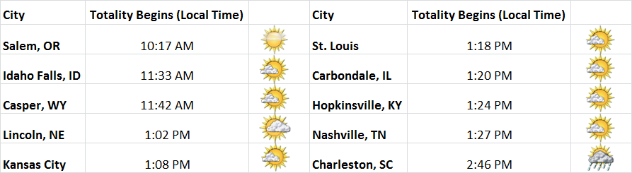
Based on a brief look at the weather models for next Monday around the time of the eclipse, the best chance of rain may be in the Carolinas. Models disagree further west (including Nashville, Hopkinsville, Carbondale, and St. Louis), with a chance of rain showers potentially. For now, I’d spin it optimistically. I don’t see any reason to be overly nervous in any given place. I am watching a band of cloud cover showing up on some models from northern Colorado into Wyoming and perhaps the Plains (think Lincoln, NE & Kansas City). Again, it’s quite early for a precise cloud cover forecast, but we wanted to offer up an early opinion for you. Look for further updates this week.