Suggested Halloween costume for Houston: A fish, perhaps?

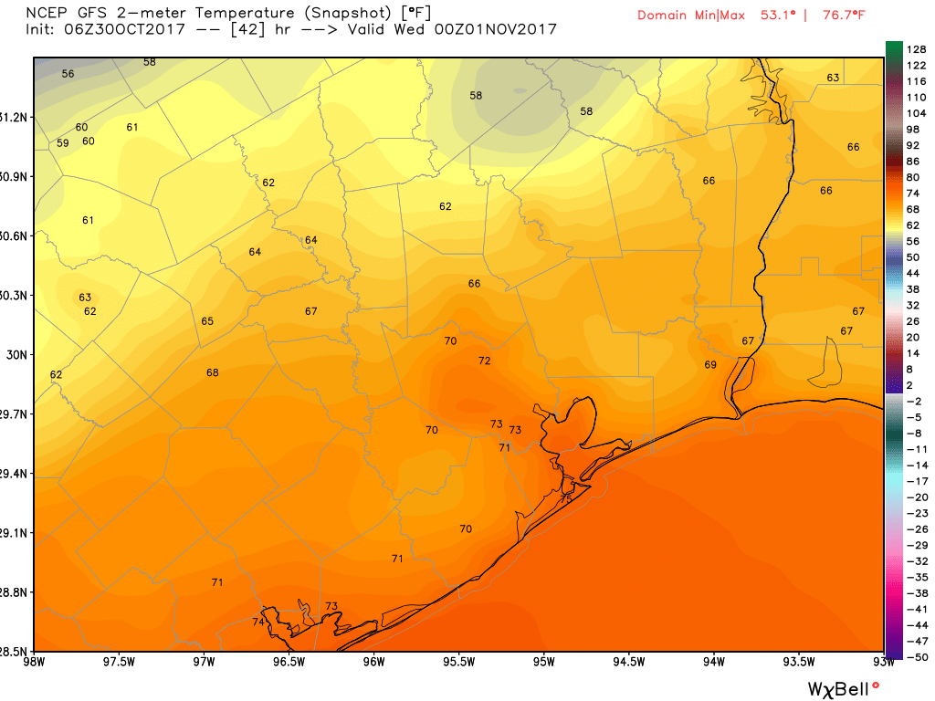
It’s much warmer this morning across the Houston area, as humidity and higher temperatures return and will stay for a while. This southerly flow in combination with a weak, stalled cold front will lead to some pretty healthy rain chances later today, tonight, and Wednesday morning. It’s nothing we’re too concerned about, but it could put a damper on some Halloween escapades this evening.

Halloween and tonight

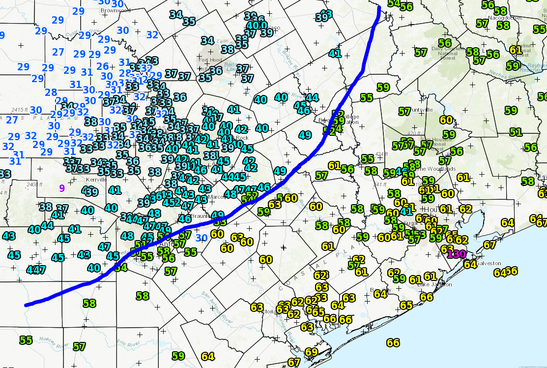
One of my least favorite things about fall weather in Houston is the stalling front—a cool front with just enough oomph to make it into the Houston area, but essentially stalls or fizzles out near the coast. This creates favorable conditions for rain (and sometimes thunderstorms) but no lasting cooling. Alas, that is what we will see today, as moisture moves back in from the Gulf of Mexico and meets the unstable air from the front.

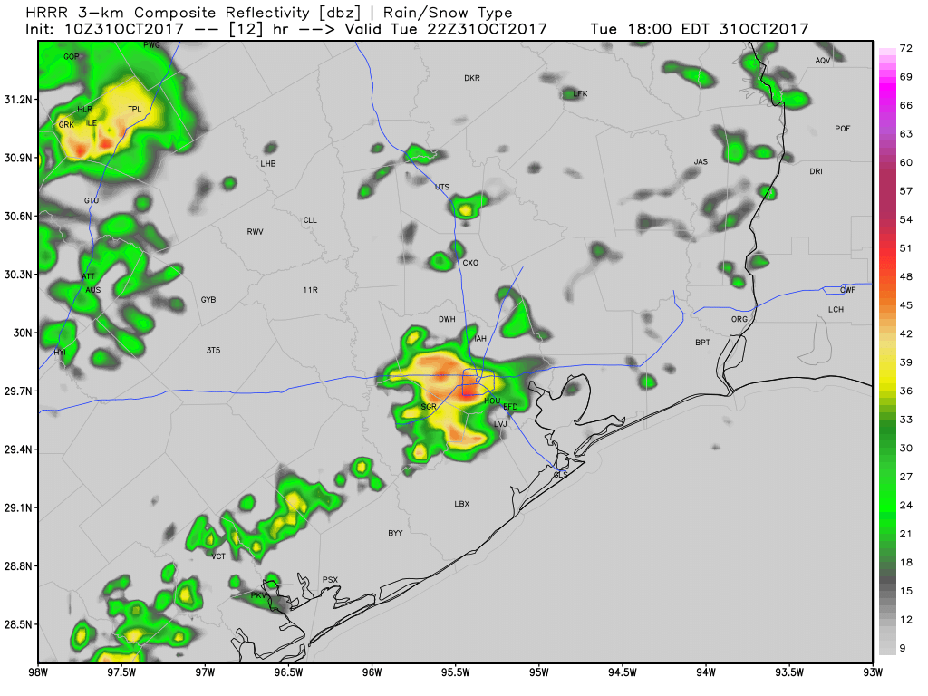
I think we’re going to see mostly light to moderate, scattered rain showers for this morning, with the added possibility of a few scattered thunderstorms this afternoon. Rain chances increase this evening—right around trick-or-treating time—and then really pick up later tonight and into Wednesday morning. For the most part I’d guess we’re looking at 1.5 to 2.5 inches of rainfall, but areas near the stalled front where heavier showers develop could see 4 or more inches over time. I don’t think we’re looking at flood concerns, because the rainfall rates don’t look particularly intense, but some areas could see steady rainfall for a number of hours that adds up.

This HRRR model forecast for radar activity at 5pm CT shows the potential for showers this evening. (Weather Bell)

My hope is that most neighborhoods can get enough dry time this evening between 6 and 8pm for trick or treating (no guarantees on that, sorry) and that we’re all inside celebrating an Astros World Series victory after the widespread, heavier rain arrives.

See full post

Chance of rain on Halloween as Houston warms significantly this week

Did you enjoy our brief romp with winter? Houston smashed some records with a low temperature of 35 degrees on Sunday at Bush Intercontinental Airport (breaking a mark of 39 degrees), and a low of 39 degrees at Hobby Airport (breaking a mark of 42 degrees). Perhaps hell is freezing over because the Houston Astros are about to win the World Series? Anyway, this cold spell offered a taste of winter, but after another pleasant day Monday we’re going to settle back into a warmer pattern for awhile.

Today

Southerly winds have already returned, and while this morning saw clear and cool conditions in the low 50s, we’ll warm quickly  into the upper 70s under mostly sunny skies.

Halloween

Tuesday will offer mostly treats in terms of weather—but potentially a few tricks as well. We’re going to see a weak cool front move into the Houston area and then essentially stall at or near the coast. Effectively, this means we are going to see some increasing rain chances later on Tuesday, especially to the west and southwest of the Houston metro area.

Temperatures during trick-or-treating will be pleasant. But what of the our rain chances? (Weather Bell)

While some light rain is possible in Houston during the afternoon and evening hours, I’m hopeful that some or most of the region will remain dry. However, rain chances will improve significantly during the overnight hours. Temperatures during trick-or-treating will likely be in the upper 60s to lower 70 degrees.

See full post

Houston beyond Hurricane Harvey

On Tuesday evening, just as the Astros took the field for game one in Los Angeles, I had the pleasure of attending a Baker Institute event at Rice University featuring Dr. Jim Blackburn. “Beyond Hurricane Harvey” was a discussion and Q&A with Blackburn, who is the co-director of the Severe Storms Prevention, Education, and Evacuation from Disaster (SSPEED) Center at Rice. During Tuesday’s event, Blackburn basically laid out his vision for how we need to discuss and tackle Houston’s flooding problem from this point forward. Many of these ideas were incorporated by Harris County Judge Ed Emmett in the plan that he unveiled on Wednesday. Nevertheless, here is a summary  and some of my takeaways from Tuesday’s event.

Tuesday night’s event was held at the Rice University Baker Institute by their young professionals group. (Matt Lanza)

As a quick note, Blackburn has published two papers in the wake of Harvey. Much of what he covered Tuesday night is covered in these papers too. The first addresses initial policy ideas after Harvey. The second describes the public/private non-profit entity described below. Both are very informative and useful reads, and I would encourage our readers to get involved in this. As I said in my own Harvey post-mortem: It is now time for a new generation of Houstonians to work out new solutions to this complex problem.

Turning point: Blackburn opened by calling Harvey a turning point in Houston’s history. This is basically our moment to get this right. We all know we live in a city that is prone to flooding. We can never stop that from happening, but we can manage it in ways that will reduce the financial and human toll that has accompanied recent flooding events. Houston has an opportunity now to become the world leaders at weather and climate resiliency. While showing a chart of hurricane tracks impacting the Texas coast, Blackburn related the story of Indianola and Galveston. Indianola was wiped out by a hurricane in 1886, and we know the story of Galveston after 1900. Blackburn believes that Houston’s future as a leading American and global city may hinge on what we are able to accomplish over the next several months. If we bungle the response to this disaster, we could be looking at a steady economic decline in our region.

Blackburn referred to this situation as a new “Jesse Jones moment” for Houston. Speed couldn’t be emphasized enough. We need to get these solutions moving now, while the wounds from Harvey (and previous events) are still fresh and raw. The longer we wait, the less likely we’ll accomplish meaningful action. Amusingly, Blackburn shared the “Off the Charts” report published by Harris County Flood Control after Tropical Storm Allison in 2001.

We were in the same boat 16 years ago, but we still have a long way to go. (HCFCD)

Here we are again. We need a vision, a plan (we seem to have those moving forward), and now we need to mobilize the public and persuade our elected leaders to take action immediately. Blackburn was asked whether Houston’s infamous lack of zoning contributed to the problems from Harvey. He made the point that it was not a major cause, but what is a problem is the typical, almost “closed door” nature of Harris County government. Lots of items get addressed really quickly without much discussion at various county meetings. The population of this area is also somewhat agnostic toward government participation. We’re not engaged enough. For problems as big as this, everyone needs to be firing on all cylinders, taking politicians to task, asking questions, demanding transparency. It’s easy to be cynical, but in this situation, it’s important not to be.

See full post

Record low watch for Houston continues

The record low watch continues this weekend for Houston. We’ll go into more detail on that below, but what a change the last couple weeks have been. The weather this time of year can get a little chaotic in the temperature department, and we’ll certainly see more of that present itself going forward. Let’s jump in.

Today & Weekend

As of 6:30, the front is just pushing (or about to push) through La Grange, College Station, and Madisonville north and west of Houston.

Using a map of dewpoints, here’s a rough outline of where the front is located as of 6:30 AM. Dewpoints in the 30s and 40s indicate much cooler and drier air on the way. (NWS)

The front should work from northwest to southeast across the Houston area between about 8 AM and Noon. A brief shower or two is possible, but I wouldn’t really expect it, as it just appears that this front lacks much punch in that department. The best chance for showers will be east of I-45 and closer to Louisiana, where the front can tap into a little more instability and moisture. Temperatures today will stay generally steady in the 60s before finally giving in and dropping into the 50s late.

We might see some lingering clouds or a shower at the coast this evening, but then things should clear out. Behind the front today, it’ll be brisk. Expect north winds of 15-20 mph at times this afternoon and tonight (a bit stronger at the coast). Temps will tumble tonight into the lower 40s on average. It will be warmer at the coast and cooler (30s perhaps) in pockets north and west of Houston.

Saturday will be crisp. Expect highs generally in the lower 60s, but it will be sunny and beautiful with a gradually diminishing wind. Saturday night into Sunday morning is our shot at a record low. Sunday morning’s record low is the last “low hanging fruit” of the year. The current record low of 39° (set in 1910) is the “warmest” record low in Houston until April. Our record lows seem to hit an inflection point right around October 30th and take a step down.

Houston’s list of record lows takes a steady step colder after Sunday. (NOAA/NWS)

So we’re going to see our first strong autumn/early winter air mass basically right on cue. Expect upper 30s north, low 40s south on Sunday morning. There will be pockets of mid 30s north and west of Houston, and there may even be low 30s for the typical cold spots like Conroe or Huntsville back into the Brazos Valley.

NWS forecast lows for Sunday morning are quite chilly! (NWS/Weather Bell)

After a cold start, Sunday looks delightful, with sunshine, calmer winds, and temperatures topping off in the upper 60s.

See full post