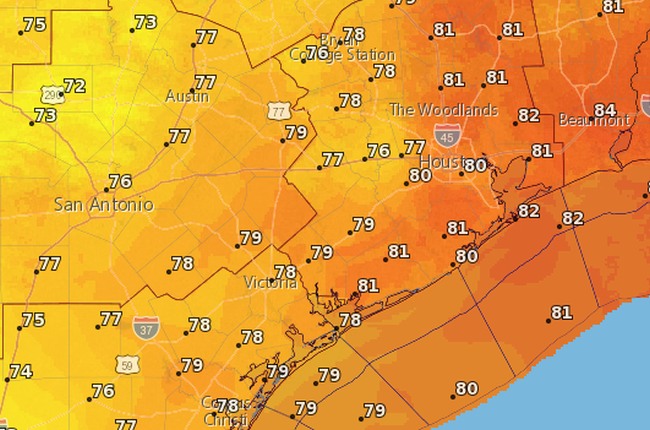
Houston’s forecast remains more or less on track: We’ll have three more hot, summer-like days before a cold front arrives later on Sunday. This front should be strong enough such that we’re calling Monday “Fall Day,” for the real beginning of fall-like weather in Houston.
Today
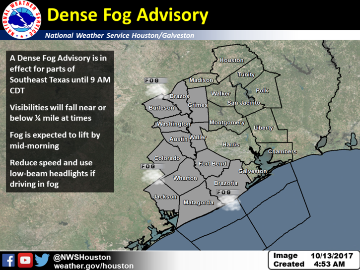
Low-level clouds have developed across much of the Brazos Valley this morning, and are extending into the western and parts of the central Houston area. This has led the National Weather Service to issue a “Dense Fog Advisory” for the western half of the metro area through 9am this morning. The rising sun should burn the clouds off, and this will give way to a warm, sunny, and muggy day with highs of around 90 degrees.
Saturday
Another day like Friday, with some fog possible in the morning before a very warm and sunny day with highs again near 90 degrees. The record high for Saturday, 92 degrees, is not entirely out of reach.