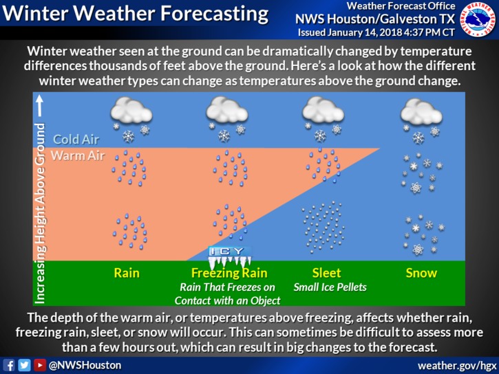
As temperatures have plunged across the Houston area during the last six hours, rain has turned into a wintry mix of sleet, freezing rain, and snow. (Yes, it has already snowed lightly at Bush Intercontinental Airport this morning, the first time that has happened three times in a winter season since 1973). Here’s a look at what happens next.
More precipitation is coming
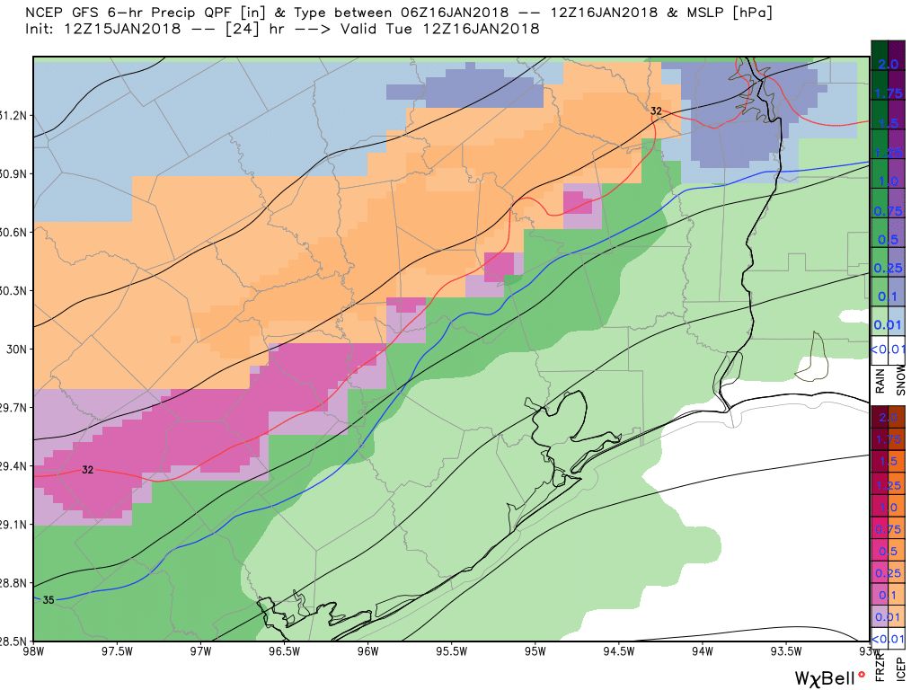
Houston has seen some breaks in the rain and sleet this morning, but there are additional areas of precipitation to the west of the region that will move into the metro area today. Although accumulations are unlikely to be too significant, it doesn’t take much moisture on the surface of a road to make it slick. Forecast models have been pretty consistent in bringing additional rounds of sleet, freezing rain, and snow through the region until about 4pm to 6pm CT today. Snow is more likely than other precipitation types this afternoon.
Roads are starting to freeze
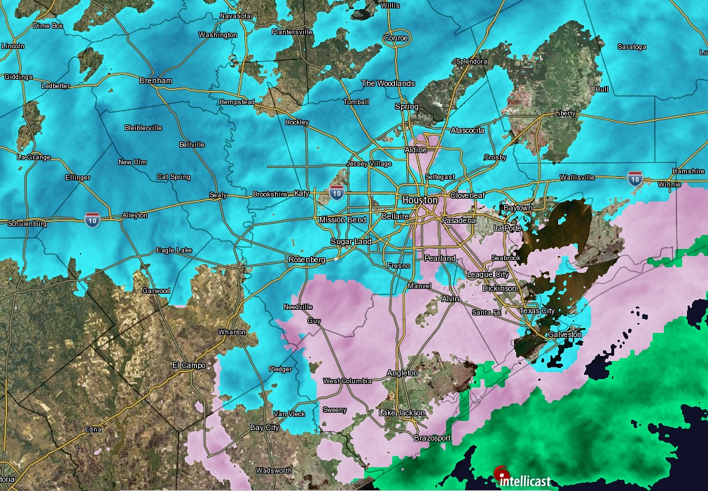
Houston Transtar is keeping a (steadily growing) list of roadways affected by ice in the metro area. So far, most of the problems have occurred to the north, in Montgomery County, and west of Houston. This is understandable, as those areas have experienced freezing conditions for a longer period of time. Most roadways within Houston itself are still covered with just water, because the ground is still “warm” from Monday, when highs reached into the upper 60s. But now that most of Houston is now at about 30 degrees, and likely to slip into the upper 20s this afternoon, wet roads will gradually become icy roads—especially bridges and overpasses. How much of an ice rink Houston becomes depends upon the amount of precipitation this afternoon. With enough wind and breaks in the precipitation, there is a chance for some evaporation and perhaps we will have dry roads by the time the hard freeze hits tonight. Perhaps. But probably not. Best to leave work early today, if possible, and stay home this evening.