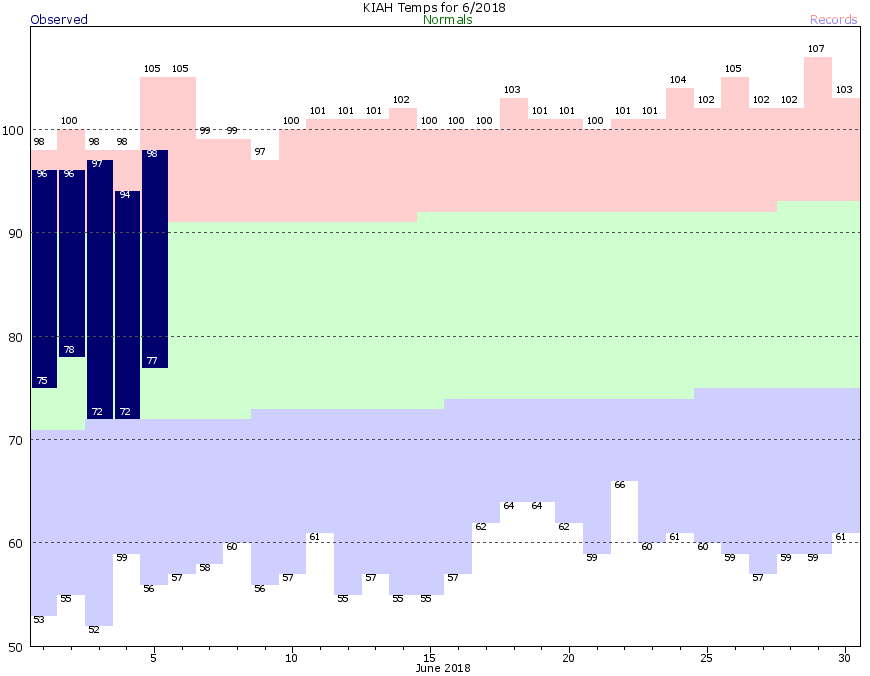
96, 96, 97, 94, 98, 96, 94.
Those are not winning lottery numbers. They are our high temperatures so far this June. I wish I could say it would get better, but it does not appear that is in the cards. However, we will continue to mention at least some increasing chances for a return to more typical summer weather, which could theoretically mean more typical daily showers and storms than we’ve seen lately. We’re optimists at heart.
Friday & Saturday
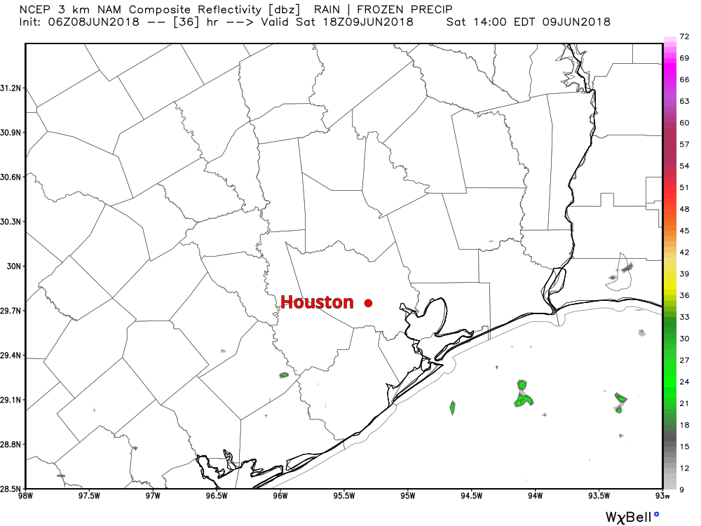
For now, there’s not much change expected. Friday should be another hot and dry one. There may be a brief downpour southwest of Sugar Land down 59 or along the coast. But aside from that, just expect sun, clouds, and high temperatures in the low- to mid-90s. I do think the coverage of showers on Saturday afternoon will be at least a little closer to average for this time of year. Odds favor most of us staying dry, but again, optimism. Here’s a look at just one model, the NAM, which suggests the best chances of a bit of rain west of I-45 tomorrow.
So don’t be entirely shocked to see some rain tomorrow, but don’t necessarily be too excited for it either. High temperatures Saturday should be low- to mid-90s again after morning lows in the middle 70s.