Parts of Houston experienced storms on Sunday evening as convection fired along a boundary, and moved from east to west. It was feast or famine—areas near downtown received 1 inch of rain quickly, while areas northwest and southeast of Houston got no rain at all. The good news is that, unlike last week, we will have some scattered rain chances this week as high pressure it not full able to assert itself over the region’s weather.
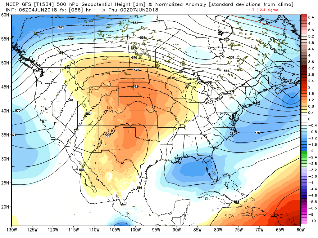
High pressure (redder colors) won’t be quite as dominant over the Texas coast this week. (Weather Bell)
Monday
Rain chances will remain today, especially for the northern half of the area, as moisture levels remain high and the atmosphere is somewhat unstable. Like Sunday, the storms should be most prevalent during the afternoon and evening hours with daytime heating, and they’re probably going to be hit-or-miss again. In addition to briefly heavy rainfall, we’re also going to need to watch for damaging winds and perhaps a little hail. One thing we’re sure not to miss out on is heat and humidity, with highs in the mid-90s for the most part.
It’s sunny and hot out there on Sunday afternoon, but an approaching (weak) front should provoke some scattered showers and thunderstorms later this afternoon and evening. We think a lot of the region won’t see more than some clouds, but for the parts of the region that do see storms they could be strong, with some brief heavy rain and winds.
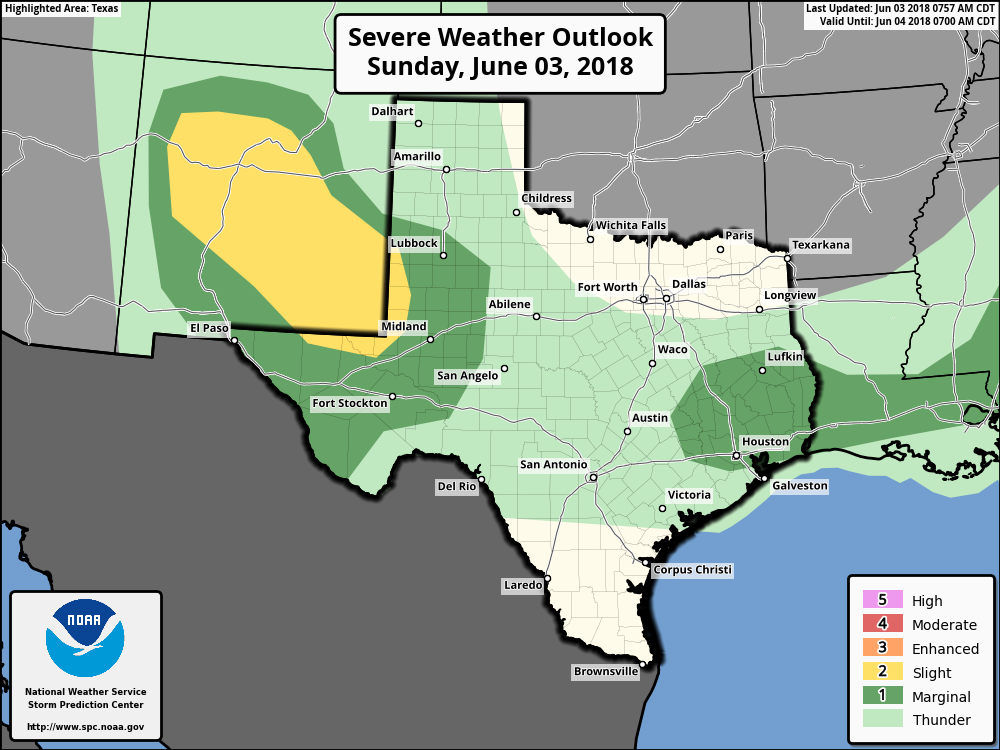
Severe storm outlook for Sunday and Sunday night. (NOAA)
Storms are most likely to form north of Interstate 10 later today as the precipitating front is presently only sagging into counties north of Houston. Most of the higher-resolution forecast models aren’t overly bullish on storms, however moisture levels are high enough, and there’s potentially enough instability, that the environment seems right for at least a few thunderstorms to develop.
The bottom line is that if you see storms forming nearby, it’s best to take cover if possible. They probably won’t last long.
In our second story to mark the beginning of the 2018 Atlantic hurricane season, Matt discusses how meteorologists are preparing for life after Harvey. If you missed part one, you can find it here.
In early October of 2017, I had just completed an invigorating 4 mile, 2,100 foot climb to Observation Point in Zion National Park, Utah. It marked one of my prouder moments as a person, because as hiking goes this was considered strenuous for someone like me who isn’t exactly crushing it at the gym every week. And I conquered it. The view was spectacular, but unfortunately, the cell service was great too. At the top of this beautiful overlook, an email was pushed to my phone, asking if I was certain that then Tropical Storm Nate was not going to threaten Texas. And I was reminded that the 2017 hurricane season was almost never going to end, nor was the job of a meteorologist. Even in the middle of nowhere.
The author (and his hat) at Observation Point in Zion National Park last October.
Here we are eight months later, officially beginning a new hurricane season. Obviously, the season began in May with Alberto, which thankfully stayed away from Texas. All the same, I have mixed emotions going into this season. It feels too soon, memories are too raw, and I look at things differently after last year. I’m less meteorologically fascinated and more consumed by personal impacts to people. I think many meteorologists feel similarly. Yes, we stand at the ready to inform and help guide folks through the season ahead, but for most of us, it just feels too soon.
We know so many people in the Houston area, Texas in general, Florida, and Puerto Rico also think it’s much too soon for hurricane season to be upon us once again. But we have to accept that hurricane season is a part of life in these places. It’s a risk we have to live with. After the devastation and misery of last year, I reached out to a handful of folks to “take our temperature” as we head into a new season. We learned much from last year, and we need to apply those lessons in the 2018 season. Here are some thoughts on both the challenges ahead and the progress made.
The month of May will go into the books as the third hottest May on record back to 1889 in Houston. Our average temperature was 79.8 degrees, putting us in between 2010 and 2003. The warmest May on record for Houston was 1996 when we had an average of 81.4 degrees. May 2018 also finished with 20 days of 90 degrees or hotter, a new record for number of 90 degree days for the month.
We have much more heat in store for the days ahead. But we do have a nagging storm chance this weekend, just low enough to be disappointing but just high enough to have to mention. The details…
Today & Saturday
Look for very similar conditions both today and tomorrow: Sun, clouds, and hot. There will probably be no showers in the area either day. Expect temperatures to hit the middle 90s again today and the mid to perhaps upper 90s tomorrow.
Sunday & Monday
I’m actually going to lump Sunday and Monday together today. There have been a couple minor changes to the forecast, mostly in terms of timing the rain chances. A weak boundary (call it a “front” if you’d like) will drop south from northeast Texas on Sunday. It sort of drags its feet as it approaches Houston, so that will allow rain chances to appear both Sunday and Monday. I wouldn’t get too excited, as the ingredients for storminess still look rather sub-par. But, nevertheless, we’ll hold on to some hope for some cooling rains. If we were assigning odds for who could see rain, those north of I-10 may stand the best chance on Sunday and Monday.
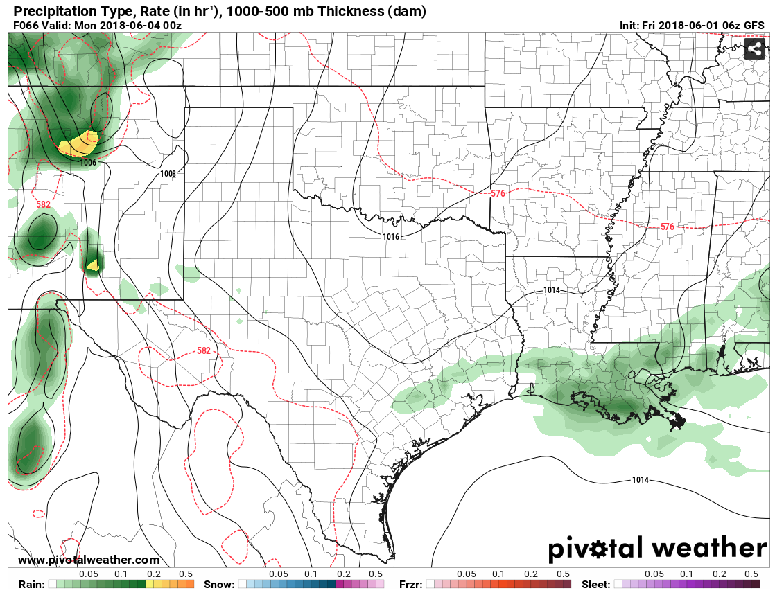
The GFS model shows just the slightest of rain chances on Sunday afternoon across southeast Texas. (Pivotal Weather)
Outside the rain chances, it will be partly to mostly sunny and continued hot. I expect mid to upper 90s Sunday and similar temperatures on Monday, but perhaps a degree or two cooler.