Houston’s temperature dropped below 40 degrees on Tuesday morning for the first time since February 12, and our lows this morning will be quite a bit warmer than the next two mornings. The region’s first freeze since January is on tap for tonight for most of Houston except the coastal areas.
Tuesday
Today will be a cold one, without a doubt. Skies should remain mostly cloudy, and this will likely limit high temperatures in the mid-40s. Brisk, northerly winds at around 15 mph will push wind chill temperatures into the 30s—so you’ll definitely want a jacket at the very least. The radar is showing some very spotty snow flurries and sleet to the west of the region this morning, and this area of moister air aloft will move over the Houston region between about 8am and noon. However, the air nearer the surface of our region is very dry, so while we can’t entirely rule out a few sleet pellets or snow flurries this morning, they’re unlikely.
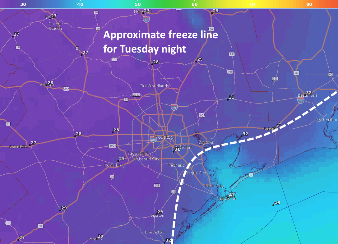
Tonight will be the region’s coldest since mid-January, with most of the area seeing a light-to-moderate freeze .The usual precautions for pets and plants apply, although it probably won’t be cold enough to threaten pipes. The record low for Nov. 14 in Houston is 28 degrees, and I suspect the city’s official station at Bush Intercontinental Airport will come close to that.