Houston may hit 90 degrees for the first time this year on Tuesday

Houston’s temperature last reached 90 degrees way back on October 14, 2018. Since then, 177 days have passed—nearly half a year. However, our string of sub-90 degree weather may soon be at an end. High resolution models indicate that both Tuesday and Wednesday (less likely) have a chance of hitting the 90-degree mark at Bush Intercontinental Airport and other parts of the city. The odds are probably a bit less than 50-50, but definitely non-zero. Cooler weather lies beyond.
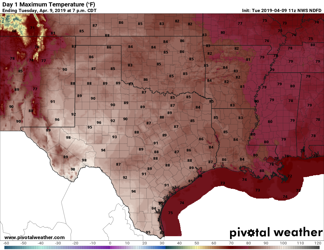
Tuesday will be a warm one for Texas, probably the warmest of 2019 so far. (Pivotal Weather)

Tuesday

With sunny skies, somewhat dry air, and light winds, conditions will be ideal for heating today, and so most of the region should see the upper-80s. We are already at a time when the Sun is high enough in the sky—it reaches an angle 68 degrees today, about the same as Labor Day weekend—to fairly quickly cause sunburns so please remember that if you’re outside for extended periods of time this week. Lows tonight will fall into the 60s.

See full post

Spring storm season arrives in Houston, with a warm week ahead

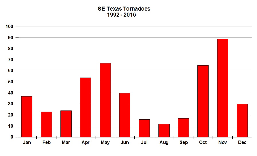
Sunday’s strong storms, including some significant straight-line wind damage in parts of Houston and at least one confirmed tornado, heralded the beginning of spring storm season for the region. This period of heightened tornadoes and severe weather typically occurs during April, May, and early June.

All tornadoes, by month, since 1992 for the southeast Texas region. (National Weather Service)

The spring storm season typically fades as we get into summer—when dynamic fronts typically end, and high pressure more or less asserts control of our weather. Then, the primary threat comes from the Gulf of Mexico and hurricane season. Speaking of that, Colorado State University’s Phil Klotzbach has issued his annual forecast for the Atlantic Hurricane Season. As always, we recommend not putting too much stock in such predictions, because they don’t have much specificity, and overall they are only moderately better than chance. With that said, Phil expects an overall near-normal year, with 13 named storms, five of which become hurricanes.

“The current weak El Niño event appears likely to persist and perhaps even strengthen this summer/fall. Sea surface temperatures averaged across the tropical Atlantic are slightly below normal, and the far North Atlantic is anomalously cool,” Klotzbach said. All of that will help restrain Atlantic activity, but one big unknown is air pressures over the tropical Atlantic later this summer. Now, let’s jump into our more immediate forecast.

Monday

Low pressure is moving away from the region, but we could still see a few, light, scattered showers today as skies turn partly sunny. Drier air will fill in, as highs get up to around 80 degrees. Under mostly clear skies, low temperatures tonight will be quite pleasant—falling to near 60 degrees in the city.

See full post

Strong storms will roll through Houston on Sunday

We’ve talked about the potential for storms this weekend for several days—and today that forecast will finally come to pass. A large squall complex of showers and thunderstorms has developed over South Texas, and we can be confident that this will move to the northeast, toward the Houston metro area.

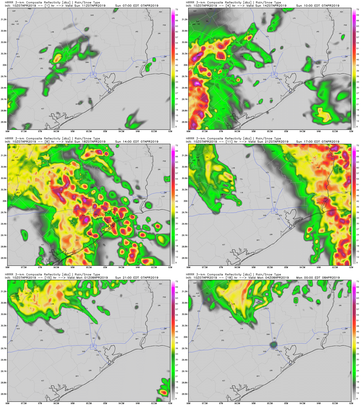
The primary threats from this system will be damaging winds, hail, and the potential for a few tornadoes. Rainfall rates will be high within these thunderstorms, but fortunately the system should be moving fairly rapidly. This will limit rain accumulations for most of the region to 1- 2 inches today. The following forecast, from the HRRR model, indicates the main line of storms should move through between 11am CT and 4pm CT. If you have outdoor plans at that time please have a strategy to take shelter quickly.

After the main line of storms we’ll see some drier air eventually move into the region. However we can’t rule out a chance of showers on Monday before sunny skies dominate our weather for the rest of the work week.

Answering questions about this weekend’s storms in Houston

We’ve got some active weather ahead this weekend, so let’s jump in and tell you everything we know right now.

Today

Right off the bat, if you have plans today, we do not foresee any serious issues. But (there’s always a “but”) that said, areas of fog have developed this morning across the entire area.

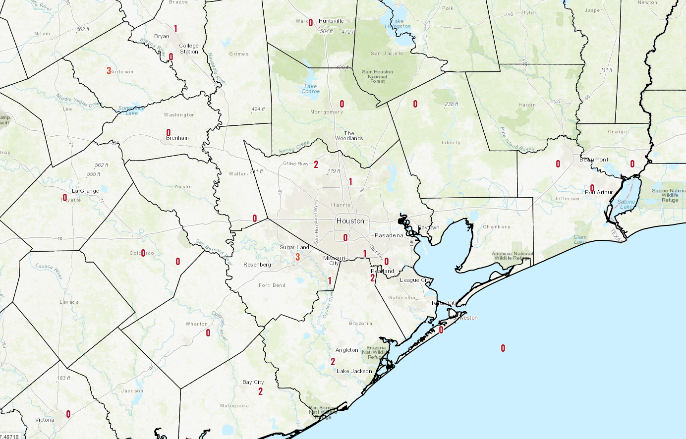
This map shows observed visibility (in miles) at various locations across the area, as of 5:30 AM Friday. It’s foggy, so give yourself a couple extra minutes out the door today if possible. (NWS)

The fog inland should gradually lift this morning, but it could persist along the coast well into this afternoon. Dense fog advisories are posted until 9 AM inland and until Noon at the coast. We’ll be partly to mostly cloudy and warm otherwise today. Highs should approach at least 80 degrees, if not the low-80s.

Tonight

For Houston, we don’t anticipate anything significant tonight, though a few showers or thunderstorms could develop after midnight, primarily north of I-10 and west of I-45, particularly out toward Sealy or Columbus up through Brenham or College Station. And even then, I really don’t think it would be anything other than very isolated through early Saturday morning. Look for low temperatures to only drop into the upper-60s.

In addition to an isolated shower or storm, fog should redevelop along the coast, possibly spreading inland again, though it shouldn’t be quite as widespread as today.

See full post