Today may be the last 80-degree day of 2019. (No promises!)

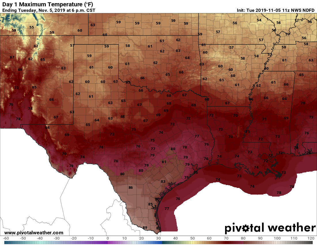
Good morning. It has only been 2.5 weeks since Houston experienced its last 90-degree day of 2019. But since then we’ve transitioned rapidly from late-summer weather into fall and now we’re teetering on winter-like weather (be sure and check the forecast for next week below). Anyway, I write that to say that I think today may be one of the region’s last 80-degree days for awhile and perhaps even the last such day of this year. Although that is certainly no guarantee.

Wednesday

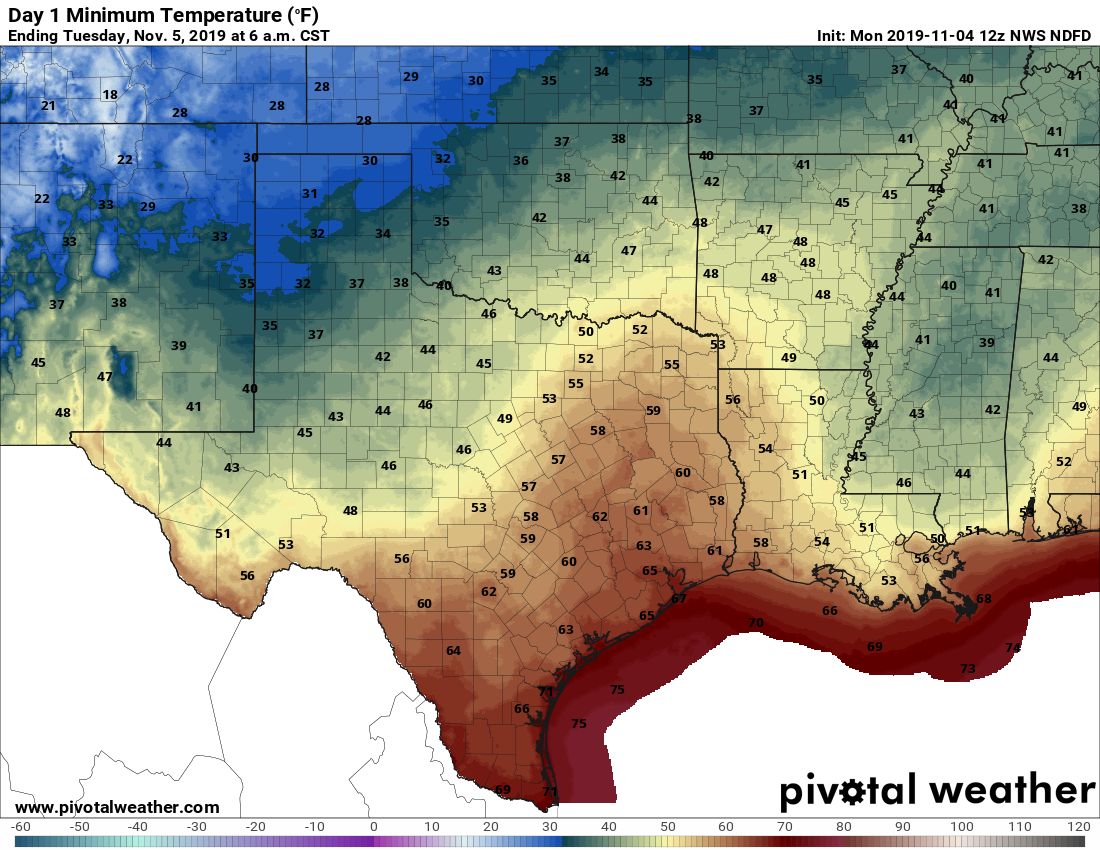
We’ll see some high clouds today, but for the most part we can probably expect mostly sunny skies throughout today. Given the sunshine, and flow of warm air, we can probably expect high temperatures to nudge up to around 80 degrees today, or a bit warmer for some inland areas. Lows tonight will generally fall into the 60s—how far will depend upon your distance from the coast.

NOAA rainfall accumulation forecast for Thursday and Friday. (Pivotal Weather)

Thursday

Clouds will build Wednesday night, and Thursday should be a mostly cloudy affair. Highs should generally get into the mid- to upper-70s ahead of the cold front. There is still some question when the front will push into Houston, but I’d guess it will reach northern and western parts of the metro area by late afternoon, and push off the coast by or before midnight—but don’t hold me to that timing. Another question is rainfall. If there’s any agreement in the models it’s that the better chances lie south of Interstate 10, and closer to the coast. I still think most of the region will see between 0.5 and 1.0 inch of rain on Thursday and Thursday night, with the isolated potential for 2.0 inches or more for some areas near the Gulf.

See full post

Houston this week: Warm, cool, then cold

Good morning. With the warmer overnight conditions, some fog has developed over the area, particularly across the western metro area in places such as Tomball and Katy. Aside from that, our weather will be pretty mellow until Thursday, after which a succession of cold fronts bring winter-like conditions to the region by early next week.

Tuesday

Today will be warm as Houston falls under the influence of Gulf of Mexico air, with highs reaching up to about 80 degrees despite mostly cloudy skies. Forecast models are hinting at some very slight, very scattered rain showers today, but for the most part we’ll just see clouds. Low temperatures on Tuesday night should fall into the low- to mid-60s as winds become more easterly.

Highs Tuesday will be fairly warm, especially to the southwest of Houston. (Pivotal Weather)

Wednesday

We’ll see partly sunny skies on Wednesday, with highs in the mid- to upper-70s. Rain chances are near zero.

Thursday

We’re still not entirely sure what Thursday is going to look like, but most of the day ahead of a cold front should be fairly warm, especially for central and southern parts of the metro area. High temperatures will likely push up to around 80 degrees despite mostly cloudy skies. Moderate rainfall ahead of, along with, and just after the front will be likely on Thursday during the afternoon, evening in most of Houston, and perhaps continuing after midnight for areas along the coast. Accumulations of 0.5 to 1.0 inch seem likely for most, with a few isolated areas perhaps seeing as much as 2 inches of rain. Temperatures and dewpoints will fall after the frontal passage, which should occur during the late evening for most of the city.

See full post

A mostly quiet fall-like week for Houston lies ahead

Well, I hope you enjoyed that weekend. Sunday, especially, offered a mix of cool, dry air, and sunshine that were just about perfect for fall. It was hard not to spend most of the day outside. The good news is that next weekend should have a similar mix of pleasant fall air and sunshine.

Monday

Clouds have returned this morning to most of the metro area, indicative of the region’s changing air flow. As a result we’ll see higher temperatures—mid-70s, mostly—and higher humidity throughout the day. Skies should remain partly to mostly cloudy. Low temperatures on Monday night will not cool down much, only falling into the mid-60s for most of the area.

Low temperatures on Tuesday morning could support the development of fog. (Pivotal Weather)

Tuesday

After several colder nights, the combination of these warmer nighttime temperatures, moisture returning from the Gulf of Mexico, and light winds will probably lead to the development of some widespread fog on Tuesday morning. A weak front will move into Houston, and perhaps stall near the coast, on Tuesday. This is unlikely to have much of an effect, but may generate a low chance of showers, perhaps 10 or 20 percent around I-10 or points south. For the most part this should be a partly to mostly cloudy day, with highs in the 70s.

Wednesday

This should be a partly to mostly sunny day, with highs in the 70s.

See full post

Gorgeous weekend after Houston’s coldest morning in months

Houston hit 57° officially on Halloween, a couple degrees warmer than expected, which allowed us to experience the fourth coldest Halloween maximum temperature since official records began in Houston in 1889. It was the coldest Halloween since we also hit 57° back in 1993, which featured the all-time October low temperature of 29° too.

A few other superlatives across Texas from yesterday:

  • Amarillo was 14° on Thursday, the second coldest October temperature on record (back to 1892).
  • Lubbock hit 16° on Thursday, their coldest October morning on record (back to 1913).
  • Midland hit 16° on Thursday, their coldest October morning on record (back to 1930).
  • Abilene hit 20° on Thursday, their coldest October morning on record (back to 1885).
  • Dallas hit 30°, their 9th earliest freeze on record.

By any measure, this is not just an early season cold air mass, this is one of the earliest wintry air masses in Texas in recent years.

Houston is close to a record low this morning, but as of 6 AM, we’re just a couple ticks short.

Temperatures this morning (as of 5:30) are in the 30s almost everywhere away from the coast and middle of the city. There were quite a few pockets of subfreezing temperatures too. (NOAA)

As I write this, Houston officially sits at 37°, our coldest temperature since at least April 2nd. We will see if we can shave another degree or two off of that reading for the official low temperature and have our coldest morning since early March. The record low this morning is 35°, set back in 1993. The coldest readings in the metro area this morning seem to be right along Spring Creek to the north, with several sites reporting 31° as of 5:30 AM. Elsewhere, Conroe is down to 30°, Navasota has hit 29°, and Huntsville shows 28° so far. Pretty chilly!

Rest of today

The rest of Friday looks great. Sunshine will dominate, with nothing more than a few high clouds and temperatures will quickly warm up through the 40s and into the 50s. Most of the area should top out around 60 degrees or a little above that with much lighter winds than yesterday.

Weekend

Both Saturday and Sunday should see mainly sunny skies. There could be a period or two of some higher clouds at times, blemishing the otherwise blue sky. But that’s about as bad as it would get. Morning lows on Saturday should still be cold, but they will end up a good bit milder than this morning, bottoming out in the low- to mid-40s.

Instead of widespread 30s, Saturday morning should feature widespread lower and middle 40s across the region. (NWS forecast via Weather Bell)

A secondary cool front is going to push through on Saturday morning, which will just serve to reinforce the cool, dry air already over the area. Look for Saturday afternoon to still top off in the mid-60s. Sunday’s morning low and daytime high should be very similar to Saturday.

See full post