Mostly sunny and pleasant through Christmas, but clouds return after

Good morning. After a fine, sunny weekend we will have continued sunshine through Christmas Day before some clouds and eventually some light rain returns toward the end of this week. Truth be told conditions this week look pretty mild, so unless something changes dramatically Matt and I are going to take Christmas Eve and Christmas Day off. We’ll be back on Thursday.

Monday

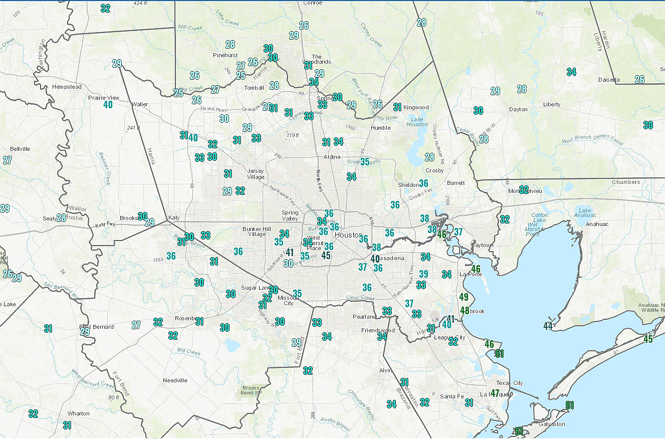
The only real weather concern we have for the first couple of days this week is some minor fog in the mornings. Aside from that, look for exceptional weather today, with highs in the upper 60s and mostly sunny skies. Winds will be light, so really there should be nothing to mar outdoors activities. Low temperatures tonight will fall into low 40s north of Houston, mid- to upper-40s in the city, and low 50s closer to the coast.

Tuesday

Look for more mostly sunny weather, with highs of around 70 degrees. Winds will be very light. This should be another exceptional day.
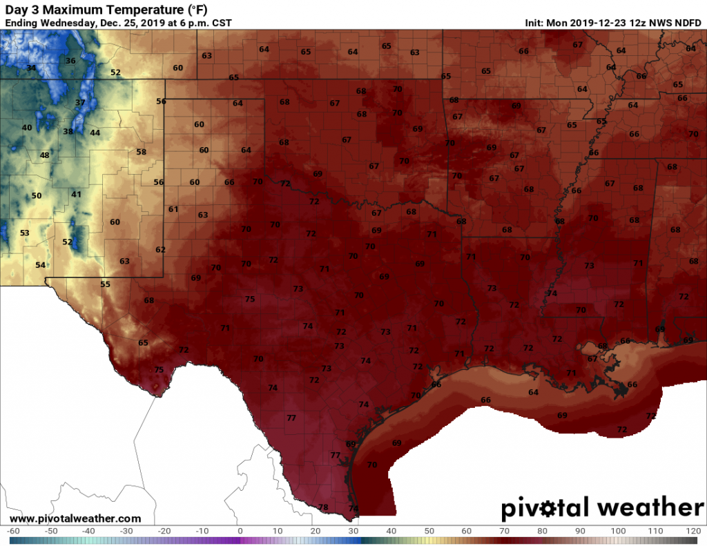
Christmas Day

Lows should start out around 50 degrees for most on Christmas morning, with a few clouds as the influence of high pressure begins to wane. However, we still expect mostly sunny skies throughout the afternoon hours, with lows on Christmas night dropping into the 50s.

Christmas Day looks pleasant across Texas, not too hot or not too cold. (Pivotal Weather)

Thursday through the weekend

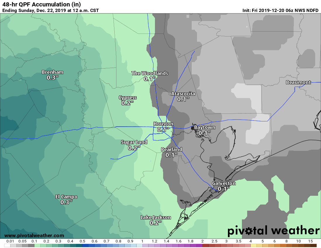
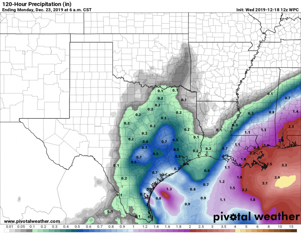
After a long string of weekends with at least one mostly sunny day, it looks like we may break the streak this weekend. Beginning on Thursday, we should see the return of mostly cloudy skies, and this probably will persist through Sunday. The details of the forecast for the end of the week are hazy, but we can probably expect highs in the 70s, with lows in the upper 50s and 60s. Rain chances will pick up to around 40 percent by Saturday and Sunday, but for now accumulations look slight, well below one-half inch. A weak front will probably move through at some point to provide moderately cooler weather.

New Year’s Eve

Our very early New Year’s Eve forecast calls for temperatures in the 40s as the New Year moves into Houston. Right now there is no strong signal for rain, so hopefully the festivities are dry. We’ll have to see.

Merry Christmas and Happy Holidays to all of our readers!


Hitting a brief speed bump in our beautiful late autumn weather

We have continued to amass nice stretches of weather here in Southeast Texas over the last couple weeks, as our seemingly endless gorgeous autumn continues. We have one small bump in the road to get through today and perhaps tomorrow before we resume our regularly scheduled programming for a few more days.

Today

We’re starting off a good bit warmer this morning than in recent mornings.The map below shows the difference in temperature between 5 AM this morning and 5 AM Thursday morning.

This map shows 24 hour temperature changes as of 5 AM Friday. Some places are 25° warmer than they were on Thursday morning. (NOAA)

Locations east of Houston are running about 10 to 15 degrees milder than yesterday morning, while from Houston to points west, temperatures are as much as 20 to 25 degrees warmer. This is because clouds have increased overnight. While there may be a few pockets of sunshine around this morning, expect those to fade as the day progresses.

It may look like rain is imminent at times today, but it may take a bit before you actually see any reach the ground. The air is still a bit dry after our recent nice weather, so it needs some time to saturate. Overall, a few light showers, light rain, or sprinkles may be observed today but for the most part, it likely won’t rain much before sunset. The best odds of any measurable rain will be west or well south of Houston.

Cloud cover should keep temperatures in check. Look for highs in the 50s for most folks.

Tonight

Houston will be caught between the best ingredients for rainfall tonight, with one batch to our south and another well east into Louisiana. Look for scattered showers here in the Houston area. The best chance for rainfall and some thunder will be to Houston’s south, closer to Matagorda Bay or Corpus Christi. There could also be some scattered showers north and west of Houston at times through the night. By Saturday morning, it is likely some of us will have seen a little measurable rain, while some others may not have seen much of anything. Overnight lows tonight will probably be in the mid- to upper-40s.

Saturday

It appears that Saturday will be a continuation of this trend. The best chance for more nuisance rain will be along the coast or south of Houston, again toward Matagorda Bay or Corpus Christi.

Rain chances should end by Saturday afternoon. Total rainfall is not going to be anything spectacular for most of us.

Total rainfall should be a few tenths of an inch (at best) through Saturday evening. Some places south and west of Houston could see a quarter-inch or half-inch or so. (Pivotal Weather)

Saturday won’t be the prettiest, as clouds dominate with highs in the 50s. We could see a few breaks of sun in the afternoon. A bit of a breeze could develop along the coast later Saturday and linger into Sunday, with some 15 to 20 mph gusts possible.

See full post

The first half of Christmas week will stuff your stocking with sunshine

Good morning—and for most of you its quite the cold one. Temperatures have fallen to freezing, or below, for most of the region except for the coast and the central Houston urban core (click the map below for details). Outlying areas such as Conroe, Cleveland, and Dayton have recorded temperatures in the upper 20s this morning. This should be the last of the really cold nights for awhile.

Thursday morning low temperatures across Houston at 6:45am CT. (National Weather Service)

Thursday

Winds are generally calm this morning, and as high pressure moves off, this will open the region to a more easterly flow. This somewhat more moist flow should allow for the development of some clouds later today, and especially tonight. Highs today should reach about 60 degrees, give or take, with light easterly winds. As clouds build overnight, lows should only fall into the mid-40s

Friday

The forecast for the first part of the weekend has changed somewhat. As atmospheric moisture levels rise, and an upper-level system in the atmosphere provides the impetus for rising air, we’re going to see some decent rain chances. However, most of the region will probably stay dry throughout the day Friday—the best rain chances appear to be west of Harris County. Expect cloudy skies, and a high of around 60 degrees. Scattered, light rain should gradually spread into the greater Houston region during the overnight hours, into Saturday morning.

See full post

The week ahead—mostly sunny except for a gloomy Friday

Temperatures have fallen to freezing levels this morning at some locations, including The Woodlands and Sugar Land, while remaining just above freezing in downtown Houston and closer to the coast. In short, it’s a cold morning, but at least the winds have died down across the region. It will feel like winter for a few more days before a warming trend next week.

Wednesday

Today will be a pleasant winter-like day for the region, with highs generally in the upper 50s under mostly sunny skies. Winds will be calm, to just a few mph out of the north. Low temperatures Wednesday night will probably be a couple of degrees warmer than Tuesday night, but a light freeze remains possible for inland areas. Venus is brilliant in the evening sky—be sure and check it out after sunset.

Rain accumulation forecast for now through Sunday. (Pivotal Weather)

Thursday

Another mostly sunny day, although as light winds shift to come from the east we may begin to see development of a few clouds during the afternoon. Highs will likely rise to around 60 degrees for most of the region. This changing flow, along with additional cloud development, should keep lows in the 40s on Thursday night.

Friday

This should be a gray and fairly gloomy day. There will be a couple of impulses for rain—the first during the day with rising moisture levels, and the second early on Saturday morning as an upper level system drags a front through the region. Accumulations look quite modest in Houston, as most of the region probably will see about one-half inch of rain, or less. Regions near Matagorda Bay could see as much as 1 inch. Highs Friday will reach about 60 degrees.

See full post