Welcome back to winter, Houston, where lows have generally dropped to around 40 degrees this morning. A freeze is possible later this week for parts of Houston, especially north of the city. Oh, and looking ahead to the weekend—it should be gorgeous again.
Tuesday
Skies are clear near the coast this morning, and should clear out over the entirety of the region throughout today. Even with the sunshine today, however, the cold air mass should help to limit temperatures to about 50 degrees. It will feel even colder, as a breeze persists out of the north at about 15mph, with occasional gusts.

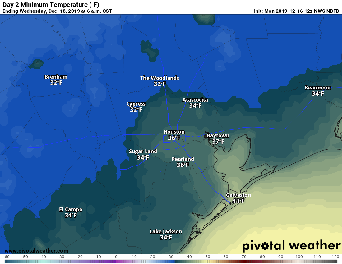
Wednesday and Thursday
Clear skies and weakening winds will lead to ideal cooling conditions on Wednesday and Thursday mornings. Expect temperatures in the mid- to upper-30s along the coast and just inland on both mornings, lows in the mid-30s to near freezing downtown, and lows at or just below freezing for Bush Intercontinental Airport and points north. Both days should be mostly sunny, although we probably will start to see the return of some clouds by Thursday afternoon along with the onshore flow. With light winds, we’ll see temperatures in the mid-50s to around 60 degrees.