We’re going to have a pair of warm and potentially wet days this week before a cool front arrives on Wednesday evening to bring sunshine and more seasonable weather back to the area. We’re still eyeing the possibility of storms Tuesday night and Wednesday, but we’re not overly concerned as we expect the system to weaken as it approaches Houston.
Tuesday
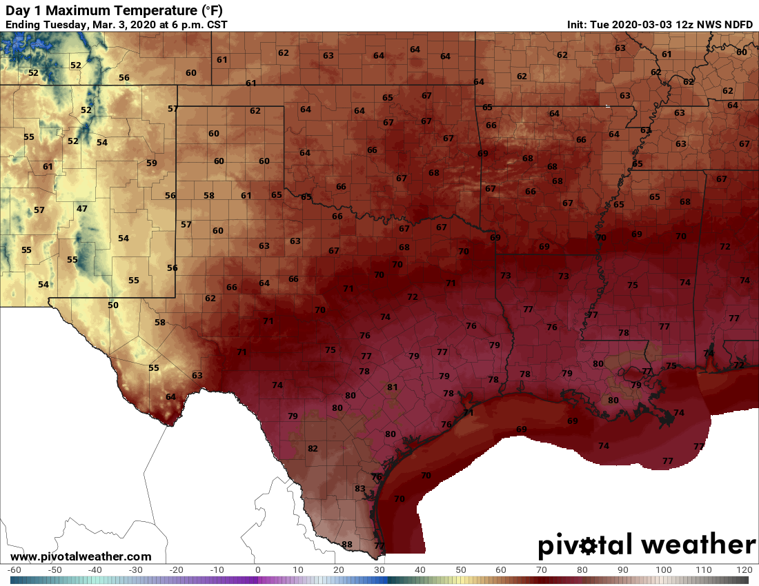
You’ve got two choices for weather today: Gray and humid, or humid and gray. Some areas near the coast are seeing foggy conditions, and that should burn off later this morning. We’ll be left with a cloudy day, high temperatures near 80 degrees, and increasingly moist air. But it seems likely that rain showers will, for the most part, hold off until at least the overnight hours. 
If you’re heading out to the Houston Livestock Show and Rodeo’s opening night, you probably don’t need sleeves. Temperatures this evening should remain in the low 70s, with only light winds from the southeast. A smattering of light rain is possible, but our guess is that you’ll remain dry.
Wednesday
An upper-level low pressure system will push through the region on Tuesday night and Wednesday, but the models are all over the place in terms of rainfall. They’re struggling with the fact that while there is a fair amount atmospheric moisture, a capping inversion may prevent widespread showers and thunderstorms. At a best guess, I think most of the area probably will see a couple of tenths of an inch of rainfall, but its certainly possible that northern areas (likely north of The Woodlands) could get 1 to 3 inches, and southern areas little to no rain at all. A front arrives Wednesday afternoon or evening to begin to cool us down.