Changes are coming to the Houston region beginning late tonight and tomorrow morning, taking us back into a wintry pattern for a couple days. Let’s break it all down.
Today
It actually should not be a terrible day today overall. It will continue quite warm and humid, but rain chances look low for most. The best chance of showers today would be for areas east and north of Houston, with a slightly better chance late today versus earlier. So have the umbrella, but I would be fairly surprised if you actually needed to break it open.
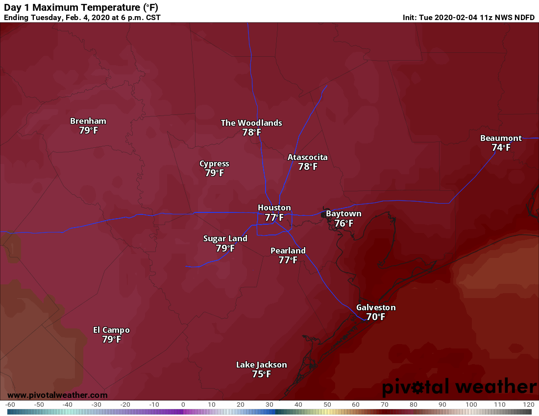
Today will be quite warm. We should be able to reach the upper 70s with little trouble today, and I think several 80 degree readings will be reported, particularly if we can break the clouds a bit. Some patchy fog is possible in Galveston or near the bays as the day goes on. It will probably be breezy again today, but winds should not be quite as strong as Monday.
Tonight & Wednesday
The chance of showers and even a few heavier thunderstorms will pick up overnight tonight and into Wednesday morning as our cold front approaches. We are not expecting any severe weather at this time.
In terms of timing, I think the front will approach the northwest suburbs between 10 PM and 1 AM tonight. From there, it gets a little trickier to exactly time out, but in general, a southeastward push of colder air should work across the region from the north through the morning.
Temperatures early tomorrow will be all over the place. Behind the front, essentially from Houston north and west, tomorrow morning should already be in the upper 40s through mid 50s. South and east of Houston may be in the low to mid 60s. The front will probably stall over Houston in the early morning, then resume a slow south and east slog by to mid late morning, reaching the coast by Noon. If you’re still on the warm side of the front tomorrow, look for a slow, steady 10-15 degree drop in temperatures after it passes. We should all drop back into the 40s (low 40s N & W, upper 40s near the coast) Wednesday afternoon. These shallow, cold air masses tend to overperform more often than they underperform around here, so I’m taking a slightly more aggressive posture with things today
In addition, it will be breezy behind the front, adding an extra chill.
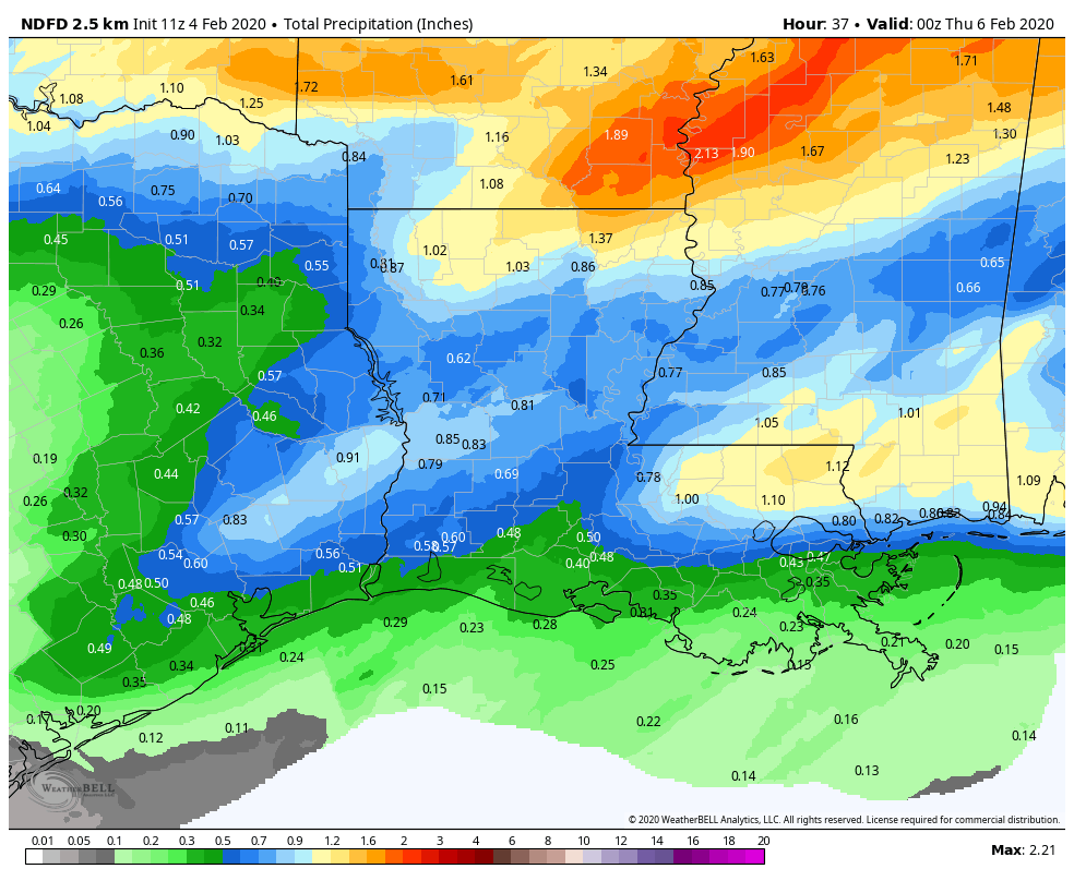
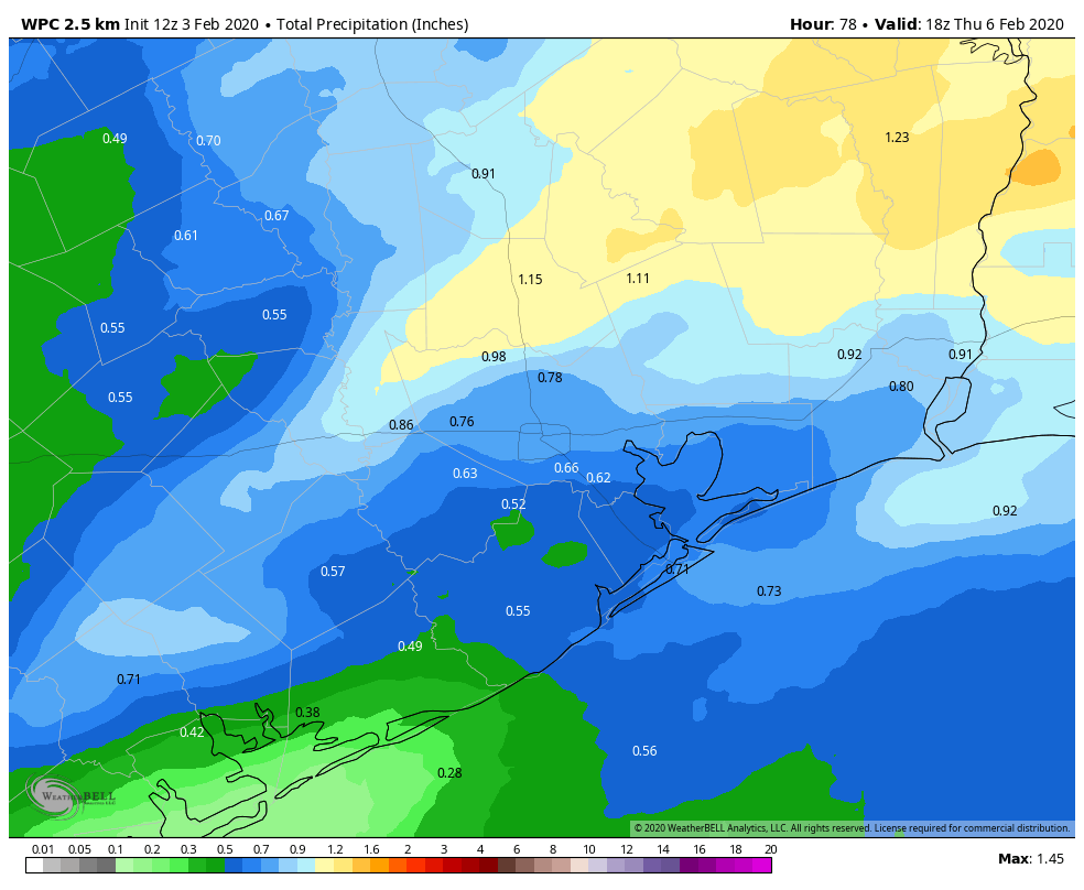
Rain totals will range from a half-inch or less south of Houston to perhaps near an inch in a few spots north. Showers should taper off in the afternoon on Wednesday.