After our splendid weekend weather—and who can quibble with two mostly sunny days, dry air, light winds and moderate temperatures?—our weather during the first half of the week will turn warmer, humid, and a little more unsettled before a strong cold front sweeps through the area. The first half of next weekend looks wonderful again.
Monday
Southerly winds are really going to get cranked up this morning, eventually gusting into the 20s, or possibly even the 30s for the western half of the metro area. These winds will help bring in warmer, more humid air, allowing high temperatures to rise into the mid-70s during the afternoon hours. It might be warmer, but for mostly cloudy skies keeping a lid on daytime heating. Those same clouds will insulate the area during the overnight hours, keeping low temperatures in the mid-60s. Light rain will be possible Monday and Monday night, but most of the area should remain dry.
Tuesday
Another day a lot like Monday, albeit with slightly lower winds. We’ll still see plenty of cloud cover, and if anything temperatures on Tuesday should be a few degrees warmer, possibly reaching 80 degrees. Rain chances will again be in the neighborhood of 30 percent for the region, with mostly light showers where precipitation does occur. Lows Tuesday night will again be warm—at least ahead of the cold front.

Wednesday
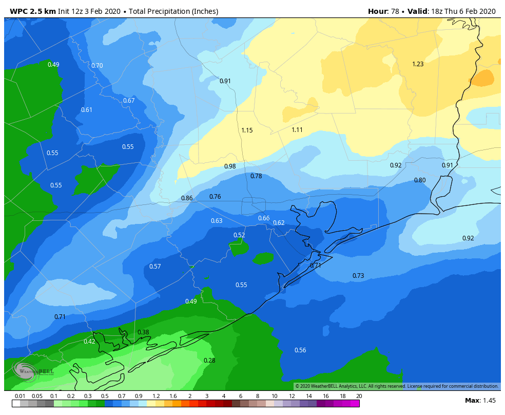
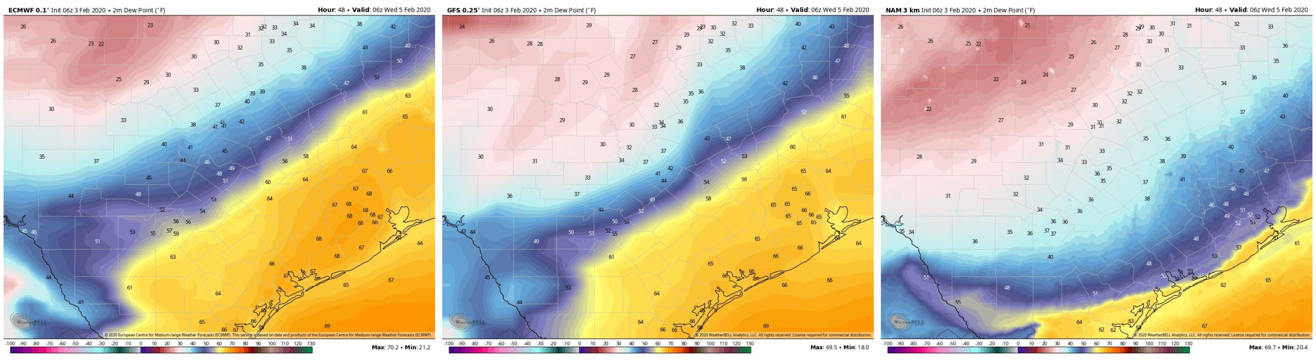
The big question in the forecast concerns the timing of our next strong front. There is a wide variance in the models about the timing of the front, with the NAM model bringing the front into central Houston at 10pm Tuesday night, the GFS model at 6am Wednesday morning, and the European model at 2pm Wednesday afternoon. Since this is a rather strong front, and will have some decent precipitation (perhaps 0.25 to 1 inch of rain) out ahead of it, Wednesday’s weather is going to be highly dependent upon when this front reaches your location. Temperatures will drop at least 20 degrees with the front’s passage, so yeah, we’re going to have wait until the models come into better agreement.
Thursday
Assuming the front makes it through on Wednesday, temperatures Thursday morning should get into the 30s for most of Houston, and despite clearing skies highs Thursday will likely only get into the low 50s. Winter!
Friday and Saturday
In the wake of the front, Friday and Saturday look like splendid days, with mostly sunny skies, highs perhaps in the upper 60s to lower 70s, and lows perhaps around 50 degrees.
Sunday
Clouds likely return at some point during the weekend, so at this point we’re going to pencil in Sunday as most cloudy, with highs of around 70 degrees.
should we protect plants?