Storms rumbling through Houston as a “cool” front arrives

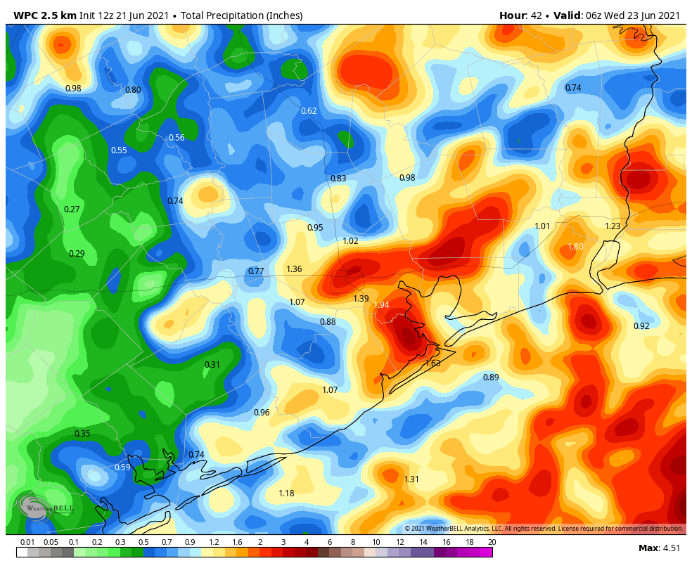
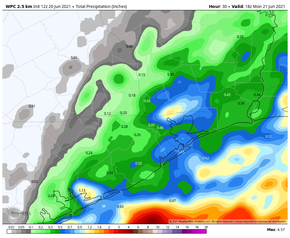
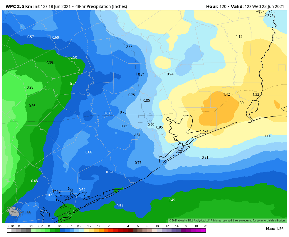
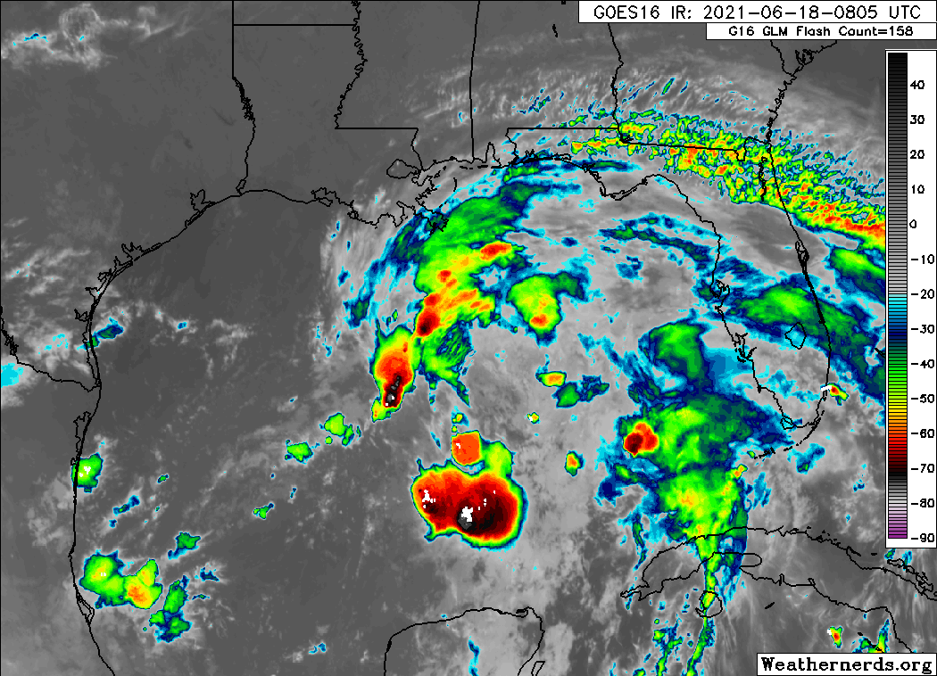
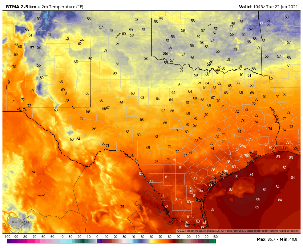
In meteorological terms, a cool front is in fact moving into the region. However, in practical terms, it’s late June. So don’t expect much cool or dry air. Far inland areas may see some dewpoints in the upper 60s, but overall the only sensible effects from this storm will be elevated rain chances. We saw scattered storms on Monday—some of which were pretty intense on the east side—and a slightly more organized line of storms dropped into Houston overnight. These rains should continue to progress toward the coast this morning.

Tuesday

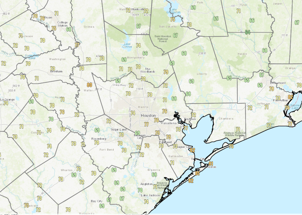
Skies will clear out later this morning for most of the region, with light northeast winds and high temperatures reaching about 90 degrees. All in all, for late June, not bad. Moisture levels will remain higher south of Interstate 10, so we could well see the redevelopment of at least some scattered showers there after noon today. Overnight lows will generally be in the upper 70s.

You can find lows in the 50s in the Panhandle this morning. (Weather Bell)

Wednesday

The “front,” such as it is, will retreat back north on Wednesday and high pressure will gradually replace it. This will allow for skies to remain partly to mostly sunny, and highs should push back into the low 90s at least. A few showers may develop during the afternoon hours, along the sea breeze.
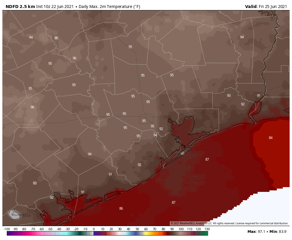
Thursday and Friday

Full-on summer weather returns, with ample sunshine and highs reaching the mid-90s. Again, the sea breeze may spark a few showers, but most of us will remain dry.

Saturday and Sunday

The high pressure that will make for sunny conditions during the second half of the work week will likely weaken by Saturday, leading to an increase in rain chances. Saturday still will probably be mostly sunny, and with perhaps a 30 percent chance of rain I’d say many outdoor activities should be OK. I’m less confident in Sunday, when shower coverage might increase some, especially during the afternoon hours. Highs will be in the low- to mid-90s, regardless.

By Friday, highs will reach the mid-90s at least for Houston. (Weather Bell)

Next week

Rain chances will likely tick up further on Monday and Tuesday of next week as atmospheric moisture levels are likely to increase, and atmospheric conditions favor rising air. It’s too early to say much about accumulations, but 1 to 2 inches of rain after several hot and sunny days would be not be unwelcome.

Tropics

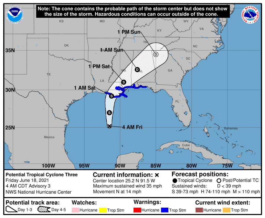
The Gulf of Mexico is quiet in the wake of Tropical Storm Claudette, but we’re starting to see some signs that the deeper tropics are waking up. (To be clear, there is nothing out there right now that should really concern us at all). Matt will have a full roundup on the tropics in a post early this afternoon.

After the summer solstice days get shorter, but alas, not less hot

The summer solstice arrived late on Sunday night, at 10:32 pm CT. The solstice, of course, is the longest day and the shortest night in the Northern Hemisphere, and results from the 23.4-degree tilt in the Earth’s axis and the planet’s rotation around the Sun. The solstice begins a three-month period known as “astronomical summer.”

In Houston, of course, it generally feels summer-like from June through September. Although our days will now slowly begin to grow shorter, due to our proximity to the Gulf of Mexico and a lag in oceanic warming (and cooling), most of our summer heat comes after the longest day of the year.

The following map, shared by Brian Brettschneider on Twitter, shows the the time of the sunset across the United States and Canada on the summer solstice. This is affected both by the solstice as well as time zones that humans have created around the Earth. The area that sees 24 hours of daylight on the solstice, of course, lies above the Arctic Circle.

Map showing the time on sunset on the summer solstice. (Brian Brettschneider/Twitter)

As for our weather this week, we will experience a couple of more wet and slightly cooler days before high temperatures return into the mid-90s for the second half of this week.

Monday and Tuesday

Our weather over the next couple of days will be driven by a cool front—and we’re using the meteorological definition of a front, because it won’t have too much effect on how things feel out there. This front will act to increase the likelihood of rainfall on Monday, Monday night, and Tuesday morning. I don’t think we’re going to see widespread, heavy rainfall, but some of the showers that develop will be capable of fairly intense rainfall rates. I think much of Houston will see 0.5 to 1.5 inches of rain, with a few bullseyes of 3 or more inches possible. Our best rain chances will likely come during the overnight hours.

In terms of temperatures, most of us will see highs around 90 degrees for the next two days due to the combination of cloud cover and the front. Will you feel it? If you live inland of Interstate 69/Highway 59, and you go outside on Tuesday evening or Wednesday morning, it may feel slightly drier outside.

NOAA rain accumulation forecast for now through Tuesday. (Weather Bell)

Wednesday, Thursday, and Friday

For the second half of the week we should see mostly sunny skies as high pressure begins to build over the area. Highs will likely rebound into the mid-90s and we’ll be right back into full-on summer days in Houston, with overnight lows of around 80 degrees.

Saturday and Sunday

The weekend forecast is a little bit less certain, as yet another front is likely to approach the region. However, this one very likely will stall out before reaching the Houston metro area. Nonetheless it may introduce some clouds and rain chances for the weekend. It does look like Saturday will be mostly sunny, and while there may be some scattered showers, the chances for wider rainfall likely will not come until Sunday. But all of these details will need to be hashed out in future forecasts.

Father’s Day may see the return of storms, especially near the coast

Hi all. I’m jumping in on Father’s Day to say that we are seeing some fairly high atmospheric moisture levels this morning that may, in turn, lead to at least scattered thunderstorms today, if not more widespread storms. This will provide a contrast to the recent string of hot and sunny days Houston has experienced.

NOAA rain accumulation forecast for Father’s Day. (Weather Bell)

The next three days all look fairly wet for the region. Given the higher moisture levels, a disturbed atmosphere, and a weak “cool” front on Monday night and Tuesday, each day should see elevated rain chances. Sunday through Tuesday will each probably have about a 50 to 70 percent chance of rain during the daytime, with lesser odds at night. The better rain chances will come closer to the coast, and for the eastern half of the region.

In terms of three-day accumulations, most of the area will probably see 0.5 to 1.5 inches if rain. However, for areas closer to the coast, and east of Interstate 45, it would not surprise me to see some areas pick up 3 to 5 inches between now and Tuesday night.

It’s not going to be a total washout, by any means. And areas west and north of Houston will likely see a fair bit of sunshine over the next few days. But if you’re heading to the beach to celebrate dad today, you probably should also buy him an umbrella as a gift—just in case.

We’ll return with a full post on Monday morning.

A mostly quiet couple days in Houston, as Gulf tropical system passes well to our east

Compared to earlier this week, it certainly feels a little more comfortable, with temperatures ranging from the mid or upper 60s well inland to around 80 degrees at the coast.

6 AM and it doesn’t feel dreadfully humid in much of the area, with even some 60s peppered in on the map. (NOAA)

We will see another day or so of drier air, helping to keep us relatively comfortable, thanks in part to Potential Tropical Cyclone #3 in the Gulf, which will pass to our east into Louisiana. This farther east track leads to a handful of minor forecast changes this weekend.

Today & Saturday

Both today and tomorrow look fairly uneventful in our area, with a mix of sun and clouds. Yes, there could be a stray shower or two that makes into the Houston region, and there could be a portion of an outer band from PTC3 that grazes eastern fringes of our area. But aside from that, it will just be hot and a bit humid. Look for highs in the low to mid-90s (some isolated upper-90s can’t be ruled out) and lows in the 70s. Humidity will likely increase a bit tomorrow, and the morning will feel less comfortable than yesterday or today has felt.

The big weekend change is that rain chances look higher on Sunday than they do Saturday now.

Sunday

We begin a little more onshore flow on Sunday, which means more humidity. Morning lows in the upper-70s seem more likely here. It also means a better chance at isolated to scattered thunderstorms, as a weak disturbance in the upper atmosphere finds a route into Texas and taps into some of that onshore flow. Not everyone will see rain, but there will likely be at least a few showers or storms around Sunday afternoon. High temperatures will be in the mid-90s.

Monday

Right now, Monday looks like a classic June day in Houston with sun, clouds, high humidity, morning lows in the 70s, daytime highs in the low-90s, and a chance of afternoon thunderstorms.

Tuesday & beyond

By Monday night, an actual cold front will be moving across Texas from north to south. We are unlikely to enjoy the cooler, less humid benefits of said front, but we will likely see scattered to perhaps even numerous showers and thunderstorms on Tuesday. Locally heavy rain is possible here, and a healthy chunk of the area should see at least some rain. Expect a less hot day Tuesday, with some chance highs don’t get above 90 degrees.

Expected rainfall on Tuesday and Wednesday next week will vary, but many places could see a half-inch to three-quarters of an inch of rain, with others seeing less and a handful seeing more. (Weather Bell)

By Wednesday and Thursday, rain chances won’t drop to zero, but they will diminish a bit as the front fizzles and high pressure begins to nose into the area. Look for highs back in the 90s and lows in the mid to upper-70s.

PTC 3 update

Potential Tropical Cyclone #3 continues across the Gulf this morning. To be honest, this is about as healthy as it has looked in its life cycle since it became an area to watch.

PTC 3 is steaming across the Gulf, heading toward the central Gulf Coast. (Weathernerds.org)

There’s a significant blowup of thunderstorms near and north/east of the center. This is why forecasters have been banging the drum regarding heavy rain being the main concern. Whatever the case, we assume we will see Tropical Storm Claudette come of this mess and approach the Louisiana coast tonight between Vermilion Bay and New Orleans.

PTC 3, what should be Claudette, will make landfall in eastern Louisiana tonight. (NOAA)

Locally, no impacts are expected, aside from perhaps slightly rougher surf and stronger than normal rip currents. Please use caution if swimming in the Gulf this weekend.

The main impacts in Louisiana and the Southeast will be from heavy rainfall. About 4 to 8 inches of rain should fall in southeast Louisiana, southern Mississippi, southern Alabama, and portions of the Florida Panhandle.

Heavy rainfall will occur across much of the Southeast over the next 3 days. (Pivotal Weather)

Higher amounts will be possible there, but the system may actually move along fast enough now to prevent major problems. But if your travels take you east of Louisiana this weekend, plan accordingly.

We aren’t expecting significant forecast changes this weekend, so look for our next update, as per usual, on Monday morning.