Rain chances remain, but our focus turns to heat this weekend

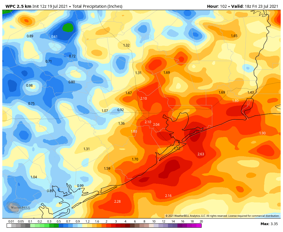
We are definitely beginning to transition from a wetter pattern to a drier one across our region, but before sunny skies dominate our weather we’ll see two more days with at least scattered chances of rain showers. Then, the heat really settles in this weekend, with some of our warmest weather this summer.

Also, some birds near Jersey Village were apparently having some fun this morning around sunrise, as you can see on the video below.

Wednesday

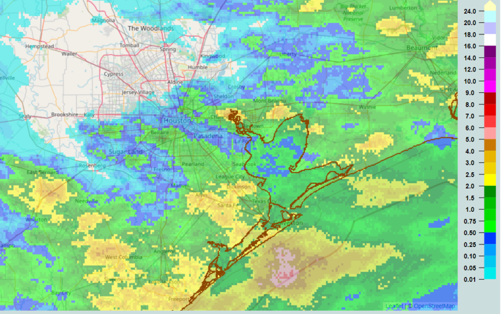
Conditions are warm this morning, with lows across much of the city barely dropping below 80 degrees. Mostly sunny skies will allow highs to rise into the low- to mid-90s this afternoon. This daytime heating combined with the sea breeze will allow for showers and thunderstorms to develop from about 2 pm to 8 pm CT, with briefly heavy rains possible. About one-third of the area is likely to see rains today, with the most likely locations along and near Interstate 10, I’d guess. Winds will be very light, and showers should abate as the sun sets.

Thursday

Thursday should be a lot like Wednesday.

Friday

By Friday we should begin to fall under the influence of high pressure. While some isolated showers will still be possible, chances are probably less than 20 percent that you’ll see rain. Highs will be solidly in the mid=90s.

Saturday and Sunday

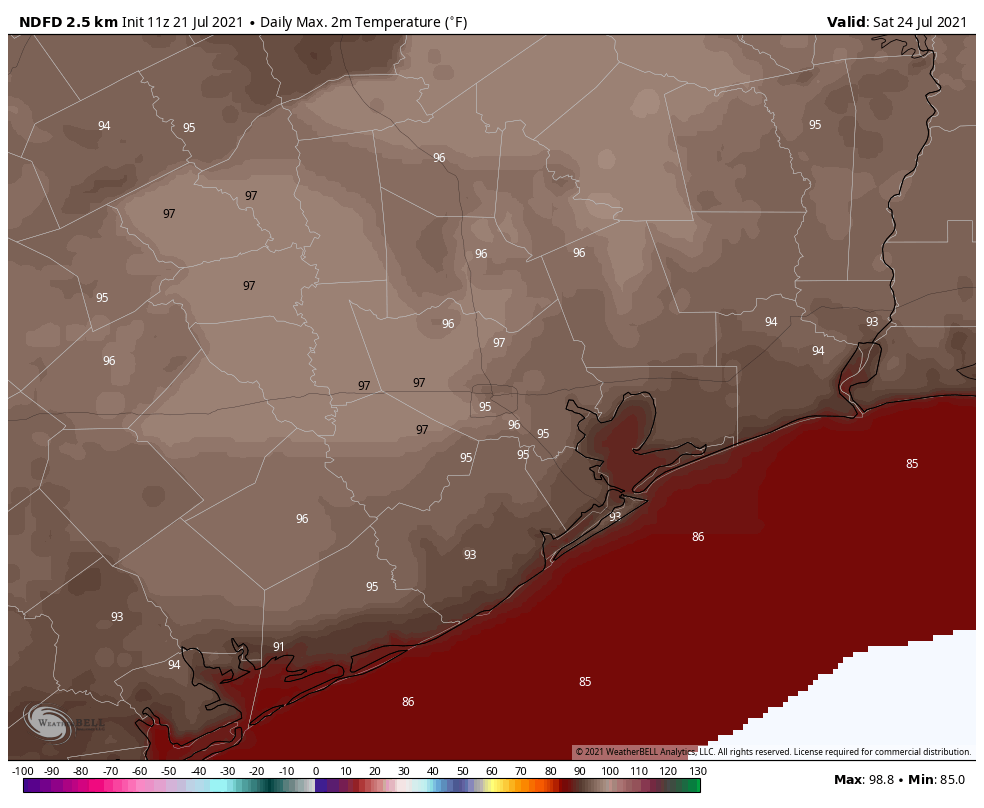
For those of you who have bemoaned the lack of hot and sunny weather in Houston this summer, you’re in luck. This weekend should bring the burn as high pressure settles over the area. We should see ample sunshine and high temperatures in the upper-90s. You’ll want to take care outside during the hottest parts of the day.

Next week

The aforementioned high pressure ridge may begin to back off a bit as we head into next week, and this would allow for highs to drop back into the mid-90s. We may also start to see the return of some slight rain chances by Tuesday or Wednesday as the sea breeze jump starts a bit of activity, but for now the timing of this remains uncertain.

Rain mostly offshore this morning, but a couple more days of storms around Houston

We’ve had quite a 12 hours of storms across the region, particularly from just north of I-10 south to the coast, with some impressive lightning and heavy rainfall. The highest 24 hour total I can find on the Harris County Food Control website is just a hair over 3 inches of rain near Dickinson. Radar estimated rainfall from the last 24 hours is shown here.

Rainfall estimates on radar since yesterday show that areas south and east of Houston hit the jackpot. (NOAA)

This morning’s radar snapshot below shows the bulk of the rainfall hugging the immediate coast, with the heaviest mostly offshore at this time.

The heaviest rain is mostly offshore now, with the exception of the Matagorda Bay area, where heavy rain was between Freeport and Palacios just after 6 AM (NOAA)

So, what’s next?

Today

Often, when we see this sort of cluster of rain offshore, it helps to cut off moisture inflow from the Gulf of Mexico. In other words, significant moisture is involved with the offshore rain, and it could help reduce rain chances on land a bit, especially the first half of today. That doesn’t mean it will be totally dry, but showers should be very isolated this morning for the most part.

As the day wears on and daytime heating takes over and presumably we see offshore rains weaken a bit, look for a few more storms over Houston and other inland locations. But today’s rain and storms will probably be more hit and miss than widespread, and odds may favor you avoiding rain. We’ll see how that goes. As someone flying to Houston in just a bit, I am okay with this.

Other than rain chances, expect clouds and sun. Highs will probably approach 90 degrees.

Wednesday and Thursday

Look for afternoon showers and thunderstorms, driven mostly by daytime heating and the sea breeze for the middle of the week. Not everyone will see storms, but those that do could easily see an inch or two of rain between both days. The overall pattern will stay pretty unsettled on both days, but it’s tough to get too cute with details today. We will know more tomorrow morning. Highs should be in the upper-80s with lows in the 70s.

Friday and weekend

The storm system in the upper atmosphere that will help the midweek period be so unsettled will continue working back to the west Friday, into West Texas. By Sunday, it ends up in Arizona (good news for the drought plagued West), so things should begin to really settle down around here this weekend. With more sun, that means more heat, and high temperatures should go from the low to mid-90s to mid to upper-90s as the weekend progresses. Rain chances are never zero in summer here, but they look to be quite low. We’re coming up on our hottest time of the year, so this isn’t too surprising. But still, be ready.

In addition to all that, it’s likely we’ll be seeing another blast of Saharan dust this weekend.

Saharan dust (purple) is going to blast ashore in Texas this weekend, coinciding with high heat. (NASA via Weather Bell)

It’s going to look, feel, and taste like high summer around Southeast Texas.

There are signs this very hot, drier weather will continue well into next week. If you’ve managed to keep the sprinklers off most of this summer, that may change next week.

Due to travel and work for both Eric and myself, we’ll be foregoing our tropical post today, but there’s honestly not much to discuss right now. The tropics remain quiet, and that should continue for at least another week or so. Things may change heading into August, as they often do, but for now we have nothing in particular to discuss. We will let you know when that changes.

Heavy rains, strong winds likely later today and tonight for Houston

Most of the Houston area saw a hot and sunny weekend, with highs in the mid-90s, and only a smattering of showers. We’ll now return to a wetter pattern for most of the coming work week, with strong storms possible tonight and Tuesday, before hot and sunny weather comes back for next weekend.

Monday

Conditions for much of today will be warm and muggy, with partly sunny skies and highs in the mid-90s. Scattered showers will be possible. The potential for more organized storms begins to increase later this afternoon as a weak front approaches our region from the north, and an associated line of showers and thunderstorms moves into Houston.

NOAA excessive rain outlook for Monday and Monday evening. NOAA)

Some of these storms could be strong, producing heavy rainfall and damaging winds, especially north of Interstate 10. In terms of timing, the line of storms is likely to reach a line from Sealy to Conroe at around 6 to 8 pm CT, push into Houston along Interstate 10 between 7 and 9 pm, and possibly weaken as they near the coast after 9 pm CT. Generally, we should see accumulations of 1 to 3 inches of rainfall, with higher localized amounts.

Tuesday

As the frontal boundary stalls out over the Houston region, we could see the redevelopment of showers and thunderstorms early on Tuesday morning, either just before or around sunrise. This may make for a mess during Tuesday morning’s commute, especially for areas along and south of Interstate 10.

After this second burst of rainfall, it is possible shower activity could wane some during the later morning and afternoon hours. However, I expect skies will remain partly to mostly cloudy, with highs in the upper 80s.

Wednesday and Thursday

The overall pattern will remain favorable for rainfall on Wednesday and Thursday, with fairly moist air and an atmosphere that promotes rising air. While I don’t think either of these two days will see the kinds of organized storms expected on Monday, you nonetheless probably have about a 50 percent chance of showers or a thunderstorm during the afternoon hours. Otherwise, expect highs in the low 90s with partly sunny skies.

Friday

Some scattered rains will be again possible on Friday, but by this point we should begin transitioning to a hotter and drier pattern, as high pressure begins to build over the area. Look for highs in the low 90s.

NOAA rain accumulation forecast for now through Friday morning. (Weather Bell)

Saturday and Sunday

Toward the end of July we expect to see high pressure assert itself, and for Houston that means hot, sunny, and humid weather. For now, therefore, we expect hot and mostly sunny conditions this weekend, with high temperatures in the mid-90s—and perhaps a touch warmer than that for inland areas. Most likely this hotter and drier pattern will persist into next week. If you’ve missed classic summertime weather in Houston, you’re in luck.

Weekend looking decent, and we perhaps see an end to the wet spell

Apologies for the late post this morning, but both Matt and I are balancing work, travel, and family schedules for the next few days so posts may be a bit off schedule through next Wednesday. Fortunately, the weather does not look too crazy as we continue with this wetter-and-cooler-than-normal pattern for July.

Friday

If you’ve appreciated Houston’s weather over the last several days you’re in luck, as Friday is likely to see similar conditions. The combination of daytime heating and the sea breeze should again spark the development of showers and thunderstorms later this morning, and these will be capable of producing briefly heavy rains and strong wind gusts. Perhaps 50 to 60 percent of the Houston region will see rain today to go along with partly sunny skies and highs in the low 90s. Rain chances will slacken this evening with the loss of daytime heating.

High temperatures on Friday will be moderate for mid-July. (Weather Bell)

Saturday

I’m cautiously optimistic about the forecast for the weekend. It looks like atmospheric moisture levels will fall back a little, and this should help to limit both the coverage of showers on Saturday and their intensity. I’d say you probably have about a one-in-three chance of seeing at least some light showers on Saturday, and with partly sunny skies highs will likely get into the low 90s.

Sunday

Sunday should bring more of the same weather, with highs not over-bearing for mid-July and a decent chance of a passing shower. At this time we don’t see much evidence for organized, significant rainfall this weekend. Winds will be light all weekend, out of the east or southeast. Humidity will, of course, be sky high.

NOAA rainfall accumulation forecast for Saturday and Sunday. (Weather Bell)

Next week

Monday will likely see persistence weather, meaning more scattered rain chances before the upper-level pattern becomes more favorable for rainfall later next week. Tuesday and Wednesday look fairly wet, and at this point I’d say much of the area could pick up an additional 1 to 3 inches of rain during the middle of next week. But that’s just a guess at this point.

By Thursday it really does look like high pressure will start to build over the area, and we could begin an extended period of hotter days in the mid-90s with mostly sunny skies. Some of you will welcome that, and others will dread it. As for Space City Weather’s opinion, I have to say, we’re just here for the fall cold fronts.

Have a great weekend, everyone.