Nicholas exiting the Houston area, and we now get a few days of calm

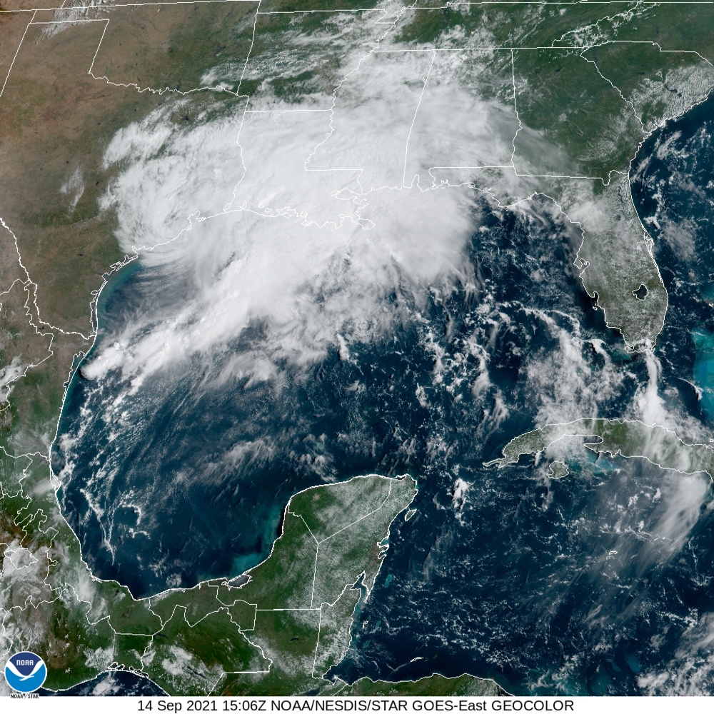
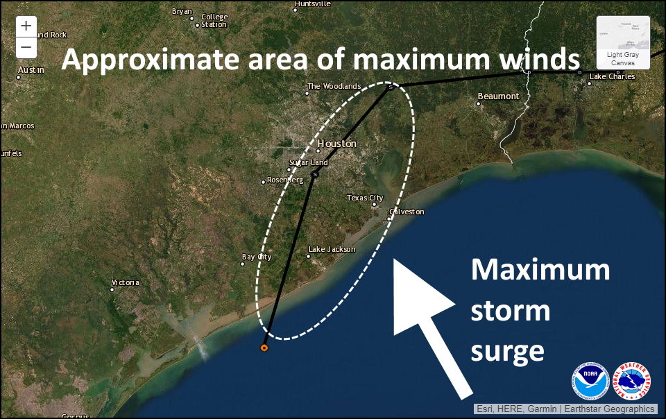
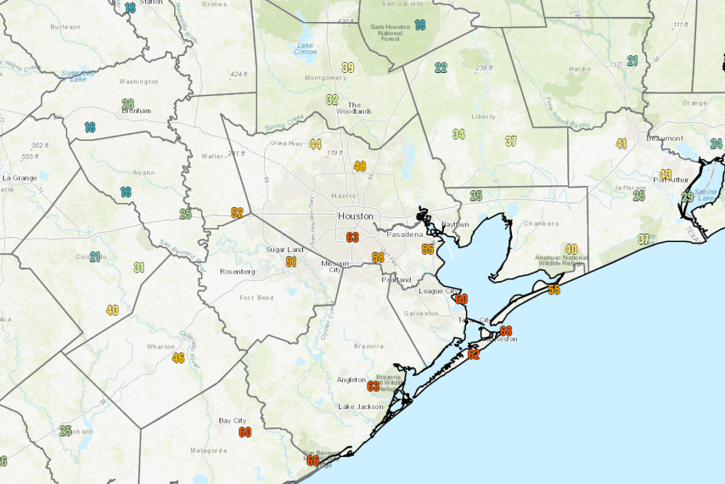
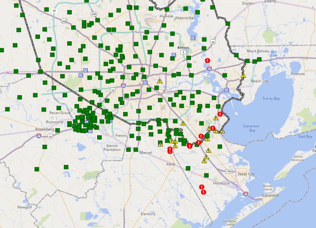
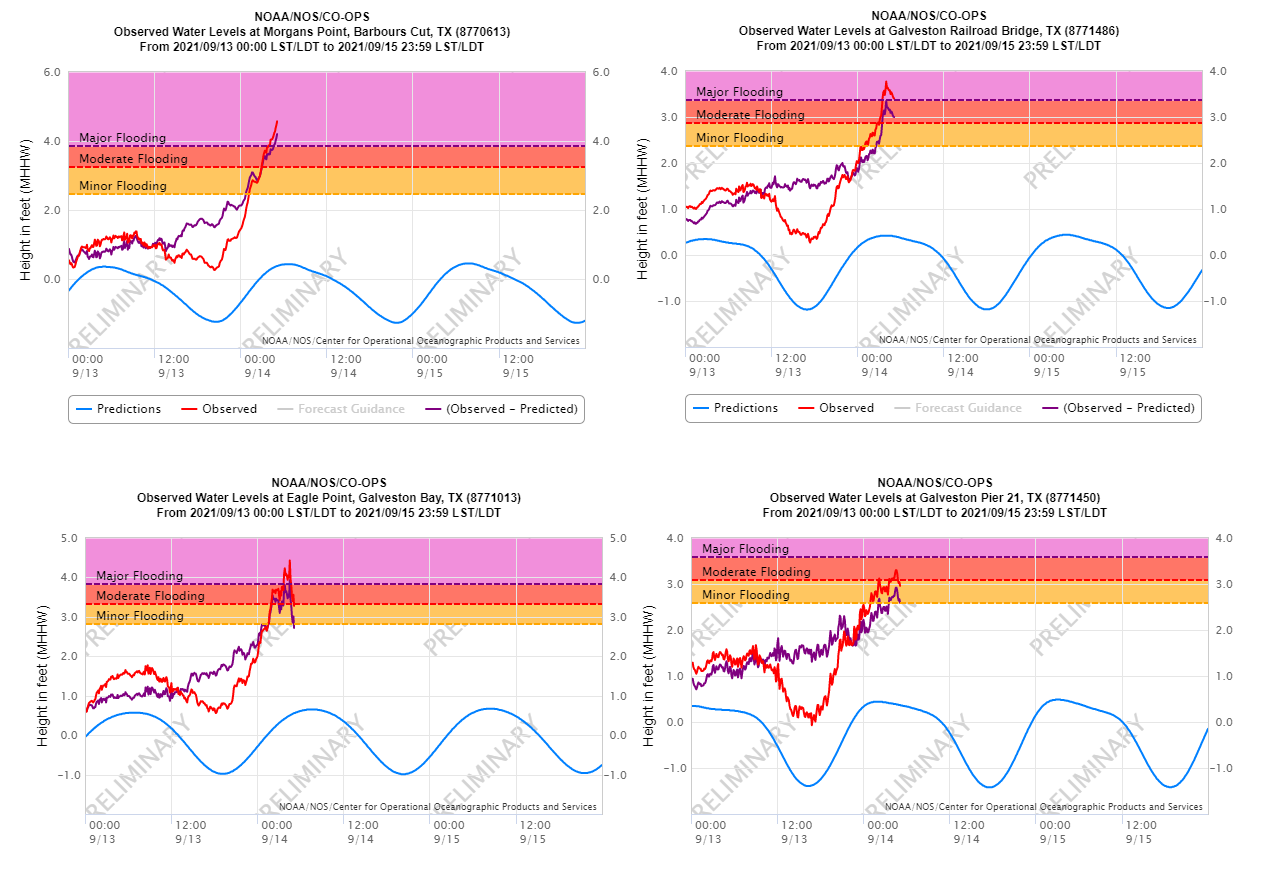
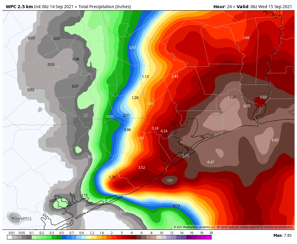
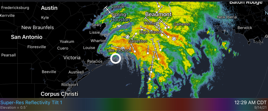
Good evening, and we hope folks are doing well and are safe after the passage of Nicholas. After nearly half a million customers lost power in the Houston area this morning, Centerpoint has restored all but about 150,000 as of 4:45 PM. Meanwhile, Nicholas is just barely a tropical storm, centered in far eastern Chambers County.

Radar shows the center of Tropical Storm Nicholas in eastern Chambers County, drifting east toward Louisiana. (RadarScope)

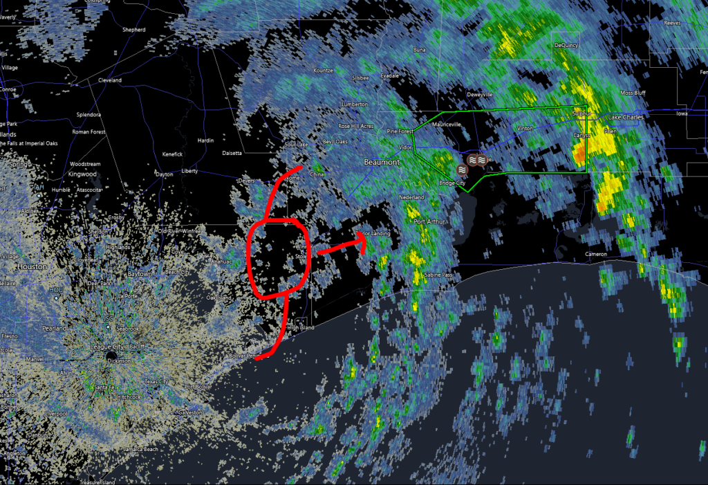
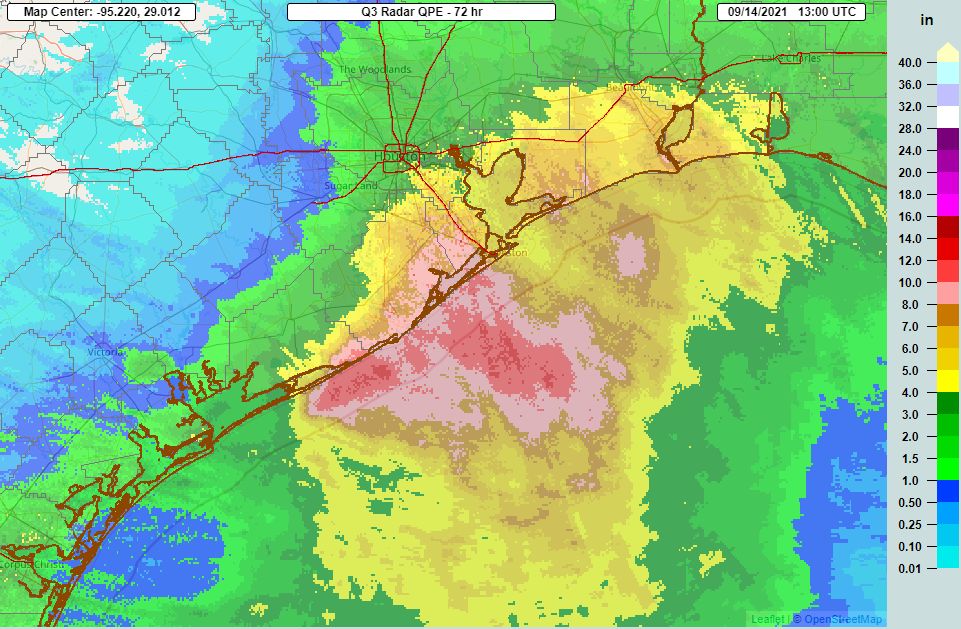
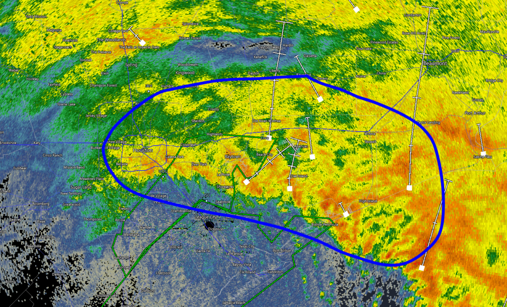
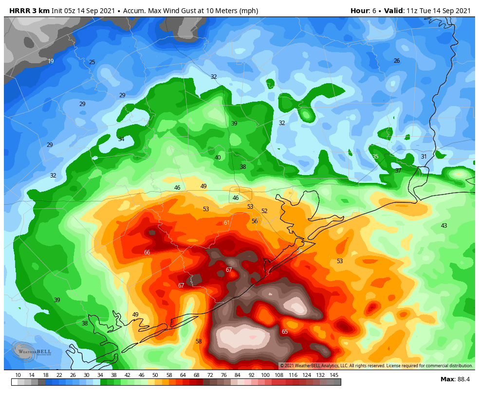
Maximum sustained winds are 40 mph, but in the Houston area, most sites are no longer reporting wind gusts, and those that are report fairly benign gusts. Nicholas is done with us, and it’s a reminder that wind and surge are issues here too. The next act will be rainfall and flooding along the central Gulf Coast. About 6 to 10 more inches of rain is possible in eastern Louisiana, southern Mississippi, southern Alabama, and parts of the Florida Panhandle from Nicholas as it very, very slowly creeps east across Louisiana tomorrow and Thursday before dissipating.

Flooding concerns will stay well to our east, with an additional 6 to 10 inches of rain possible between New Orleans and Destin, FL. (NOAA)

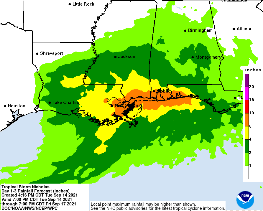
Hopefully the flooding will not be too serious in those areas, particularly those still very much recovering from Ida.

Back here in Houston, we get to look forward to 2 or 3 days in a row of calmer weather.

Wednesday through Friday

Look for a mix of clouds and sun all three days, with perhaps more sun than clouds on Thursday and/or Friday. Highs will be in the mid-80s tomorrow, upper-80s on Thursday and 90 or so on Friday. Morning lows will be tolerably in the low-70s tomorrow to perhaps mid-70s by Friday in spots. Rain chances are not zero, and it’s possible we could get a few showers or storms here or there, but those should be fleeting and isolated.

Rest of the tropics

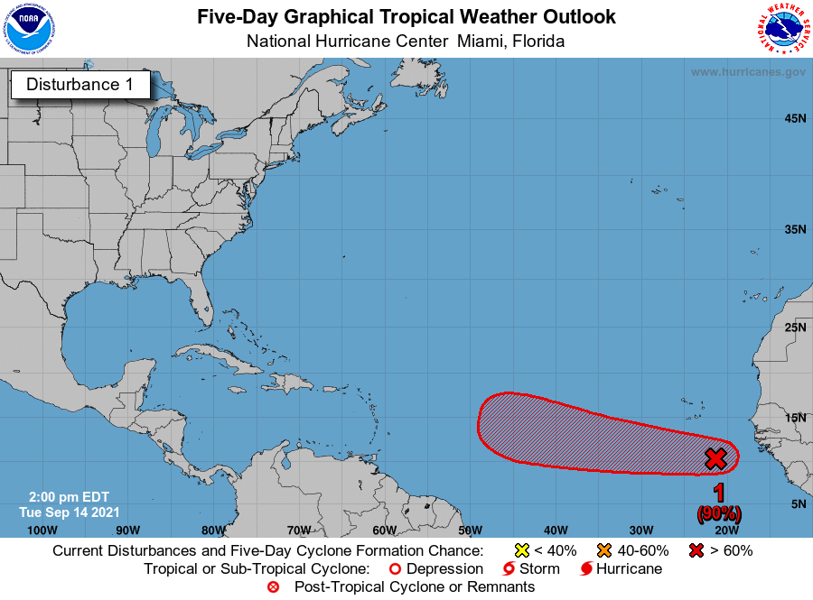
A lot of folks are beginning to ask questions about Invest 95L, a tropical disturbance wayyyyy out in the Atlantic. The National Hurricane Center gives it a 90 percent chance of developing by the weekend.

A tropical wave (Invest 95L) in the far eastern Atlantic has a 90 percent chance of developing over the next 5 days as it moves west across the Atlantic Ocean. We will watch this, but no reliable guidance currently brings 95L into the Gulf. (NOAA)

First, let’s just breathe after Nicholas for a moment.

Second, it appears that the models are split into two camps with respect to 95L. Those that strengthen it quickly over the next few days turn it north into the open Atlantic quickly. Those that don’t, keep it coming west or west-northwest into the islands or just north of there by the weekend. So far as I can tell, there is not one single ensemble member of 85 on either the GFS or Euro that delivers 95L into the Gulf of Mexico. Most turn it out to sea before getting to the islands. Still, it’s probably something to check in on again in a few days. But at this point, we don’t view this as a serious concern for the Houston area. Rest easy tonight if you’re able.

A final word

Thanks to all of you for your kind words of support and encouragement through yet another storm. We are grateful to those of you that choose us and share us with your friends and family. This certainly was not an easy forecast, but we tried our best to manage expectations throughout. We always put a lot of thought into our word choices and the messages we want to send, and it’s a responsibility we don’t take lightly. Certainly a few lessons learned from the ramp up in intensity last night that we’ll carry forward with us for the future too. But, whether you’re a new reader or a longtime reader, thanks for sticking with us, and we hope to be your choice during the next storm, whenever it may occur.

Eric will have our usual daily update in the morning.

It may not feel like it, but Houston narrowly escaped a much worse fate from Hurricane Nicholas

Well, they don’t call them natural disasters for nothing. For some residents, of course, last night was but a breezy affair. For others, especially along the coast, there is substantial wind and flood damage to contend with this morning from Hurricane Nicholas. And then there are the half a million customers in the greater Houston region without power this morning.

For those of you recovering today—and I count myself among you as power went out in my neighborhood, trees are down, my backyard flooded—it may not feel like it, but this storm could have been so so much worse. With this post I want to discuss that, but first lets update the status of Nicholas and present a short-term forecast.

Tropical Storm Nicholas

As of 10am CT, the center of Nicholas is very nearly directly over Houston, located just 10 miles southeast of downtown. As it has moved inland for nearly 10 hours, Nicholas has weakened to a storm with sustained winds of 45 mph. The storm is moving slowly, the northeast, at about 6 mph. It should continue to turn more easterly, and then dissipate over Louisiana in two or three days. The main rainfall threat has moved east, and the southern half of Louisiana could see 6 to 10 inches of rainfall over the next several days.

Nearly all of the moisture associated with Nicholas is now east of Houston. (NOAA)

Short-term forecast

The forecast for today and Wednesday will allow for recovery in the greater Houston area. Some light, scattered showers will be possible today and Wednesday, but chances are fairly low and accumulations should be slight. The strongest winds, too, have moved east of the area despite the presence of Nicholas’ center.

If you’re without power, high temperatures today will be quite reasonable for this time of year, in the upper 70s. Humidity will be high, of course. Lows tonight will drop into the low 70s. Highs on Wednesday should reach the mid-80s with a mix of sunshine and clouds.

If you want a more hopeful thought, we’re seeing fairly strong hints in the models for a decently strong fall front moving into the region in nine or ten days time. That’s a long way out to forecast, so grain of salt and all that, but it is the right time of year for a front. So maybe, hopefully, fall is but 10 days away. I’m ready.

Nicholas could have been so much worse

First of all, if you can remember all the way back to Saturday, I presented three different scenarios for Nicholas’ track and eventual flooding in Houston. The first of these was the “Coast Hugger,” in which the storm remained close to the Gulf, brought 2 to 4 inches of rain to Houston and higher amounts along the coast, while keeping the heaviest rains offshore. This is largely what happened, with Nicholas remaining very close to the coast even after moving inland. If we look at satellite-derived precipitation totals for the last three days, the heaviest swath of 10-20 inches of rainfall came offshore.

Satellite estimated rainfall totals for Nicholas during the preceding 72 hours. (NOAA)

A track even 40 or 50 miles further inland would have set up those heaviest rains directly across the Houston metro area, and created a much more serious flood situation. Hopefully this offers you some insight into the challenge of predicting these kinds of rain events. It was a very close call, a matter of miles, between significant inland rainfall flooding in Houston, and relatively clean bayous this morning.

The second factor is wind. Nicholas turned out to be a fairly nasty storm in terms of wind gusts, and pushed a larger storm surge—as high as 6.1 feet into Clear Lake—than predicted. This is a reminder of the power of a hurricane, even one that was “only” a minimal Category 1 storm. The truth is that the track of the storm was very nearly a worst-case one for Houston in terms of winds and putting a maximum storm surge across Galveston Island and into Galveston Bay.

Image showing approximate track of Nicholas, with winds and surge overlaid. (NOAA)

It is September 14, the absolute peak of hurricane season in the Atlantic, and a time when sea surface temperatures in the Gulf of Mexico are at their warmest of the year. So this morning I’m thinking about what would have happened if we had not had some wind shear over the western Gulf of Mexico yesterday, or if Nicholas had been able to consolidate a more well defined and consistent center of circulation. It would have been much, much worse for all of us had a significantly stronger hurricane made landfall last night. So while we pick up the pieces this morning, realize Nicholas could have been much more of a terror.

Matt will have our next update—and probably our last update specific to Nicholas—at 5 pm CT today.

Nicholas gliding across the Houston area, knocking out power to hundreds of thousands

Good morning. A rollicking night across a healthy chunk of the Houston metro area continues this morning, as now-Tropical Storm Nicholas slowly, but steadily, passes through. As of 4:45 AM, Centerpoint’s website reports over 380,000 customers without power. Wind gusts of 45 to 55 mph are still occurring across southern and some eastern parts of the metro area, with gusts generally in the 30s to the north. The maps here shows the maximum wind gusts we’ve seen at various sites across the area since midnight.

Gusts well over 60 mph have occurred along the coast, with gusts of 50 mph or higher south of I-10, lessening as you go north. (NOAA)

You can see a list of highest reported wind gusts for the entirety of the storm (as of 5 A.M.) here. Judging by radar at 4:55 AM, Nicholas’s center was just getting ready to exit Brazoria County, just north of Rosharon. The center should pass very near or right over Houston a little later this morning. Maximum sustained winds were still reported to be 70 mph at the 4 A.M. National Hurricane Center advisory, though it’s likely to have weakened a bit further by now.

Wind impacts

As Nicholas continues to move north, you can expect gusty winds to travel north and east with the storm. Continued wind gusts of 45 to 55 mph are likely in the city of Houston and points south and east for another couple hours, with a general trend toward lessening wind overall. Areas north of Houston will likely see 35 to 45 mph gusts continue as well through the morning. This could continue to sporadically knock out power to folks across the area. If you have power, it would be a good idea to keep your phone charged, just in case you lose power. As winds subside a bit this afternoon, power crews should be able to get out to begin to repair damage. Power restoration may take somewhat longer where damage is more significant, namely along the coast and southeast of Houston. It would be a good idea to check in on anyone vulnerable, especially the elderly today, just to make sure they have what they need in case they’ve lost power.

Rainfall/Flooding

The good news in Houston is that serious flooding has not materialized in the city. The story is a bit different south and east of the city, however. The Harris County Flood Control maps of gauge status as of 5 A.M. shows several locations that are either flooding or close to flooding in far eastern Harris County and along Clear Creek or into Galveston and Brazoria Counties.

Most of Harris County and surrounding areas shows that watersheds are in good shape. As you get south and east of Houston, into the Clear Creek watershed in particular, the situation becomes a bit more serious and is being exacerbated by storm surge. (Harris County Flood Control)

Some of the flooding south and east of Houston is coming as a result of surge on Galveston Bay. With the center of the storm over inland Brazoria County, winds have piled up water on the west side of the bay, leading to a generally 2 to 5 foot surge in many areas, highest along the bayshore in Harris or Galveston Counties.

Various tidal gauges along Galveston Bay are reporting mostly a 2 to 4 foot surge, but it is certainly higher in some spots. (NOAA)

Clear Lake even is close to a 6 foot surge. Expect these values to peak soon, with gradual improvement through the morning and into the afternoon.

Rainfall continues heavy at times, mainly in Houston and points east now. The circled area below is seeing rates at times over 1 inch per hour. This will be enough to cause some flash flooding, especially as you get into southeast Harris County, Chambers County, and Jefferson County.

Radar as of 5:15 A.M. shows heavy rain in Houston and due east. Rates over 1 inch per hour are falling, and flash flooding is likely in spots, in addition to surge flooding on the bayshore. (RadarScope)

While these rates are a little less than we feared, we will still see travel issues in spots east of the city, as well as south of the city as water continues to flow through the system. These conditions should improve a good bit by later this morning and especially this afternoon. The lopsided nature of this storm means that although the center may only just be on the east side of Houston by midday, the main impacts should be mostly out of our area by then.

Heavy rain and flooding risk will continue through the morning across Beaumont, Port Arthur, and into western Louisiana.

Later today and tonight

Though we expect the overall picture to greatly improve this afternoon, at least a few areas may see daytime heating lead to additional showers and storms popping up. Any of those would be capable of producing heavy rainfall, but they will be scattered and likely not widespread. We should see dry conditions tonight. High temperatures today will peak in the 70s, but if we do see any breaks in the clouds west of Houston, we could sneak into the 80s in a few spots. Certainly not terrible, but something to keep in mind if you are still without power this afternoon.

Eric will have our next update around 10 A.M.

Nicholas makes landfall south of Houston, will pass over the city later this morning

Hurricane Nicholas made landfall at 12:30 am Tuesday on the eastern part of Matagorda Peninsula, about 10 miles west of the small city of Sargent. It had maximum winds of 75 mph at landfall. The storm is moving about 10 mph to the north-northeast, and along this track the storm should pass almost directly overhead Houston on Tuesday after sunrise. After that it should turn more to the northeast.

Winds

We’re starting to see wind gusts above 60 mph along the coast of Galveston Island, and we expect to see gusts in the 40s and 50s spreading inland over night. So far power outages in coastal counties range from about 90 percent of customers out in Matagorda County, closest to Nicholas, to about 20 percent in Brazoria County, to 10 percent in Galveston County. Further inland, Wharton and Austin counties have significant outages. More can be expected as Nicholas moves closer to Houston and Harris County this morning.

Forecast for maximum wind gusts through sunrise on Tuesday. (Weather Bell)

Rains

So far tonight we’ve seen a thick band of rain showers moving inland from Nicholas, and while the rains have been heavy they have not been excessively so. These rates of generally less than 2 inches per hour are helping to moderate totals. Overall accumulations through Tuesday should be 2 to 8 inches for coastal counties near Houston, with potentially more rain east near Beaumont as Nicholas tracks inland and slows down. Here is the latest rain accumulation forecast from NOAA for now through Wednesday morning.

NOAA rain accumulation forecast for now through Tuesday night. (Weather Bell)

For the Houston area, it’s likely that the heavier rainfall will wind down between sunrise and noon on Tuesday, with lesser chances afterward. Winds should die down as well. A sense of normalcy should return to our weather by Tuesday afternoon.

“Dirty” side of the storm

We often talk about the “dirty” side of a hurricane, which is located to the right of a storm’s center. This is where the strongest winds, rains, and surge typically lie. And this evening as Nicholas was moving into the Texas coast, its radar signature provided a textbook example of all the activity falling on the east side of the storm, with virtually nothing occurring to the west of the center.

Radar signature of Nicholas, with the center highlighted, shows the “dirty” versus “clean” side of the storm. (RadarScope)

Matt will have our next update by or before 5:30 am CT.