Is winter over?

One year ago, after a warm spell in early January, several readers asked if the 2020-2021 winter was effectively over for the Houston region. Our response at the time was, “It is decidedly not, but we are having quite mild conditions during what is normally the ‘dead’ of winter.” Of course, a little more than one month later, temperatures plunged as part of the Valentine’s deep freeze that prompted widespread, prolonged power outages, deaths, and significant home damage due to burst pipes.

A similar question might be asked this year, especially after record warmth in December, and a high temperature of 77 degrees on Wednesday. However, our answer remains the same. Houston can have pretty strong cold outbreaks through the middle of March, so “winter” will likely last for about two more months. With that said, the window for a terribly cold freeze, on par with what occurred last year, is closing. We probably have about six or seven weeks during which we really need to worry about seeing a really hard freeze. At present there are no indications of such happening.

Thursday

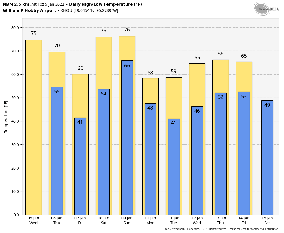
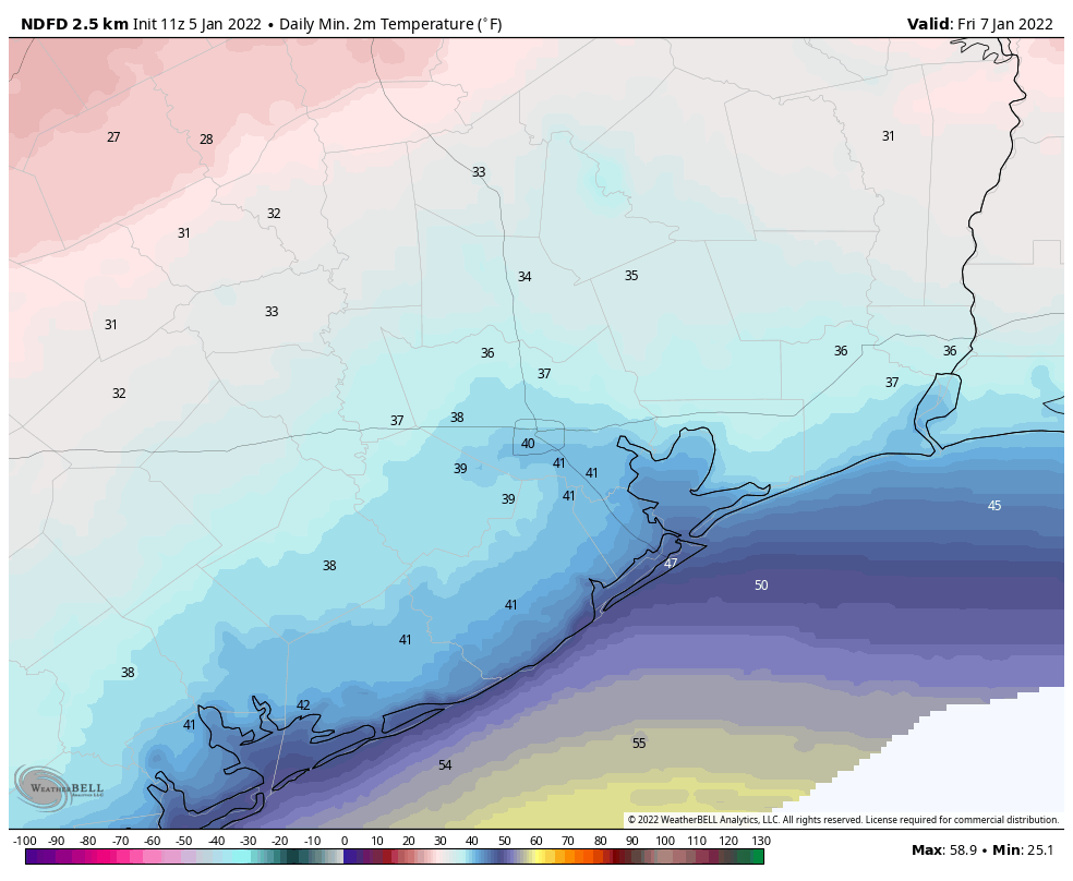
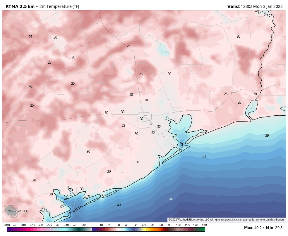
It will certainly feel like winter later today and tonight as a front moves through the region this morning. Drier air will move into the region from the northwest today, and winds will gust up to about 20 mph from the north-northwest. Although high temperatures will get into the 60s this afternoon beneath sunny skies, they’ll drop off pretty quickly this evening, and bottom out at about 40 degrees overnight in Houston. A few outlying areas may see a light freeze.

Friday morning’s low temperatures look quite chilly for Houston. (Weather Bell)

Friday

Friday will be mostly sunny, and after a chilly start temperatures will warm to about 60 degrees. As winds shift to come from the east and then southeast, our air mass will modify pretty quickly. As a result we should see clouds returning by Friday evening, and temperatures won’t drop much, if at all, during the overnight hours.

Saturday and Sunday

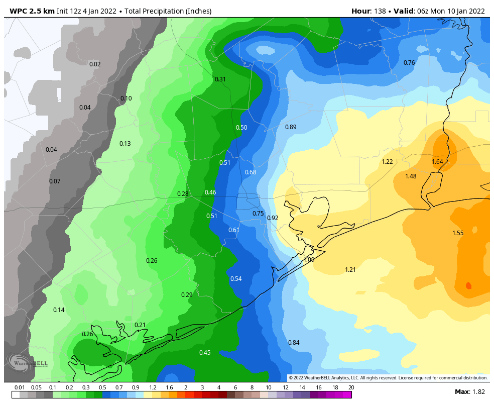
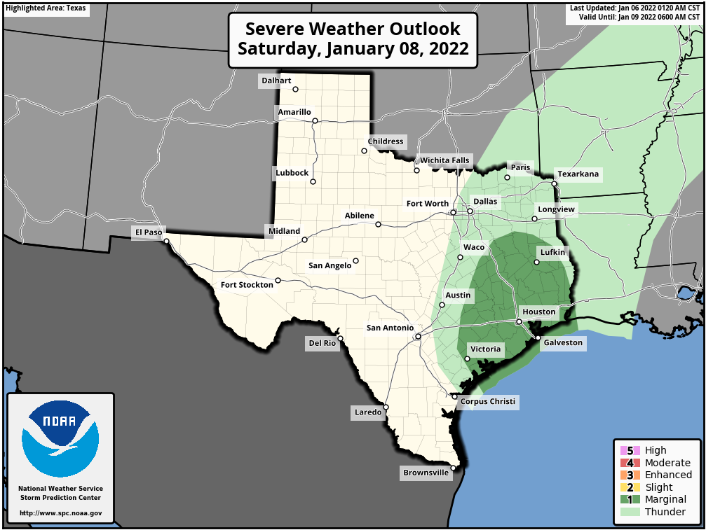
The weekend still looks wet, gray, and warm. The combination of moist air and a low pressure system will yield our first real rain chances since mid-December. The ingredients are there for showers and thunderstorms, and even some heavy rainfall. Right now, models are pegging area-wide accumulations at about 1 inch, but I could certainly see some areas picking up 2 to 3 inches from Saturday morning through Sunday. Rains will likely end by late Sunday morning, so there’s a chance of some sunshine later in the day. Both days look warm, with highs in the mid- to upper-70s. A front will arrive on Sunday afternoon, or evening, to drive the moist air away.

There is a marginal chance for severe weather in our region on Saturday and Saturday night. (NOAA)

Next week

Accordingly, most of next week should see highs somewhere in the 60s, with overnight lows in the 40s and 50s. Some rain chances return mid-week, and some kind of front should arrive by Friday or Saturday to cool us down for the weekend. Start line temperatures for the Houston marathon still look pretty cold, probably about 40 degrees, give or take.

Roller coaster weather returns to Houston

Up and down, up and down—so will go our temperatures over the next 10 days as Mother Nature vacillates on whether it should feel like winter or spring outside. This is good thing for those who believe variety is the spice of life. We’re also continuing to track the likelihood of rain this weekend, which would be the region’s first meaningful precipitation in about three weeks.

There will be more temperature swings this week before a prolonged cooler spell next week. (Weather Bell)

Wednesday

Temperatures are generally starting out in the 50s this morning, and with light winds a few areas of patchy fog have developed. This should not last, and skies will be mostly sunny later today, allowing for temperatures to warm nicely into the mid-70s. Winds will be modest, out of the south and southwest, at 5 to 10 mph. Temperatures tonight will start out moderate, but a cold front will arrive to cool things down. It looks like the front will reach the Interstate 69/Highway 59 corridor around midnight, and push down to the coast between 3 and 6 am. As a result, Houston will be generally in the 40s (inland) to low 50s (near the coast) when you wake up on Thursday. No rain is likely to accompany the front.

Thursday

Conditions will be breezy on Thursday, as northerly air follows the frontal passage. Look for winds gusting up to about 20 mph to go along with sunny skies, and highs likely topping out in the upper 60s. As winds die down overnight, this will set the stage for cold temperatures. I think the urban core of Houston will remain at about 40 degrees, but outlying areas should fall into the 30s. A light freeze is possible for far inland areas, such as College Station.

Friday morning will be cold before temperatures quickly rebound this weekend. (Weather Bell)

Friday

This will be a sunny and cool day, with highs around 60 degrees. However as high pressure moves off and winds shift easterly, this will set the stage for warmer weather ahead. Lows Friday night will probably be about 15 degrees warmer than Thursday night.

Saturday and Sunday

Conditions will be quite warm and muggy this weekend, especially for early January. Look for highs in the mid-70s with partly to mostly cloudy skies and plenty of humidity. The onshore flow will also ramp up moisture levels, and this will lead to increased rain chances beginning as early as Saturday morning. This pattern will hold sway until about Sunday afternoon or evening, when the next front arrives. This front may bring additional rainfall with it, and all told I think most areas will average 1 inch or so this weekend, with less for some areas, and more for locations that see some briefly heavy rainfall. Rains will end with the front’s passage, and lows on Sunday night should drop into the upper 40s.

Next week

We’ll see fairly cold conditions next week, with highs in the 50s and 60s, and lows in the 40s and 50s. Another front arrives by the weekend, perhaps Saturday the 14th, to keep things on the cooler side. If you’re running the Houston marathon, my best guess remains chilly start line temperatures of about 40 degrees.

Houston weather to offer a little bit of something for everyone

Good morning. The upcoming forecast offers a little bit of something for everyone. There is more cold weather in store, but also some spells of warmer weather. We should also see some measurable rainfall this weekend, which would be the region’s first real precipitation since mid-December.

Tuesday

After a cold start this morning, with a few freezing spots far inland but temperatures mostly in the upper 30s and low 40s, Houston will warm nicely today under the influence of a more southerly flow. Highs will likely top out in the mid-60s, with sunny skies. Easterly winds will turn south, and generally blow at 5 to 10 mph. Skies turn partly cloudy tonight, with lows getting into the low 50s for most areas except the coast, which will be a bit warmer.

Wednesday

This will be a warmer day, with mostly sunny skies and highs in the mid-70s. Expect another mild night with temperatures in the mid-50s.

Inland areas could see a light freeze on Thursday night. (Weather Bell)

Thursday

A fairly sharp cold front will drop into the region on Thursday morning, and while the timing remains yet uncertain it should be off the coast by or before noon. There should not be any rain with this front, and skies should remain mostly sunny on Thursday. The influx of northerly air will limit highs to the mid- to upper-60s as winds come out of the north at 10- to 15 mph. Lows on Thursday night will drop to about 40 degrees in Houston, with a light freeze possible for some far inland locations.

Friday

The cold air will be fairly short lived, as winds return from the south on Friday. Expect a pleasant day, with partly sunny skies and highs around 60 degrees. But lows on Friday night will only drop a few degrees, into the low- to mid-50s, as the southerly flow reestablishes itself.

Saturday and Sunday

This warmer pattern will hold sway this weekend, with warm days in the upper 70s, partly to mostly cloudy days, and more humidity. With moist air and low pressure in the vicinity we’ll see healthy rain chances, especially from Saturday afternoon through Sunday morning. Accumulations should range from 0.25 to 1 inch, but there probably will be a wide variance in totals. Rain chances will be best for areas along and east of I-45. A cold front should arrive on Sunday night, some time, to return a drier and colder pattern to the region. Look for several days of highs near 60, and lows in the 40s next week.

NOAA rain accumulation forecast for now through Sunday. (Weather Bell)

Houston Marathon

We’re getting closer to the Houston Marathon, which takes place on Sunday, January 16. Right now it’s really quite early to have any confidence in a forecast a dozen days from now. But given the overall pattern, I think the greatest likelihood is that we see a fairly normal January day, with a temperature in the low 40s at race start, and highs in the 50s or low 60s. The air should be reasonably dry, but it’s way way way too early to have any confidence in such details. I’ll keep an eye on things, and let you know when something more concrete emerges.

Houston records its first freeze since the Valentine’s Day winter storm of 2021

Good morning, and Happy New Year! For some perspective, temperatures on Sunday afternoon peaked at 44 degrees in Houston. This was far below the minimum temperature on the the first morning of the new year, when the low temperature at Bush Intercontinental Airport bottomed out 75 degrees. Much of the region outside of the city’s urban core, and away from the coast, is seeing a freeze this morning. A light freeze will be possible for areas well inland again tonight, but this morning should yield our coldest weather for awhile.

Low temperatures at 6:30am CT on Monday. (Weather Bell)

It’s worth noting that the city’s official station at Bush Intercontinental Airport did record a freeze this morning. This marks the first freezing temperature there since February 20, 2021, the tail end of the Valentine’s Day freeze last year. During that cold spell Houston recorded a freeze seven nights in a row, with the temperature bottoming out at 13 degrees on February 16.

Monday

Skies will be sunny today, with light northerly winds. As a result highs should be able to work their way into the low- to mid-50s. Temperatures tonight should be about 5 degrees warmer than Sunday night, but still rather chilly. As the high pressure system near the surface moves eastward, we’ll begin to see winds shift to come from the southeast by Monday night, and this will begin the process of warming us up.

Tuesday

Highs will accordingly jump back into the mid-60s on Tuesday, with mostly sunny skies, and winds of about 10 mph out of the south. Lows drop into the 50s late Tuesday night into Wednesday morning.

Low temperature forecast for Houston on Tuesday morning. (Weather Bell)

Wednesday

This should be the warmest day of the week, with highs in the mid-70s and mostly sunny skies. Dewpoints won’t be oppressive like they were in late December, but the air won’t exactly be dry, either. Lows on Wednesday night will drop into the upper 50s for most.

Thursday

The forecast for Thursday is highly uncertain, as it’s not clear when the next cold front will push through the area. It could be anywhere from Wednesday night through Thursday night. If it’s the former, highs on Thursday may top out in the 60s, if it’s the latter, then expect mid- to high 70s. We’ll see. This front should be dry, bringing no rain with it. Lows on Thursday night will probably drop to around 40 degrees.

Friday, Saturday, and Sunday

After a brief cooldown on Friday, with highs perhaps reaching about 60 degrees, a warmer pattern along with a southerly flow should return for the weekend. We’re probably looking at highs in the mid-70s, or thereabouts, on Saturday and Sunday. The days will be partly sunny, but as a low pressure system moves inland from the Gulf of Mexico there will be a decent chance of rain from Saturday afternoon through Sunday morning. Accumulations of a few tenths of an inch of rain are possible closer to the coast, with lesser amounts inland. Another front should arrive later in the weekend, perhaps on Sunday night, to cool things off somewhat for next week.