Houston’s weather to change, with storms possible later today, and a short-lived front

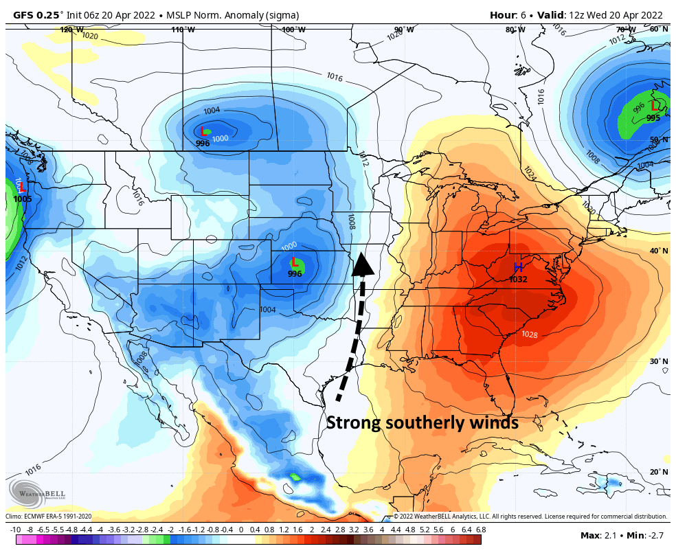
After days and days and days of warm weather, with a persistent southerly breeze, our weather will change today and tonight. Most of the region should see scattered showers this morning, with an increasing chance of thunderstorms this afternoon and tonight. It has been a rather dry spring, so this rainfall will be mostly welcome. A front will bring some briefly drier and cooler weather before we warm up again next weekend.

Monday

It’s rather warm this morning, with lows only dropping to around 75 degrees in the city of Houston. Highs today will reach the mid-80s, with mostly cloudy skies and light southerly winds. Light rain is possible this morning. Due to the front’s approach and our extremely moist atmosphere, thunderstorm chances will start to increase this afternoon for areas north of Interstate 10 before sagging southward this evening toward the coast, where conditions will be less supportive of heavy rainfall.

This is the HRRR model’s forecast for what Houston’s radar might look like at 6 pm CT Monday. Do not take it as gospel. (Weather Bell)

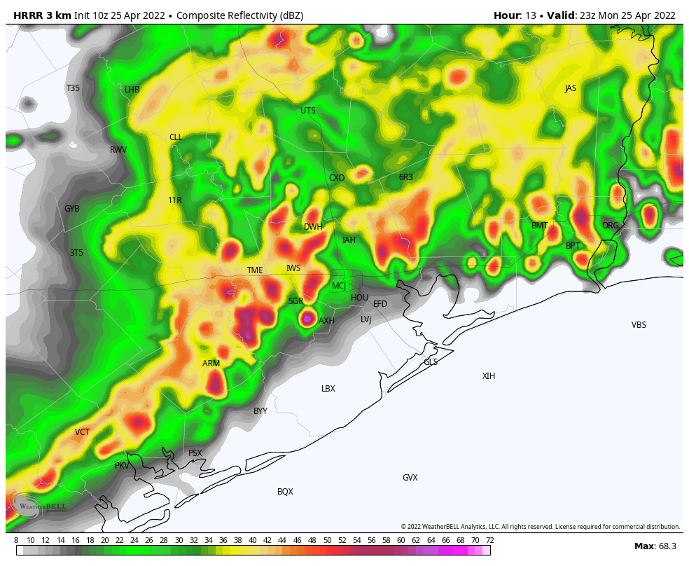
Most of our region will probably get rainfall through the overnight hours, with areas north of Interstate 10 seeing perhaps 1 to 2 inches, and areas south of the freeway recording 0.5 to 1 inches. However there will be wide variability in rainfall totals depending on precisely where storms set up. One location may pick up 4 inches, whereas a few miles away there’s a few tenths of an inch.

Tuesday

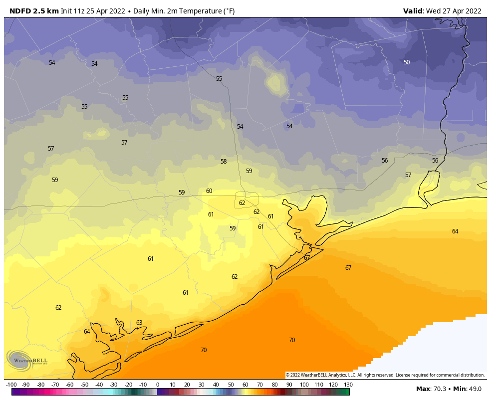
Some rain chances will linger on Tuesday morning, but the threat of heavy rainfall will have passed. However, skies will remain mostly cloudy, and with moderate northerly winds highs probably will only reach the mid-70s. As skies start to clear out overnight, and with the influx of more dry air, lows on Tuesday night heading into Wednesday morning will be the coldest of the week. Expect 50s for inland areas, with mid-60s right along the coast. Don’t blink, because it won’t last long.

Low temperature forecast for Wednesday morning. (Weather Bell)

Wednesday

This should be an extremely pleasant day, with highs of around 80 degrees, light winds, dry air, and partly to mostly sunny skies. Lows Wednesday night will be a few degrees warmer than Tuesday night as a southerly flow starts to exert its influence.

Thursday and Friday

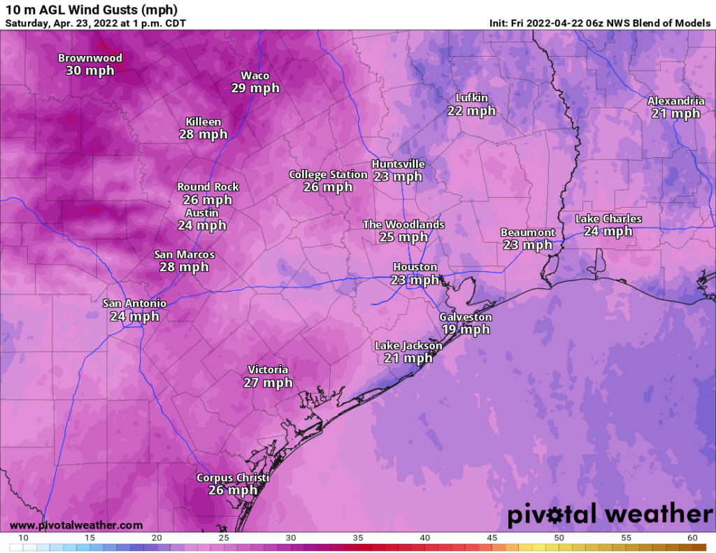
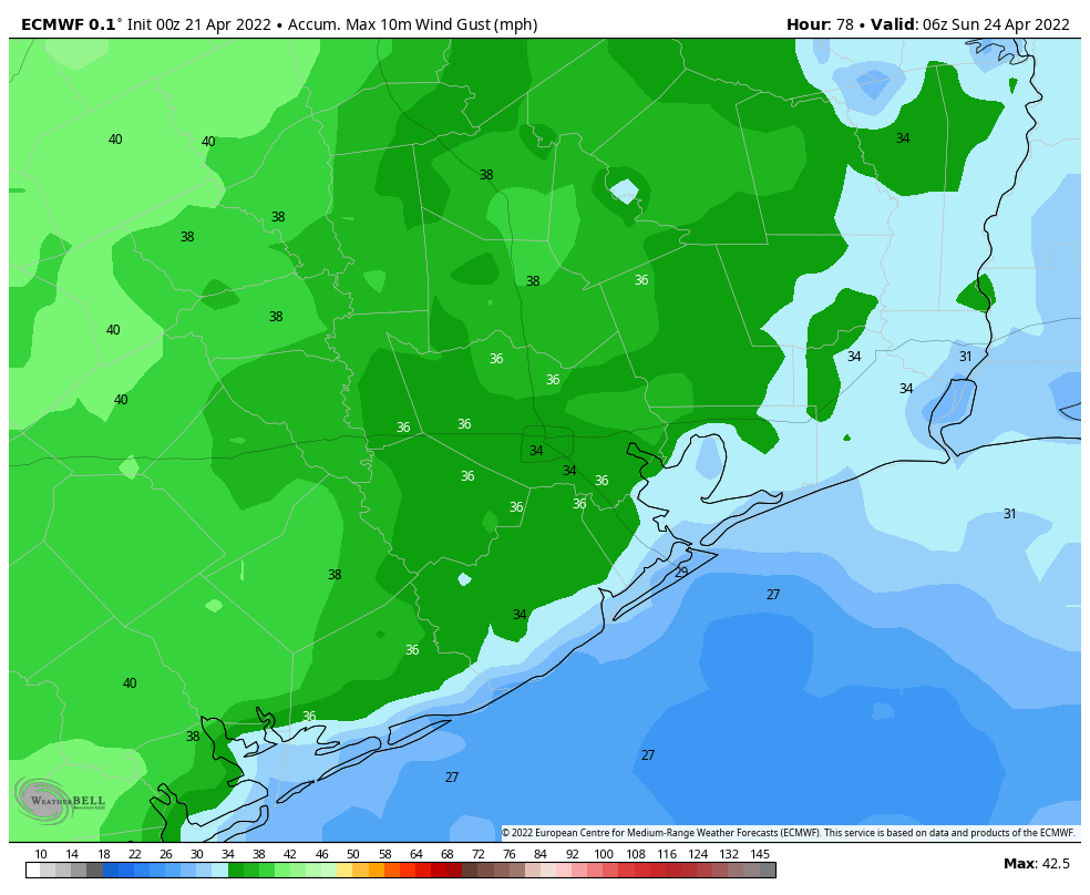
These should be a pair of partly to mostly sunny days with highs in the 80s, although by Friday highs will probably be pushing into the upper 80s. Southerly winds will start to pick up, at 10 to 15 mph, likely with gusts of about 20 mph.

Saturday and Sunday

The weekend looks warm and humid, with highs ranging from the upper 80s to 90 degrees. Both weekend days should see a mixture of sunshine and clouds. We can’t entirely rule out some scattered showers, but for now I’d put the chances in the 10 percent range. Winds will be noticeable out of the south, perhaps gusting to 20 mph. If you’re riding Bike MS: Texas MS 150 on Saturday and Sunday, those southerly winds should be fairly consistent along your whole route.

Conditions look to remain warm heading into early May, with only a slight chance of a weak front during the first week of next month. I hate to say it, but summer is nigh.

Texas drought continues, but Houston area still holding up fairly well

As occurs each week, the U.S. Drought Monitor updated their drought assessment yesterday. Texas continues to see pretty difficult drought conditions overall, however that’s not so much the case locally.

West and central Texas are being hard hit by drought this spring with over 15 percent of the state in D4, or “exceptional” drought. (NOAA)

While over 87 percent of the state is classified in drought conditions, only about 57 percent of the Houston area qualifies for drought at this time. Our most recent serious drought occurred in 2011. It may be somewhat comforting to know that during this week in 2011, the entire state was in drought, with much of the Houston area in D4, or “exceptional” drought. At this point, while it may be tempting to compare current conditions to 2011 across Texas, that is not quite an accurate assessment, certainly locally.

The Houston area’s drought situation is better than most of the rest of Texas, with the only severe drought assessed to be south of the city and no areas of extreme or exceptional drought at this time. (NOAA)

Precipitation over the next few weeks is not going to be absent from Texas, so we’ll see if it’s enough to start denting this drought before it gets too troublesome. But if your travels do take you to central or western Texas, just be aware that the ground there will be much drier than usual and fire risk higher than usual.

Today

The week will close out with, you guessed it, wind. Look for yet another breezy day, with southeasterly winds of 15 to 25 mph. Any morning clouds should give way to sun, with high temperatures up into the 80s.

Saturday

More wind.

Another round of breezy to gusty winds will be likely Saturday. (Pivotal Weather)

Look for another day of 15 to 25 mph winds, with higher gusts at times over the water. We will see a mix of sun and clouds with temperatures warming from the 70s into the 80s. Humidity will remain high.

Sunday

Look for mostly a rinse and repeat of Saturday, with wind perhaps checking in just a notch under Saturday.

One thing I haven’t yet mentioned: Rain. We don’t expect anything meaningful or widespread this weekend, but the chance of a passing shower or some patchy drizzle or sprinkles is not zero. So although it probably won’t rain on you this weekend, don’t be entirely shocked if it does for a short time.

Next week

As we continue our transition toward summer, the cold fronts pack less and less punch in terms of temperatures. The cold front we are expecting later Monday or Tuesday morning should follow that rule as well. Expect scattered showers or a chance of storms, especially north and west of Houston on Monday with morning lows in the 70s warming to highs in the 80s. Those storms should move into the Houston area Monday evening or night, assuming they can survive the trip. There are still some questions as to how much in the way of storms we will see.

Whatever the case, clearing should commence on Tuesday with slightly cooler and less humid weather arriving early. Perhaps we’ll see lows in the 60s with highs in the lower 80s. You’ll probably notice the more comfortable weather mostly on Tuesday night into Wednesday when some outlying areas drop back into the 50s.

Low temperatures may find their way into the 50s on Tuesday night and Wednesday morning next week. (Pivotal Weather)

That will be nice, but it will be short-lived. Humidity should come surging back in late next week, restoring our typical mid-spring pattern. For those of you planning to get back out for MS 150 next weekend, it looks as if you’ll have very warm, humid weather, along with southerly winds. For day 1, it won’t be a true tailwind per se (certainly if you’re starting from Austin), but it will definitely be coming off the Gulf as it stands right now. The day 2 trek from La Grange to Kyle Field should have a pretty stout tailwind. More on this next week!

An early look at the Atlantic hurricane season as windy, warm weather continues

We are only a little more than a month away from the beginning of the 2022 Atlantic hurricane season, and the early indications are that we will see yet another busy season in Atlantic Ocean, Gulf of Mexico, and Caribbean Sea. Phil Klotzbach released his first extended range forecast earlier this month, predicting 19 named storms, or about 25 percent above-normal activity. Then, on Wednesday, Klotzbach shared another data point. The latest modeling suggests that the Pacific Ocean is likely to fall into a La Niña pattern during August, September, and October.

The issue here is that when La Niña forms in the Pacific, inducing a general cooling of sea surface temperatures near the equator there, it tends to increase Atlantic hurricane activity by making conditions more favorable for tropical systems to develop and strengthen. Seasonal forecasting is not perfect, of course, but with hurricane season rapidly coming upon us, this is your reminder to start making preparations. Accordingly, the State of Texas is having a sales tax holiday this weekend for emergency supplies, from April 23 to April 25. Full details are here.

Thursday

Conditions today will once again, you guessed it, be windy and warm. Look for highs in the mid-80s with partly sunny skies. Winds will blow from the southeast at about 15 mph, with gusts up to 25 mph or so. With dewpoints near 70 degrees, it will feel plenty sticky outside. Overnight lows are unlikely to fall below 70 degrees on Thursday night.

Friday

See Thursday’s forecast.

Saturday

The first half of the weekend will bring more of the same conditions, with highs in the 80s and partly to mostly sunny skies. However, as we’re caught between low pressure and high pressure systems, expect winds to be that little bit stronger on Saturday. We might see gusts of 30 mph or higher at times. Over night lows will again not fall much, if any, below 70 degrees.

European model forecast for maximum wind gusts on Saturday. (Weather Bell)

Sunday

Winds will relax a little bit on Sunday, but there will still be a persistent southeasterly flow to go along with our mostly sunny skies and highs in the upper 80s.

Monday and beyond

Confidence is reasonably high in a front approaching our region on Monday and bringing some widespread (and much needed) rain showers to the region. Early guidance indicates that the better rain chances will be inland of Interstate 10, rather than along the coast, but we shall see. It’s my hope that most of the area picks up an inch or so of rainfall, but some of us will very probably see less than that. The rains are needed as our region slides toward a severe drought, which I’m guessing Matt will probably discuss on Friday. Lows will probably drop to around 60 degrees with some drier air for a couple of days after the front.

Gusty southerly winds likely the norm through the weekend for Houston

Springtime winds have returned to Houston. On Tuesday the region recorded gusts above 35 mph, and it was at times unpleasant outside. As a reminder, April is the windiest month of the year in Houston, with an average wind speed of 8.9 mph. However this month has been windier than most. So far, the monthly average this month is 10.0 mph, and we will probably end up a little higher than that with gusty conditions ahead this week.

Wednesday

Low temperatures this morning have only fallen to around 70 degrees. Highs this afternoon will reach the low-80s, moderated in part by mostly cloudy skies. Strong southerly winds will again be the story, with gusts up to 30 mph or even a bit higher. The winds are being driven by a surface low pressure system over Kansas, the rotation of which is drawing winds northward. Low temperatures tonight will, again, likely only drop to around 70 degrees.

Low pressure near the surface of the Plains states will help drive southerly winds. (Weather Bell)

Thursday and Friday

The overall pattern will remain much the same, with highs in the 80s, partly sunny skies, breezy southerly winds, and plenty of humidity.

Saturday

The first half of the weekend should bring more of the same, but conditions might even be slightly windier. So yeah, while it should be sunny on Saturday, there will be plenty of wind to go along with it, with gusts of 25 to 35 mph possible.

By Sunday temperatures will be quite toasty for our region. (Weather Bell)

Sunday, Monday, and beyond

Sunday should be partly sunny and breezy as well, with highs likely in the upper 80s. But by Sunday night and into Monday we start to see some uncertainty creep into the forecast. Rain chances will increase on Sunday night and Monday, as a front nears. Right now chances appear to be better north of Houston. Then there is the question of how strong the front is, and how far it pushes through the region. For now I’m going with the front only having a fairly modest effect on temperatures and humidity, but we could see something stronger by Monday or Tuesday. Regardless, highs toward the end of next week probably will be near 90 degrees as we near the end of April.