Heat continues for Houston as hurricane season draws nearer

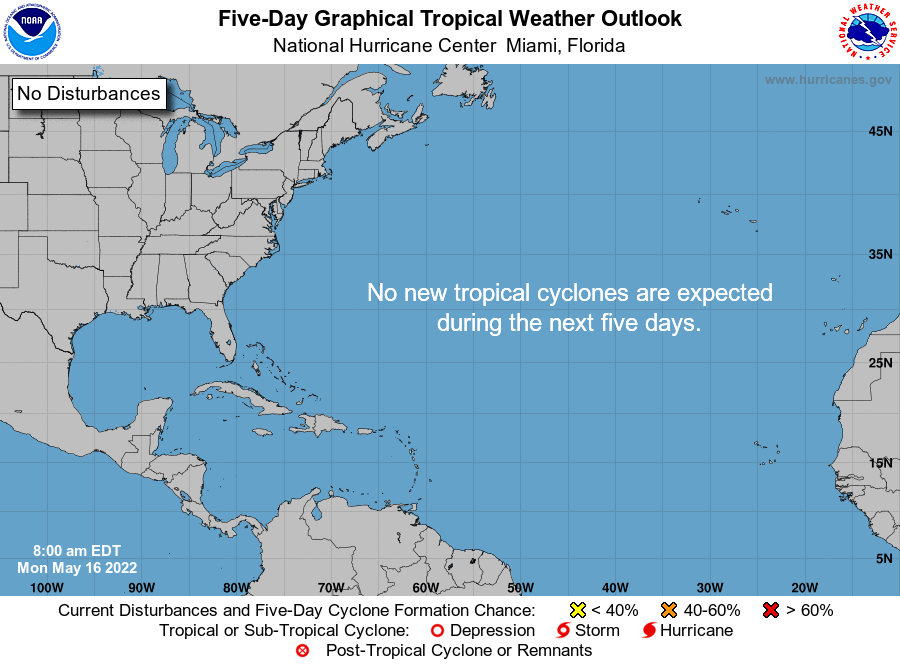
Good morning. Just a quick note about the 2022 Atlantic hurricane season: We are a little more than two weeks from the start on June 1, and on Sunday the National Hurricane Center began its regular issuance of Tropical Weather Outlooks. The five-day outlooks are released four times daily at 1 am, 7 am, 1 pm, and 7 pm CT through November 30th. There is nothing imminent, but this serves as another reminder that hurricane season is nigh.

That’s the way we like it. (National Hurricane Center)

Monday

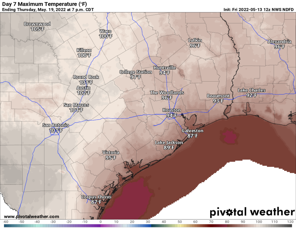
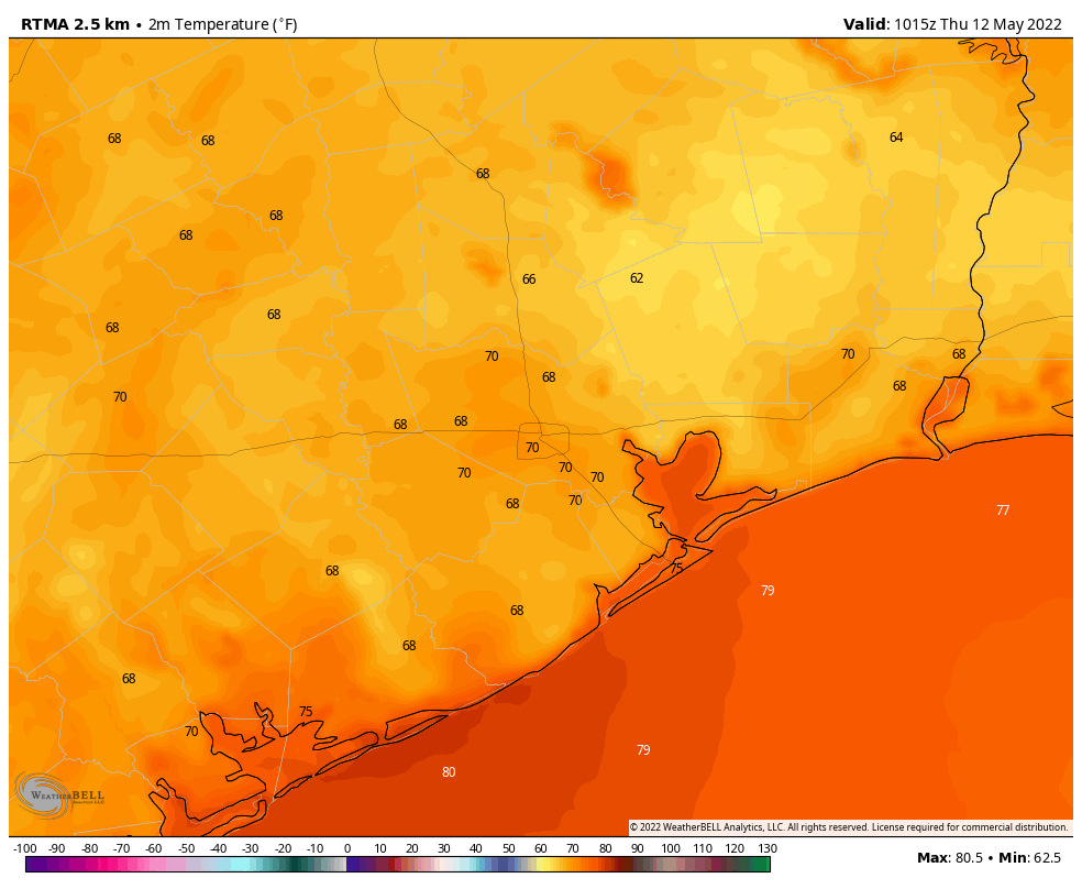
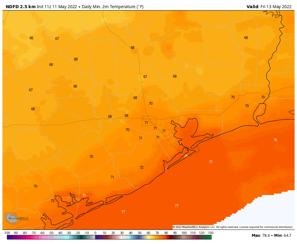
As for our more immediate weather, after a hot and sunny weekend, more hot and sunny weather is on the way. Partly cloudy skies this morning will give way to mostly sunny skies this afternoon as high temperatures rise into the low- to mid-90s. Winds will be light, at about 5 mph, out of the southwest. A few, very scattered showers may be possible later this morning as a dying storm system moves southward into the region. But I don’t think these showers will make it all the way to the metro area. Lows tonight will drop into the low- to mid-70s for most.

Tuesday

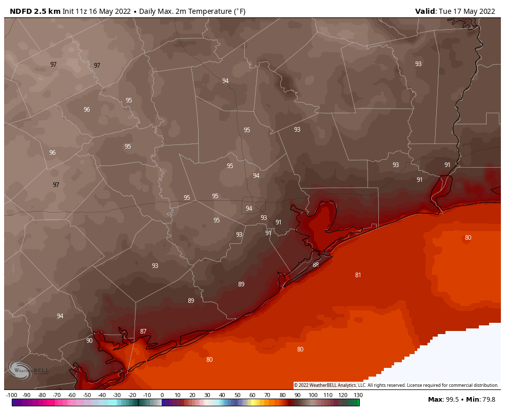
This will be another hot and sunny day with highs in the mid-90s, lows in the mid-70s, and modest southerly winds at 5 to 10 mph.

Tuesday should be a hot day across the metro region. (National Weather Service)

Wednesday, Thursday, and Friday

The high pressure system that has pushed our highs upward will start to weaken slightly during the second half of this week. Effectively that means that our high temperatures may fall back slightly, to about 90 degrees or a few ticks higher, with sunny skies. However, a few more clouds overnight should push nighttime temperatures up a few degrees. So toward the end of the week overnight lows probably will not be dropping below the mid- or even upper-70s. Rain chances remain very low, at 10 percent or less.

Saturday and Sunday

The pattern may start to change by Friday night or Saturday, as the overall flow in the atmosphere opens us up to the potential for some rain showers, and possibly even a very weak, late season front. All of this is very speculative, however. For now, let’s go with highs of around 90 degrees for each day this weekend, and a 30 percent chance of rain. Obviously we’ll have to adjust this forecast in the coming days.

Drought expands near Matagorda Bay, as heat persists for Houston

Another day of upper-80s and low-90s across the area on Thursday. And much more to come. The U.S. Drought Monitor update was released yesterday. It did show slight improvement in and north of Houston, mostly in the Brazos Valley. However, drought classified as “extreme” (level 3 of 4) continues to expand now across Matagorda County and portions of Brazoria and Wharton Counties.

Drought is creeping in from the south, as all of Matagorda and portions of Brazoria & Wharton Counties are considered to be in “extreme” drought. (NOAA)

I expect this will expand a little bit next week and then, depending on how next weekend goes, possibly even more the week after. The weather pattern across Texas continues to look abnormally hot for mid-May and also quite dry. Soil moisture continues to dry out, especially in coastal and south Texas this month. We still have time to stave off a potentially bad drought situation in Texas for the summer, but we really need a system or two to come through and give us a widespread rain. Perhaps there is some hope next weekend or beyond, but as Eric noted yesterday, our confidence in that occurring is not particularly high. So it goes.

Today through Sunday

Some slightly drier air has allowed us to turn a good bit cooler this morning, with lows in the 60s. It actually feels…nice? Whatever the case, it likely won’t last more than a few hours. The Friday through Sunday period will just be sun, sun, sun. Lather up with the SPF-a-lot and try to keep cool this weekend. Look for highs in the low to mid-90s and lows in the 70s. Each subsequent morning heading into next week looks just a little warmer and a little more humid. Certainly not as pleasant as this morning. We’re firmly into June/July-type weather.

Could it rain this weekend? Yes, if you’re lucky, you may see a shower or downpour, particularly on Saturday. I’m not expecting miracles, but don’t be too shocked if you see a passing shower or two.

Monday through Thursday

Each subsequent day looks to get just a little hotter. We’ll be firmly into July/August-type temperatures by midweek with highs likely in the mid-90s, if not hotter in some spots. Lows will be in the 70s, if not the upper-70s. And we continue to look sunny.

Forecast high temperatures for next Thursday remain very, very hot for May. (Pivotal Weather)

There’s just no meaningful relief in sight. A shower or two is possible on a day or two here or there, but again, you would be fortunate to see that.

Next weekend & tropics?

We continue to at least see hints of change coming next weekend. That could be via a cold front or passing disturbance that brings a day or two of higher rain chances. We’re not confident in exactly what it is we see just yet, but most models show at least some kind of change in things for a couple days. I’m not sure it will be quite enough to tilt the scales toward meaningful, lasting change though, as most models bring heat right back after that system exits.

I’ll close by saying that there have been a few social media accounts pushing out model data that shows a rogue tropical storm or hurricane in the Gulf on like forecast day 15 or so. Models (this one in particular, the GFS) generally do show these early season “scareicanes,” but they essentially never come to fruition, at least as shown. While, yes, we could always get tropical activity in the Gulf in late May, it would be highly unlikely to see a significant storm this early. Your best bet is tune that nonsense out. We’ll let you know if anything looks like it could realistically impact our area. It does not at this time.

If anything, next week should be a good deal hotter than this one

Good morning. Temperatures are moderately cooler this morning, with most of the region away from the coast seeing readings in the upper 60s. We’ll see one more slightly cooler night before July-like weather returns to the area this weekend. I apologize if we sound like a broken record, but we try to report things like they are, and the reality is that this unseasonably hot pattern is unlikely to change for the next 10 days. We are likely to set several high temperature records, as well as high minimums overnight.

Temperatures just before sunrise on Thursday morning. (Weather Bell)

Thursday

Skies will be mostly sunny today, with highs in the mid-80s. Winds will be fairly light, out of the south to southeast at 5 to 10 mph. Due to the diminished onshore flow we can probably anticipate one more night with overnight lows falling into the upper 60s tonight for areas well away from the coast. It won’t feel “cool” by any means, but it will sure beat our lows next week which may be as much as 10 degrees warmer.

Friday

Expect mostly sunny skies, with highs in the mid-90s and southeasterly winds at 5 to 15 mph. Overnight lows will be a touch warmer than Thursday night.

Saturday and Sunday

On Saturday, rain chances with an associated disturbance in the upper atmosphere have decreased to the point where I’d probably put them at 10 percent for areas west of Interstate 45, and 20 percent for areas east. This means that, for the most part, Saturday should be sunny and hot, with highs in the mid-90s. Expect winds at 5 to 10 mph with some higher gusts. Sunday will be the same, except the chance of rain will be near zero percent.

The outlook for next week is very, very hot. (Pivotal Weather)

Next week

Enjoy conditions this week, because next week high pressure is likely to tighten its grip even further on our region. We are talking highs in the mid- to upper-90s with overnight lows in the mid- to upper-70s for most of the region. Rain chances look to be close to nil until the weekend, at least. Some relief may finally come Sunday, May 22 or early the following week, but that’s at the end of the forecast window, so my confidence in conditions then is very low.

Hot and mostly sunny weather ahead, but at least skies should be clear for Sunday’s lunar eclipse

Good morning, Houston. The overall picture remains the same for Houston, with hot and mostly sunny weather ahead. We’ll see a pair a slightly drier nights on Wednesday and Thursday, and a low-ish chance of rain on Saturday, but mostly it is just going to feel like mid-summer in Houston.

The good news is that, with this pattern, we should see mostly clear skies on Sunday evening, when there will be a lunar eclipse. From 10:29 pm CT through 11:54 pm the Earth will move between the Sun and the Moon, casting a reddish light on our satellite. Such total eclipses of the Moon are relatively rare during the evening hours, so you should definitely check it out.

Timing for the lunar eclipse in Houston on Sunday evening. (Timeanddate.com)

Wednesday

High temperatures today will reach about 90 degrees for Houston, with slightly warmer temperatures possible for inland areas. Winds will blow out of the southeast at 5 to 10 mph, with occasional gusts to 20 mph. A slight slackening in this southerly flow tonight will allow for tiny dip in temperatures and humidity tonight and Thursday morning, with lows falling to around 70 degrees in Houston.

Thursday

Look for hot and sunny weather, with high temperatures in the low- to mid-90s. Dewpoints “bottom out” on Thursday afternoon and evening, dropping into the low 60s. This won’t be much, but it will be something as you venture outside on Thursday evening. Lows Thursday night have a chance to drop into the upper 60s for parts of Houston.

Low temperature forecast for Friday morning. (Weather Bell)

Friday

Look for hot and mostly sunny weather, with light southerly winds, and highs likely in the mid-90s.

Saturday and Sunday

Most of the weekend looks hot, sunny, and humid with highs in the mid-90s. The exception to this will come on Saturday afternoon, evening, and overnight when the atmosphere is perturbed by some passing disturbances. For now I’ll go with a 20 percent chance of rain west of Interstate 45, and a 30 percent chance to the east. Accumulations will be slight, likely only a tenth of an inch of rain, or two.

Next week

I’m afraid there’s likely to not be much of a change in this overall pattern through much of next week, which looks downright hot for mid-May, with highs generally in the mid-90s. The next real chance of rain after this Saturday probably comes next weekend, in the May 21 to May 23 time frame, as high pressure continues to dominate the central United States. We’ll be on the lookout for a pattern change, but I’m afraid the middle of May in Houston is going to feel more like the middle of June or even July.