Triple digit heat returns before cloudy, cooler, and somewhat rainier weather to end the week

The forecast for Houston is pretty straightforward: Houston will see a few more very hot days before a weak front arrives on Thursday to increase cloud cover and rain chances, and bring down temperatures a bit. Then, we are likely to see near-normal to below-normal temperatures into at least the middle of next week. Finally, the tropics may be waking up.

Tuesday

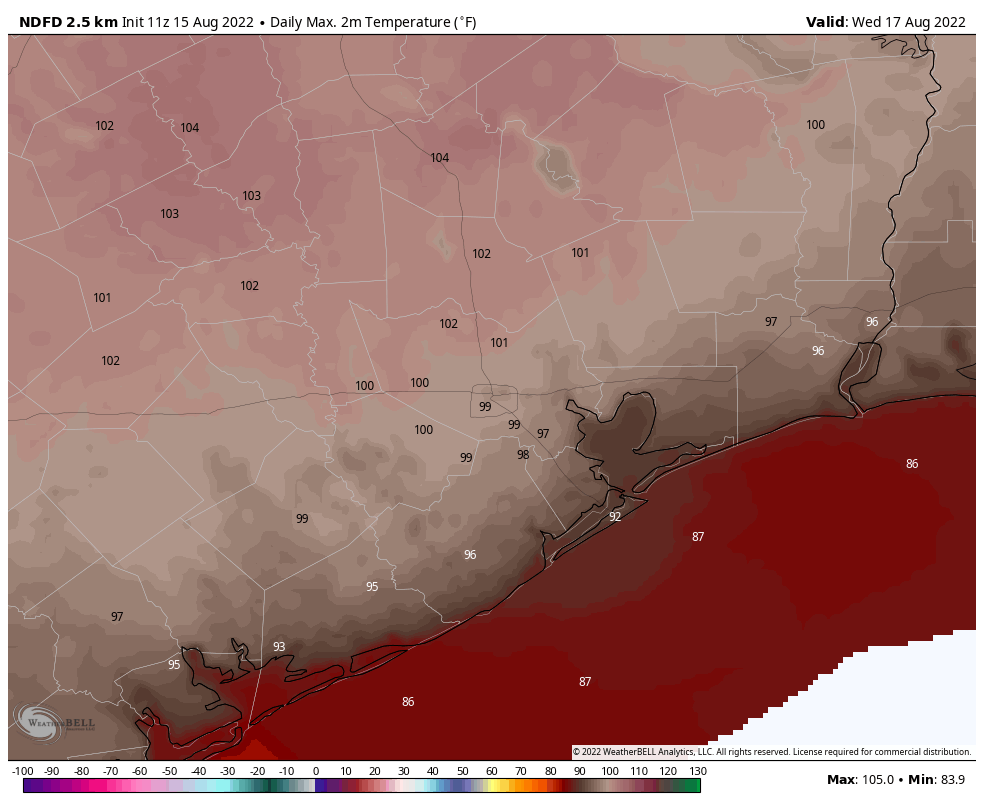
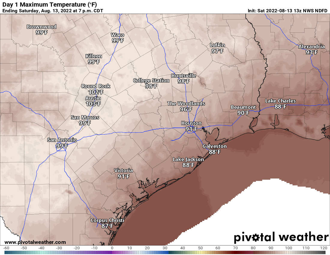
Here comes the heat. With high pressure continuing to build over the region we will see highs in the mid- to upper-90s across much of the Houston region today, with inland areas such as College Station and Huntsville likely hitting triple digits. Rain chances are, at best, about 10 percent with mostly sunny skies. Winds will be light, out of the south or southeast, at 5 to 10 mph.

High temperatures will be toasty on Wednesday (shown here) and Thursday.

Wednesday and Thursday

The heat will peak on these days, with 100-degree temperatures possible across much of the region, except for the immediate coast. Sunny skies will prevail for much of that time, but things will begin to change later on Thursday as a weak front approaches the region. This is not a classical fall cold front, mind you, when there is a distinct wind shift followed by an influx of colder and drier air. We really don’t get such fronts in August, as it’s just too early. Rather, this front will mostly perturb the atmosphere, allowing for rising air and the formation of clouds. This will, in turn, help increase rain chances and start to hold down daily highs. But because the front is unlikely to push into Houston until Thursday afternoon or so, that day is still probably going to bring triple-digit-hot for most of the area. Rain chances start to tick up Thursday afternoon or evening, likely in the form of scattered showers.

Friday

This day will probably have the best chance of rain this week, above 50 percent for the region. The additional cloud cover should hold high temperatures in the low-90s for much of the area.

Saturday and Sunday

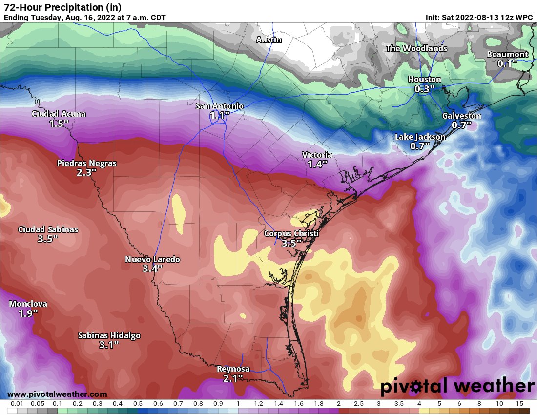
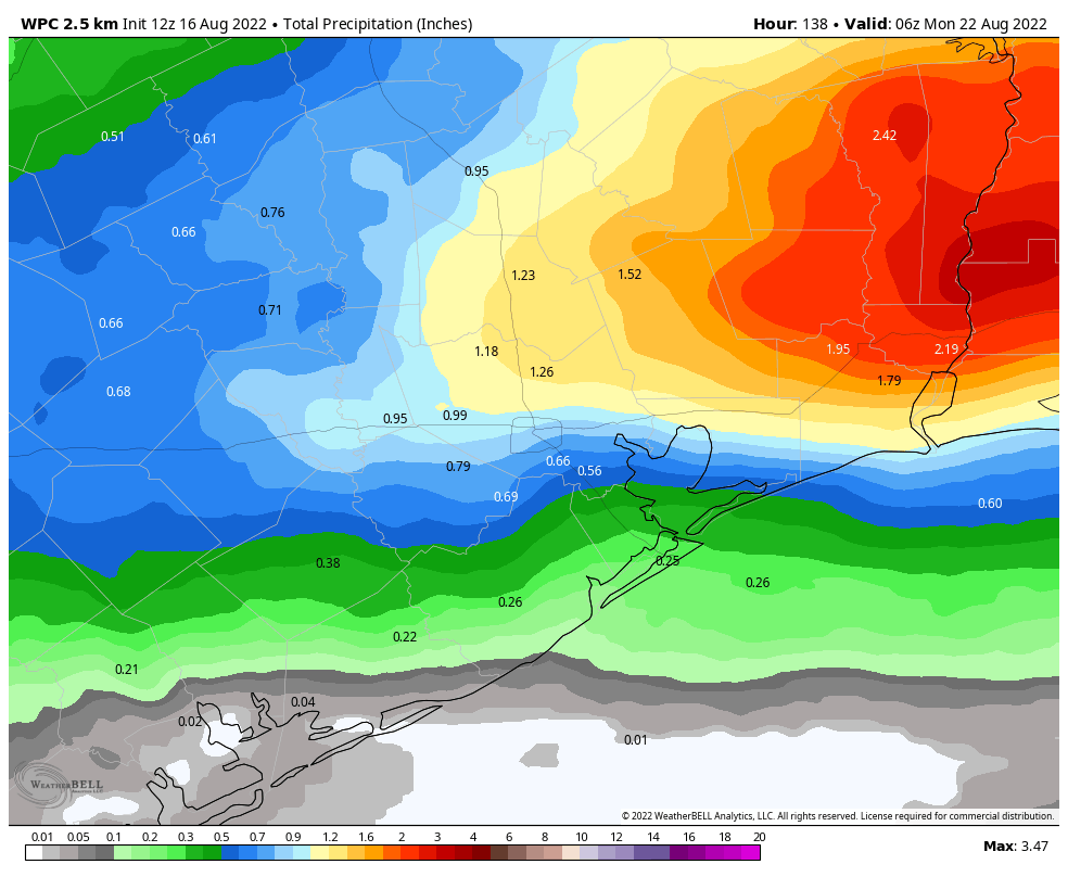
The aforementioned front is basically going to move down to the coast on Thursday, get hung up, and eventually dissipate. Nevertheless its remains should continue to help produce partly cloudy skies and decent rain chances on the order of 30 to 50 percent through the weekend. Accumulations across much of the area will vary from 0.25 to 2.0 inches, with the highest accumulations likely to the east of Houston. Highs will likely remain in the low 90s.

NOAA rain accumulation forecast for now through Sunday. (Weather Bell)

Next week

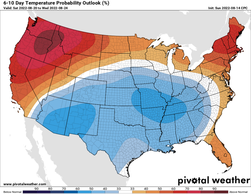
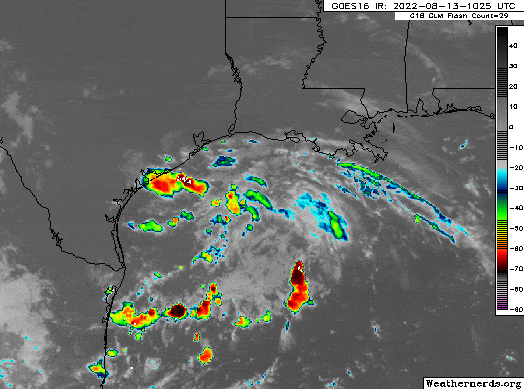
Our weather next week will be guided, to some extent, by tropical moisture streaming in from the Gulf of Mexico. Matt will have more in our weekly tropics update later this morning, but there is potential for a tropical wave currently in the Caribbean Sea to move into the Southern Gulf of Mexico toward the end of this week. There, it could start to develop into a tropical system. This is not something I think we probably need to be directly concerned about, but the system could influence our weather early next week with increased moisture and the potential for more rain showers. The bottom line is that we’re now in the middle of August, and watching the tropics closely. More from Matt, soon.

Houston turns hotter again for a few days, but some relief is on the horizon

Good morning. After several days of on-and-off showers due to an infusion of tropical moisture, high pressure will begin to reassert its influence over our weather today, and this will push our temperatures back above normal for August. The heat will peak on Wednesday before a weak front brings some relief in the form of clouds, showers, and slightly lower daytime temperatures. Miraculously, we may then be looking at a week or so of near- or slightly below-normal temperatures for August in Houston. Yes, please.

On a completely unrelated note, I’m participating in the Bay Area “Dancing with the Stars” event on September 10 that will be held at the Doyle Convention Center in Texas City. I am not a dancer by an means, but I’ve been working hard with my partner for the event, Nassau Bay City Secretary Sandra Ham, to fix that. By some miracle, Mariel Blain of Dance Visions has taught us a more than 2-minute tango. In a few weeks we will compete on stage with five other couples to raise money for the Bay Area Alliance for Youth and Families. You can find out more information here, and if you’re so inclined you can support your favorite couple by text, or buying a table.

Monday

Today will bring partly sunny skies to the region, with temperatures generally topping out in the mid-90s for much of the Houston region (far inland areas will be hotter). This is somewhat of a transition day, as high pressure is still building over the area. As a result there may still be a 10 or 15 percent chance of rain, but consider yourself lucky if you see a brief shower. Winds will be light, out of the southwest, at 5 to 10 mph.

Wednesday should be the hottest day of the week. (Weather Bell)

Tuesday and Wednesday

With high pressure fully in control we’ll see highs jump into the upper 90s to 100 degrees for much of the region. Wednesday looks like the hottest day of the week, when much of the metro area should reach triple digits. Rain chances will be low to nil for the region.

Thursday and Friday

Thursday will probably start out hot again, but the aforementioned weak front should push into the Houston area during the daytime, bringing clouds and an elevated chance of rain through Friday or Friday night. Much of the area will probably see 0.5 to 2 inches of rain during this period, but that is a general guess at this point rather than a high confidence forecast. Thursday will be hotter ahead of the front, but highs on Friday may top out at around 90 degrees. The front will not result in appreciably lower dew points, but it will at least take the sting out of daytime highs.

Below normal temperatures in August? Is such a thing even possible? (Pivotal Weather)

Saturday, Sunday, and beyond

High pressure should not reassert itself this weekend, or heading into the weekend. As a result, I think we’re looking at a fairly sustained stretch of weather in the low 90s for this weekend and beyond, with decent 30 to 40 percent daily rain chances. This could be weather like we were supposed to have in June, but did not. Either way, for the historically hottest time of the year, we’ll take anything we can get.

Tropical disturbance comes ashore near Corpus Christi bringing beneficial rain to South Texas

Invest 98L, the tropical disturbance we’ve been watching over the Gulf the last couple days, is now ashore in South Texas, ending any potential development concerns. And it’s probably a good thing, as the disturbance finally starting organizing more rapidly overnight and this morning.

Invest 98L moved ashore this morning, ending any development chances, just in the nick of time. (Weathernerds.org)

Another 12 to 24 hours over water probably would have led to a formidable named storm. Thankfully, that isn’t the case, and the steady march westward of 98L will continue through the day. For our neighbors to the south, this is about as good an outcome as you could ever ask for: Widespread drought-easing tropical rains without the damaging impacts of a strong tropical storm or hurricane.

Additional rains will add up to about 1 to 4 inches, maybe a bit more in some spots in far south Texas or northern Mexico. Flash flooding is definitely a possibility in spots, but in most cases, it should be brief and manageable. More importantly, reservoirs and rivers in that region will get a boost.

Rainfall will add up to 1 to 4 more inches in far south Texas over the next 24 hours, with localized higher amounts possible into northern Mexico, great news for parched reservoirs in the region. (Pivotal Weather)

Houston weather

For the Houston area, 98L’s last minute organization really robbed us of moisture to work with initially. As winds turn back onshore today, we should see a slight bump up in shower activity leading to more scattered action. The highest odds of rain will be near Matagorda Bay, with the lowest odds northeast of Houston. Still, there will be scattered showers around anywhere today, and even if your neighborhood will probably remain dry, it will be good to take an umbrella with you if you’ll be out and about. Highs into the mid-90s, cooler south, hotter inland.

Rain chances drop off substantially Monday, Tuesday, and Wednesday. Look for a return to upper-90s, if not 100 degrees in much of our area to start the upcoming week. Better rain chances are still on target to return Thursday or Friday, as a generally wetter, cooler pattern tries to establish over Texas. I don’t want to overstate anything, but modeling continues to strongly argue for a bonafide pattern change in Texas heading into and beyond next weekend. Eric will have more for you tomorrow morning.

Saturday showers stay mainly south of Houston, as Invest 98L tracks toward south Texas

Friday saw some very scattered rain across the area. Most inland areas got nothing, but a few spots picked up a half-inch to an inch or so. A few areas around Galveston Bay and along the coast saw a bit more. That refrain will be with us today, with inland areas mostly escaping storms, but coastal areas seeing the highest odds. This is thanks to Invest 98L, the tropical disturbance off the coast that will be tracking toward the southern part of Texas, keeping most of the rain to our south.

Invest 98L

A look at satellite this morning shows that 98L is spinning away in the Gulf. It remains ill-defined, so any development is not going to happen quickly, and it will almost certainly run out of time to become anything of note before coming ashore.

Invest 98L is loosely spinning offshore and gradually moving west-southwest toward South Texas. It is unlikely to develop, and no direct impacts are expected in the Houston area. (Weathernerds.org)

A reconnaissance aircraft is on the schedule to investigate this system around midday today, if it is still deemed necessary. The three big points from our perspective are:

1.) Any tropical development is going to be low-end and short-lived.

2.) No direct impacts are expected in the Houston area or along the coast north of Freeport.

3.) The primary issue in South Texas (Rio Grande Valley, Brush Country, Corpus Christi) from 98L will be heavy rainfall, mostly beneficial but perhaps enough to produce some flash flooding.

The heaviest rains from 98L will fall to our south, with the areas between Corpus Christi, Brownsville, and Laredo seeing mostly beneficial rain, but perhaps some isolated flash flooding as well. (Pivotal Weather)

Minor coastal impacts, like some erosion or wave runup are possible from Matagorda Bay south. For Galveston down through Surfside Beach, the water may runup the beach a good bit at high tide but flooding is not expected.

Houston area

With 98L not a direct concern for us, we will be on shower watch today. From downtown Houston to the north and west, minimal shower activity is expected today, with just a handful of downpours possible, much like yesterday. South and east of downtown, the odds of showers are notably higher, but even there it will be mostly just scattered in nature, meaning some folks won’t see rain. Wherever showers do fall, a quick half-inch to inch will be possible. Highs will range from the 80s on the coast to upper-90s inland.

Temperatures will vary widely today and could be a bit hotter inland than shown here. (Pivotal Weather)

For Sunday, expect much more of the same. Some of Sunday will depend on how organized 98L gets before coming ashore. If it can consolidate most storminess, it may keep most areas, even near the coast dry. If it remains broadly disorganized, scattered showers will be more likely, mainly south and east of downtown Houston. We’ll update you on this tomorrow!

We apologize if you did not receive an email yesterday. We had some technical issues to sort out, and hopefully those are fixed before I press send today!