In brief: In this afternoon’s update we discuss the region’s diminishing heavy rainfall threat even though a Tropical Storm is likely for form off the Texas coast on Wednesday. We also go over what you can expect from that.
The Woodlands had a day
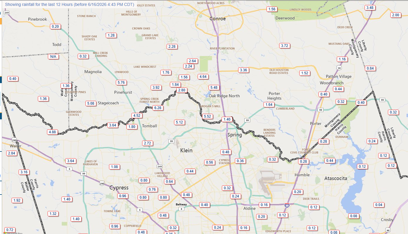
Rather than closer to the coast, the most persistent band of storms lined up along northern Harris and southern Montgomery counties on Tuesday. Some gauges along Spring Creek, including areas near Tomball and The Woodlands, picked up as much as 6 inches of rain in short order.
When we speak about highly variable rainfall totals with a few bullseyes, this is exactly what we mean. Much of Harris County received 0.5 inch or less on Thursday, but for a relatively small part of our region there were very heavy and persistent rains leading to significant street flooding. This is the textbook definition of a Stage 2 flood event in Houston. It’s pretty brutal if you’re sitting right under it, but for most of the rest of the metro area, things are just fine. Anyway, as of 4:30 pm CT the radar is largely quiet across the region.
Speaking of that Stage 2 flood alert, we are going to hold on to that overnight out of an abundance of caution. We’ll revisit things on Wednesday morning.
Tuesday night
Although some sporadic showers are possible during the overnight hours, the radar should remain fairly quiet into early Wednesday morning. So go about your business as usual.
Wednesday
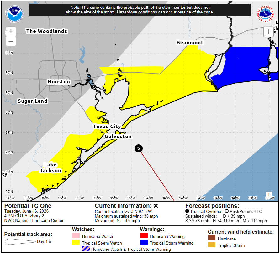
Some time on Wednesday a low pressure system may well become a tropical storm as it traverses across the Western Gulf, near the Texas coast. Its center may briefly touch land from time to time, but overall the system should continue to track to the northeast. By Wednesday evening it should be inland for good, somewhere near Beaumont or Lake Charles.
Houston’s coastal areas (including Galveston Island) may see tropical storm force wind gusts on Wednesday morning, and these will probably peak around sunrise. In terms of storm surge, expect water levels to be 1 to 3 feet above normal tide levels. So this could cause some minor flooding for low-lying coastal areas.
So what about rains? Yes, we’re going to see the continued possibility of showers and thunderstorms, and the threat of heavy rainfall looms for tomorrow. But my expectations for Wednesday is that most of Houston probably sees 0 to 1 inch of rain, with some bullseyes of 3 inches possible for a few isolated areas, most likely near the coast. Needless to say this should be pretty manageable.
The rest of the week
We’ll have more detail tomorrow, but we are now reasonably confident that Thursday and Friday will be mostly sunny days with highs in the low 90s and fairly low rain chances (if not zero). I’m not particularly confident about Saturday’s forecast as there’s a chance of some storms back-dooring in from the northeast (think 1 inch of rain, or less). Sunday looks mostly sunny and rain free.
