In brief: In today’s post we check in on the drought status in the Houston region (it’s baaack) and look ahead to next week when the region may see some meaningful relief. Also, are we just about done with highs in the upper 90s? Please?
Drought is back?
Houston has seen its precipitation fortunes wax and wane this summer, with June and most of July bringing widespread showers into the region before very dry conditions across most of the region in August. Much of the area has seen some relief this month (some areas near Sugar Land picked up more than an inch of rain on an otherwise hot and sunny day yesterday), but not everyone.
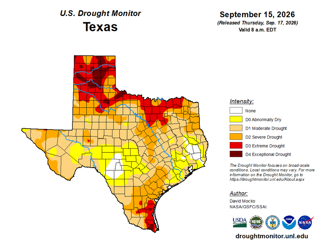
If we check the US Drought Monitor this week, we can see that some areas near Houston, particularly to the southeast including Clear Lake and all of Galveston county, have slid back into a moderate drought. I don’t expect much relief through the weekend. But what about after that?
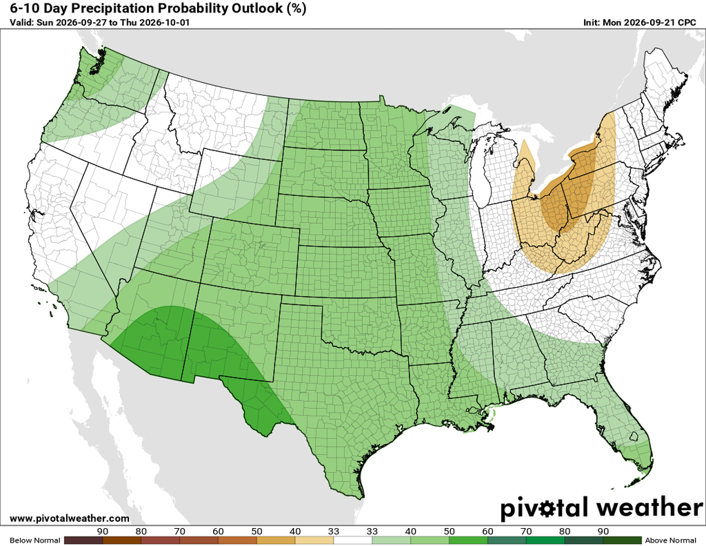
There is an increasingly strong signal in the models showing that high pressure will ease away from our region, allowing for atmospheric moisture levels to increase and bring a healthy chance of rainfall into the region. We are still about a week out, but right now it does appear as though the Tuesday-Wednesday-Thursday period of next week will bring a decent shot of rainfall, with the potential for a few inches. We’ll be keeping a close eye on things.
Tuesday and Wednesday
These will be sunny days, with uncharacteristically hot weather in the mid- to upper 90s for most of the region. We could possibly see some scattered to isolated showers and thunderstorms, like the region experienced on Monday, during the afternoon hours with daytime heating. But most of us will probably just see sunshine. Humidity remains high, with warm and sultry nights. Winds will be light, from the east-northeast.
Thursday and Friday
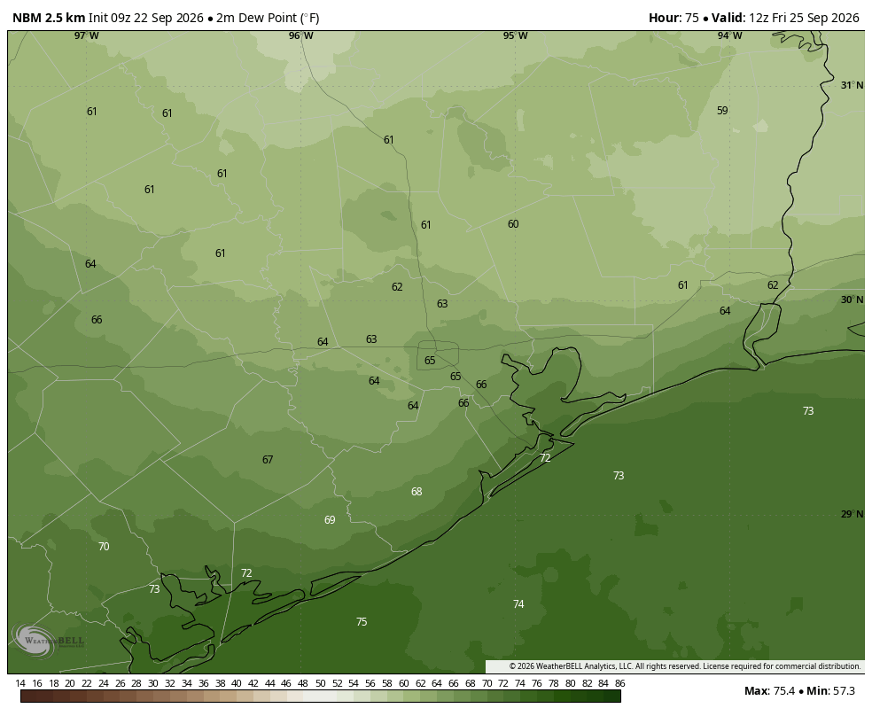
Some slightly drier air will start to arrive later on Thursday. This will not have much impact on daytime temperatures, with highs on both days likely in the mid-90s. However, it should lead to some slightly cooler nights, with lows in the low- to mid-70s and modestly lower humidity. The most noticeable time will be Friday morning. The effect will be subtle, but there. Skies will be sunny, with rain chances near zero.
Saturday and Sunday
The weekend will be sunny and hot, with highs in the low- to mid-90s for much of Houston. If you have outdoor plans this weekend there should be nothing to worry about except for the heat.
Next week
Monday should bring more of the same before we see high pressure move off, as discussed above. Right now the models are pointing toward Wednesday as having the best chance of rainfall, but it’s difficult to have any precision from this far out. As for temperatures, increased cloud cover and rain should take some of the heat out of daytime highs, possibly pushing us down into the 80s. The pattern will also open up the possibility of a real fall front moving into the region, but as of now I wouldn’t want to try to put a firm date on things. But I do feel pretty confident in saying that we should be done with this mid- to upper-90s malaise that has characterized much of September.
