Welcome to August, everyone. With an average temperature of 88.1 degrees, this month beat out 1980 (87.5 degrees) as the warmest July in Houston’s recorded history, dating back to the year 1889. Of course, Houston also experienced the warmest June in history this year. So does that mean August will be torrid as well? This is far less certain, and the first week or ten days of the month should feel mostly like a typical August. We’ll even start the month with a nice chance of rain showers today. All of this may provide little comfort, of course, as August is typically the hottest and most unpleasant of the year for Houston, weather-wise.
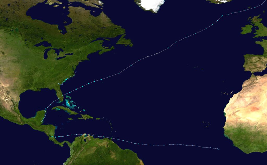
Also, as of today, we’re one-third of the way through the Atlantic hurricane season. It has been a relatively quiet start in terms of overall activity—while there have been three named storms, they have all been weak, short-lived systems. Happily, the next week or so looks pretty quiet as well. Unfortunately, most of a season’s activity comes later in August, and September, so we cannot draw any conclusions yet about what lies ahead for the Atlantic Ocean, Gulf of Mexico, and Caribbean Sea. Matt will have more tomorrow in his tropics update.
Monday
Today should bring scattered showers later this morning, and into the afternoon hours, as low pressure and a reasonably moist atmosphere support rainfall. Chances will probably be in the 30- to 50-percent range for locations south of Interstate 10, with slightly reduced chances further inland. Skies will be partly cloudy, with high temperatures likely topping out in the mid-90s. Winds should generally be light, out of the southeast, at 5 to 10 mph. Lows tonight may briefly drop below 80 degrees.
Tuesday, Wednesday, and Thursday
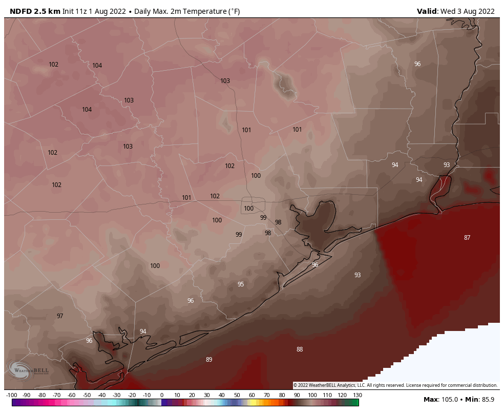
High pressure builds back into the region during the middle of the work week, and this should bring mostly sunny skies overhead. This will push high temperatures into the upper 90s, to possibly 100 degrees for inland areas. Rain chances will fall back to around 20 percent each day, with isolated to scattered showers developing along the sea breeze.
Friday, Saturday, and Sunday
As high pressure backs off, our atmospheric conditions will become more favorable for rainfall heading into the weekend. Right now I’d peg rain chances at 50 percent for both Friday and Saturday, with perhaps lesser chances on Sunday. It’s still too early for a precise forecast, but certainly we could see a fair amount of showers and thunderstorms. Regardless, partly cloudy skies should help to limit high temperatures in the low- to mid-90s.
Highs should remain in the mid-90s to start next week.
Generic August Forecast :
Hot. Humid. High near 300 F, slightly cooler near the coast. Light winds, chance of rain. Wind and rain may increase significantly due to passage of a major hurricane (or two).
We had a cloudy day yesterday and it was the first day I could be outside and not feel my skin scorching.
Eric, can you comment on why we are seeing very warm Gulf temperatures but no hurricanes? Since I was a little kid in Jr. High science, we were taught that warmer Gulf water temperature caused more intense hurricanes
Warm temps alone aren’t enough to generate tropical disturbances. The heat can help fuel an already-formed storm to higher intensities, in the presence of lower shear and other favorable factors. So necessary but not sufficient applies.
Hi Ryan — this was touched on in a post last week. Linking doesn’t always work, so look for “Eye on the Tropics: The Atlantic slumber will probably push into August” in the side navigation above.
Shakespeare Festival is this week, so hope it doesn’t rain too much.
If you see some stressed out trees in your yard–you can tell by the leaves or the needles–dump some water on your yard below them, and I mean a lit of water. You can also get some fertilizer stakes at the garden shop, just ask them for the type of tree and where to put them. I learned this the hard way back in 2011. You don’t want a weak (or dead) tree near your house when the wind blows.
“lot of water” (not lit of water)
I was thinking “only a liter ?”
So just where is this “sea breeze” located? I live about 20 miles north of San Luis Pass and it seems most of the showers are developing north of me!
The sea breeze is passing right over you and dumping moisture to the north when it condenses.
I see rain all around – the east side, southeast, southwest – but almost never on the northwest side. There’s street flooding in Aldine, and Alief. What gives? Why do we keep getting missed?
Maybe you haven’t paid Eric and Matt enough.