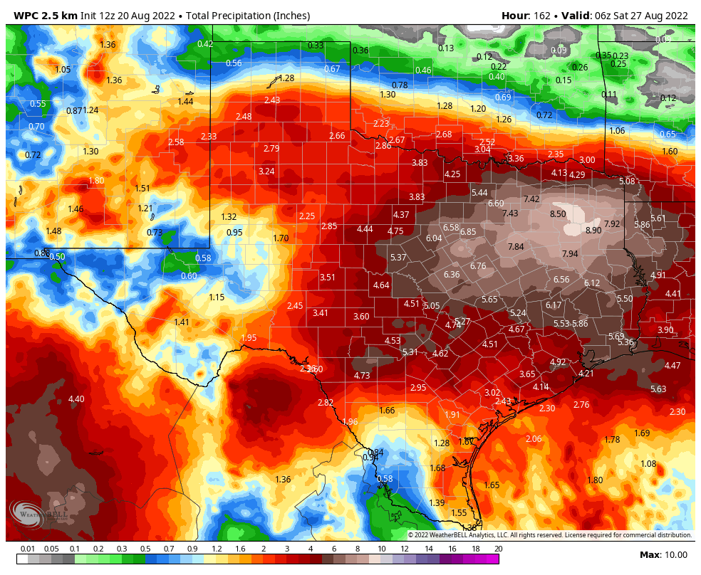
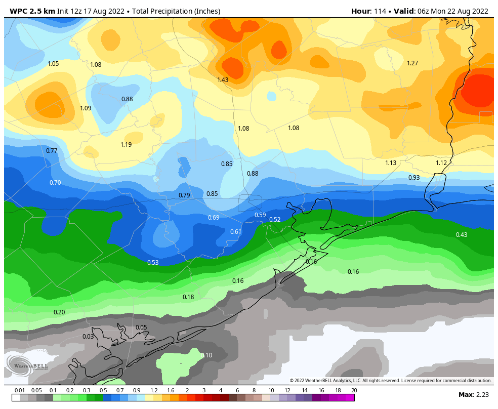
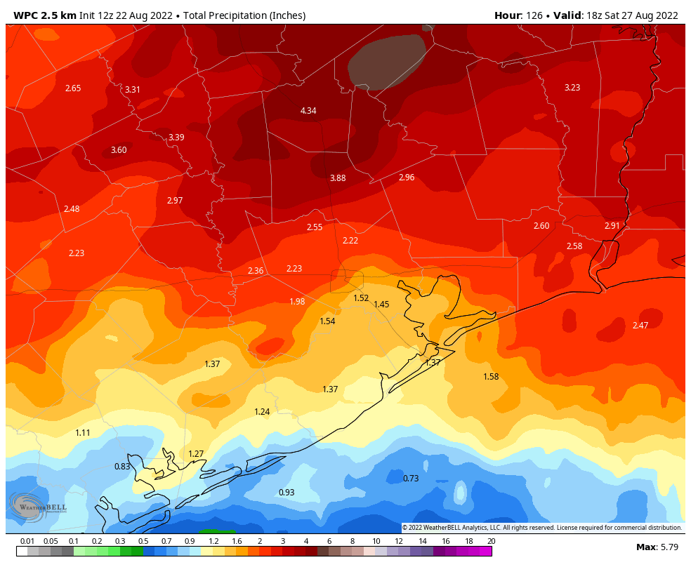
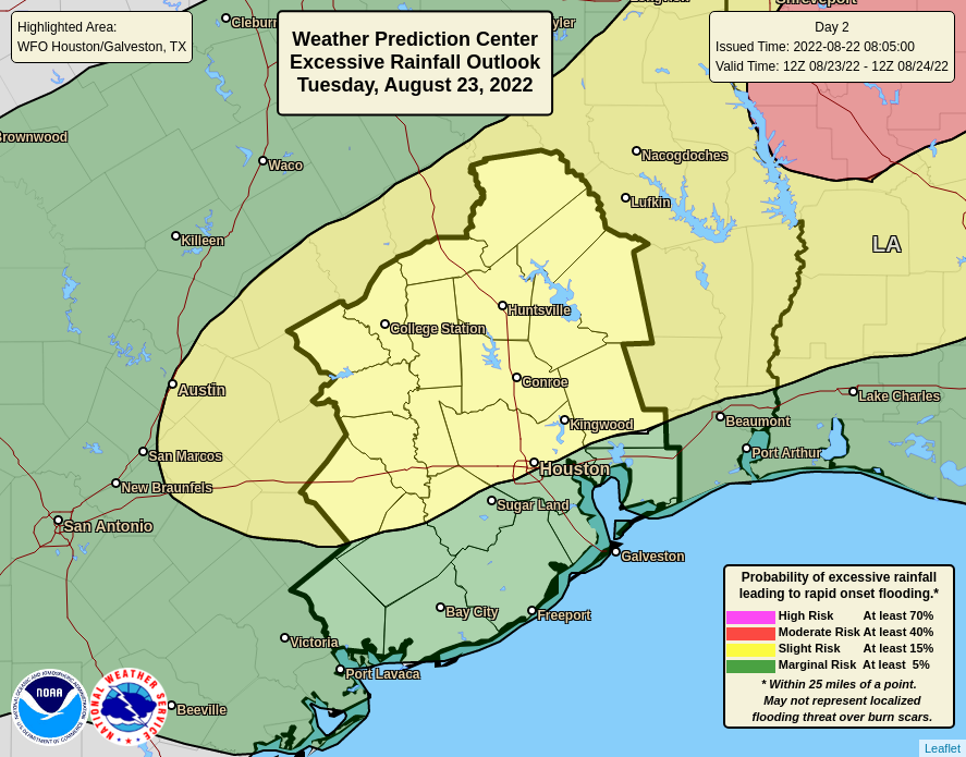
Good morning. After scattered showers and thunderstorms this weekend, the potential for more organized storms returns to Houston this week, especially areas north of Interstate 10. Most of the region will see 1 to 4 inches of rain through Friday, although isolated areas beneath the heaviest storms could see 6 or more inches. Please note that we’re not looking at continuous rainfall this week, by any means. Monday, in particular, should see a fair bit of sun.
These rains, which will likely reach their maximum coverage on Wednesday, are due to a very moist atmosphere and a series of disturbances in the atmosphere. The overall pattern will support slow-moving storms, which is a concern due to the potential for high rainfall rates. At this time we’re not expecting significant or widespread flooding in the greater Houston area, however stronger and slow-moving storms will likely flood some roadways this week.
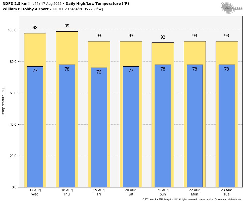
Monday
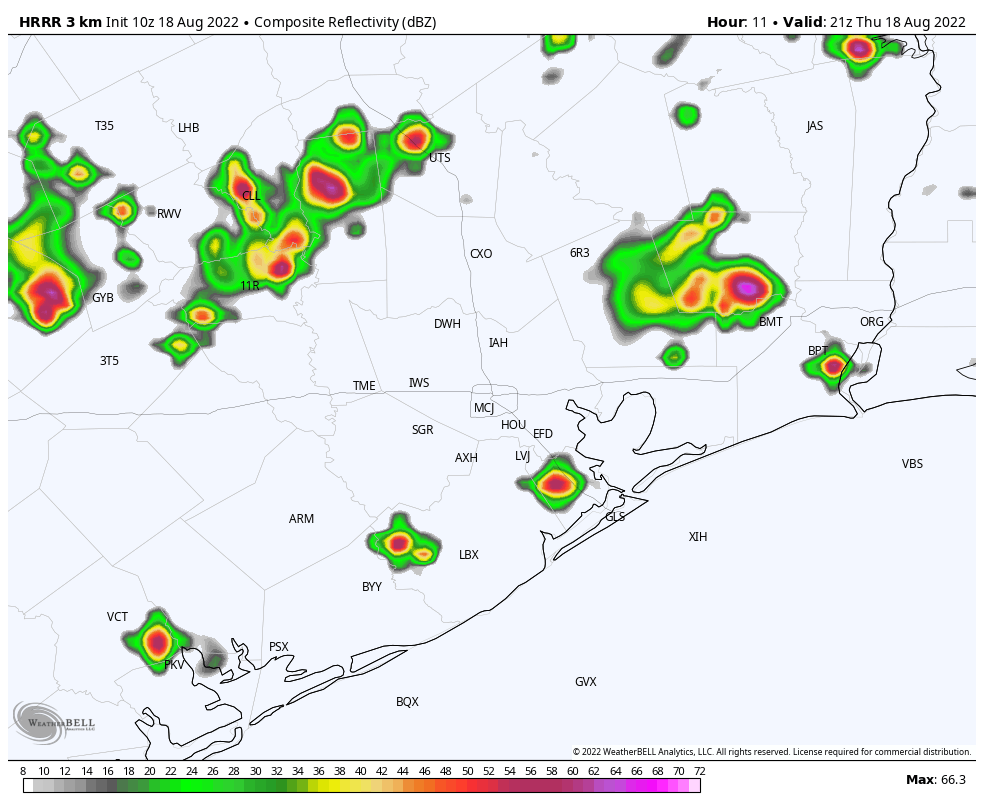
Showers today will be fairly scattered in nature, and due to at least partly sunny skies I think we’ll see a warm day with high temperatures pushing into the mid-90s for much of the area. Rain chances are likely about 40 percent for much of the day. However, late this afternoon or evening we should see a line of storms moving through our northern areas, such as Montgomery and Walker counties, in association with a boundary. This line of storms should steadily weaken, before (probably) dying around around Interstate 10. Things should quiet down overnight.
Tuesday
The potential for more widespread rainfall increases on Tuesday, with coverage of 50 to 60 percent of the area. Chances will be highest north of Interstate 10, in places such as Montgomery County. With more clouds, expect highs to peak around 90 degrees.
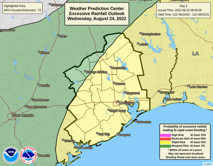
Wednesday
This is the day we expect the most widespread rain in the metro area, with chances of around 80 percent. We still don’t have great confidence in the timing of storms on Wednesday, but should be able to offer some better guidance in tomorrow’s post. Highs for most of the area should remain in the upper 80s.
Thursday and Friday
As the atmosphere starts to dry out some, rain chances should fall back to around 50 percent or so to end the work week. Look for highs of around 90 degrees, with partly sunny skies.
Saturday, Sunday, and beyond
I think the pattern will revert to more typical conditions for late summer this weekend, with partly to possibly mostly sunny skies, and highs climbing back into the low 90s. Rain chances are not zero, but likely will not be higher than 30 percent, or so, and will be driven by the afternoon sea breeze. If you were expecting us to fall into a high-pressure dominated hot weather pattern next week, don’t. All indications are we’re going to see healthy rain chances through the end of the month, with moderate highs in the low 90s.
Tropics
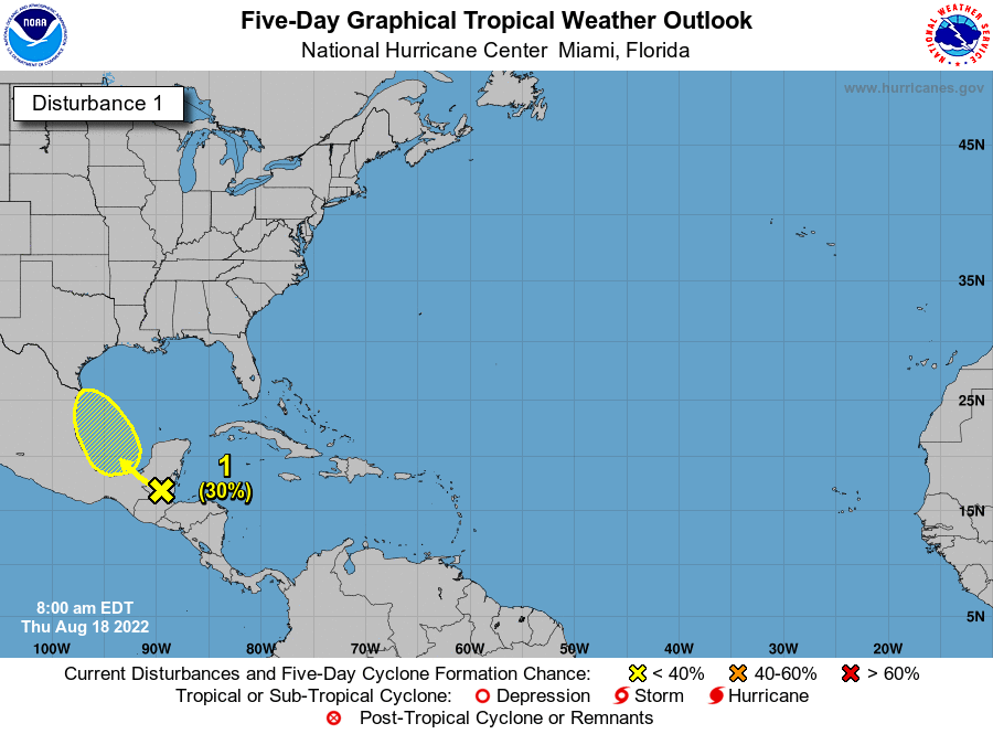
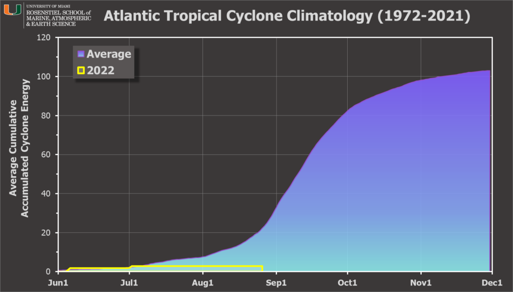
We are now officially in the heart of hurricane season for Texas, and the entire Atlantic basin. For us, this period runs for about the next six weeks, when the state is most vulnerable to hurricanes, and the Gulf of Mexico at its warmest to support them. So far, it has been a quiet year in terms of Accumulated Cyclone Energy, a measurement of the duration and intensity of tropical systems. The Atlantic basin has seen just 13 percent of its average cyclone energy through this week, according to hurricane scientist Brian McNoldy.
The tropics are waking up, however. A tropical wave that recently moved off of Africa has a chance of developing this week as it traverses the Atlantic, although it will have to combat a fair amount of dry air over the next several days so it may dissipate. Behind this wave there are more, so we should expect to see activity continue to tick up. But the good news is that the season is slower than anticipated so far, and there’s no reason to think any of these systems are going to track near the Gulf of Mexico any time soon.