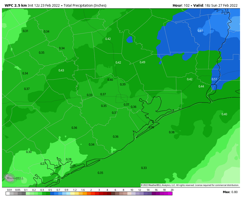
Will December ever start to feel like winter for an extended period of time?

This month has started out with significantly warmer than normal weather. So far we have experienced four 80-degree days, and the average temperature has run about 10 degrees above normal. Cooler weather has been the exception in December, rather than the norm. And this pattern seems likely to continue through at least the first two-thirds of the month. So is there any chance of a colder turn toward Christmas, the remainder of the holidays, and New Years?

NOAA’s outlook for temperatures through Dec. 22 show something of a blow-torch effect for much of the United States, including the Houston region. (Pivotal Weather)

The pattern for the middle third of the month is pretty set. We’re going to warm back into the 80s to end this work week, a strong-ish front will cool things down for the weekend, and then we’ll be back into at least the upper 70s for most of next week. So eight or even nine of the next 10 days will see warmer than normal weather. So what of the last 10 days of the month?

This extended period lies beyond the ability of our existing models for precision forecasting. However, it does look as though some sort of front may arrive around Dec. 20. After that the “weekly” models from all of our sources suggest somewhat more normal weather to end the month. That is, instead of days in the 70s and 80s, and nights in the 50s and 60s, we can more probably expect days in the 60s and nights in the 40s or 50s. At this point—and it really is way too early to say this with any confidence, but here goes anyways—I’m seeing little signal for a freeze before the end of the year. But we shall see.

The bottom line: The first two-thirds of December are going to be quite a bit warmer than normal, but the last part of the month should feel more seasonal. Probably. We think. I mean, it has to feel like Christmas sometime, right?

Thursday

There is some patchy fog west of Houston this morning, but this should burn off within a few hours. After it does, skies will remain partly to mostly cloudy, as temperatures rise into the low 80s. Some very light showers or drizzle will be possible throughout the day, but chances are less than 20 percent. Temperatures across much of the region are unlikely to fall below 70 degrees, a very sticky night for December.

Friday

This will be another warm and mostly cloudy day, with high temperatures in the low to possibly mid-80s. This will also be another day during which light showers are possible throughout the day, but accumulations should not be anything to write home about. Expect another warm night ahead of the frontal passage.

Saturday

At some point a ragged line of showers and thunderstorms will progress through the region ahead of the front. This line probably arrives in areas northwest of Houston an hour or two after midnight, reaches the city a few hours later, and arrives at the coast just before sunrise. Accumulations should measure a few tenths of an inch of rain for most. A significantly drier air mass will move in an hour or two behind the rain, and with dewpoints falling into the 30s, the air will indeed feel much drier. Highs should drop into the 50s during the afternoon hours with wind gusts reaching 30 mph. Winds start to die down a bit during the evening, with lows dropping into the 40s for most of Houston.

Low temperature forecast for Sunday morning. (Weather Bell)

Sunday

A truly winter-like day with mostly sunny skies, highs in the low- to mid-60s, and another chilly night in the 40s and 50s.

Next week

As mentioned above, we’ll see a warming trend next week, with high temperatures recovering into at least the mid- to upper 70s by Tuesday, and onward.

It’s beginning to feel not like Christmas, everywhere you go

Low temperatures are generally around 60 degrees this morning, and we’re going to be on a continuous warming trend until Friday night, when a fairly strong cold front arrives. The record high temperature for Thursday (84 degrees, 2019) and Friday (83 degrees, 1939) are both definitely in play. The weekend will see much more seasonal weather, with highs dropping back into the 60s, and lows mostly in the 40s.

Wednesday

Patchy fog this morning will burn off, leaving behind partly to mostly cloudy skies near the coast, with a little more sunshine inland. Winds will be light, shifting to come from the southeast, with high temperatures rising into the mid-70s. Temperatures tonight will be a few degrees warmer than Tuesday night, perhaps only dropping into the low- to mid-60s for much of Houston, with even warmer conditions right along the coast.

Warm air advection means Friday will probably set record highs in Houston. (Weather Bell)

Thursday

Dewpoints really start to ramp up on Thursday, into the 70s. What this means is that, in addition to temperatures rising into the low to mid-80s on Thursday, it’s going to feel rather sticky outside. Think October, not December. Some slight, scattered showers are possible during the morning hours. Overnight lows on Thursday night probably won’t drop below 70 degrees for most of the region.

Friday

As a low pressure system moves down across the central United States on Friday—this will evenutally move through Houston as a cold front—it will suck warmer air northward into the Texas coast. Effectively this means we’re going to see temperatures in the mid-80s on Friday. Again, some slight scattered showers are possible during the daytime. The front itself looks to arrive after midnight, probably reaching the coast around sunrise on Saturday or shortly before.

Rain accumulations with the front don’t look too impressive. (Weather Bell)

Saturday

A thin line of showers should accompany the front, bringing accumulations of perhaps a tenth of an inch of rain or two, into Houston. These showers should be over by sunrise, and we likely will see clearing skies by late morning or early afternoon. Temperatures will fall throughout the day on Saturday, probably into the 50s during the afternoon hours. Winds will be gusty, out of the north, up to 30 mph during the daytime, but these should start to back off during the evening hours. Saturday night will be the coldest of the week, with widespread lows in the 40s.

Sunday

This will be a splendid, mostly sunny winter-like day. Highs will peak in the low 60s, and temperatures on Sunday night a few degrees warmer than Saturday night.

Next week

Houston will see a familiar pattern, with a warming trend next week as temperatures go back into the 70s. Another front is likely toward the end of next week or into the weekend. Rain chances will likely be low, to non-existent, until that next front.

Warmth to soon return, but the weekend will feel decidedly more winter-like

This morning is pleasantly chilly for early December, with temperatures in the 50s across the area. However winds today will gradually become easterly, and this will set us upon a pretty dramatic warming trend later this week, culminating in the mid-80s by Friday. A strong front will arrive late on Friday night or Saturday morning, and reset our thermometers back to more winter-like weather.

Tuesday

Despite the chill in the air, temperatures this morning are still about 10 degrees above normal for this time of year, when we should be in the mid-40s. With skies remaining partly cloudy today, expect highs to top out in the mid-60s, with light winds turning easterly. Lows tonight will drop into the 50s tonight for all but coastal areas, which will be a bit warmer.

Wednesday

Some fog will be possible Wednesday morning as dewpoints match temperatures before sunrise. The day itself should be mild for December, with highs in the mid-70s. With mostly southeasterly winds we’ll start to see humidity levels recovering. Overnight lows Wednesday will drop into the 60s, with only far inland areas potentially dropping into the 50s.

Looks like we’re celebrating fry-an-egg Friday this week. (Weather Bell)

Thursday and Friday

These will be warm and fairly muggy days for December, with highs in the low- to mid-80s and a mix of clouds and sunshine. Some isolated to scattered showers will be possible both days, but I’d peg rain chances at less than 20 percent. Rain chances increase Friday night as a front approaches the region, but for now I think this activity will not pick up until after midnight.

Saturday and Sunday

The weekend should be clear and cold once the front passes. So when will that be? Right now the models show the front arriving in Houston by around sunrise on Saturday morning, if not a bit before. It looks like a few tenths of an inch of rain may accompany the front, but we’re not looking at anything too intense, or too long lasting. This should be a pretty clean frontal passage, with the moisture being swept out in its wake. As a result we probably will see clearing skies by late morning or early afternoon.

Temperatures will make a quick fall in the wake of the front, reaching their nadir on Sunday morning. (Weather Bell)

By Saturday afternoon temperatures will likely fall to around 60 degrees, and keep going down from there. It will feel chilly, especially with northerly winds gusting to 25 mph or higher. Right now these gusts should begin to die down during the evening hours, which is good because temperatures will be dropping into the 40s by late evening, and to around 40 degrees by Sunday morning. Inland areas outside of Houston’s urban core will likely see lows in the 30s, although temperatures most likely will remain above freezing. Despite ample sunshine, highs on Sunday will peak at about 60 degrees. It will be a fine winter day in Houston. Overnight temperatures will again get down into the low 40s in Houston.

Next week

By Monday a warming trend begins, but I don’t think we’re going back into the 80s. Mostly, next week, we should be in the 70s. So, not winter-like. But not exactly October weather, either.

Showers and a few thunderstorms possible today as a front finally brings some drier air

Good morning. A cold front is moving toward the region, and will reach central Houston by around noon, pushing off the coast later this afternoon. I’m not anticipating anything too explosive, but some showers and thunderstorms are possible with the front’s passage. We will see a brief cooldown through Wednesday before we warm up again for the second half of the week. A cold front on Saturday should bring us a more sustained stretch of cooler weather—finally allowing things to feel like winter again out there.

Also, before jumping into the forecast, several readers asked about a string of bright lights in the sky over Houston on Friday evening, at about 6:10 pm CT. I’m sharing a photo from a reader, Dave, below. The passage across the sky took about 1 minute. This was a “train” of Starlink satellites, which are launched in batches of 48 to 60 by SpaceX. The company now has a growing constellation of about 1,700 satellites to provide internet broadband service. The Starlink megaconstellation in low-Earth orbit is celebrated because it will bring high-speed internet to areas without it, but also criticized because orbit-raising trains such as this one impair the ability of astronomers to study the night sky. There are also concerns about orbital debris due to collisions as SpaceX, OneWeb, Amazon, and others assemble such constellations.

Train of Starlink satellites over Houston on Friday evening. (dave t)

Monday

High atmospheric moisture levels are allowing showers to develop south of Interstate 10 this morning, and more scattered showers and thunderstorms are possible. Rain chances will increase as a cold front passes through the area, likely around 10 am for Conroe and The Woodlands, noon for Houston, and afternoon for coastal areas. A line of showers and thunderstorms will accompany the front as it passes through. Most areas will probably see 0.5 inch of rain or less, but a few areas could pick up 1 inch or more. Rains should end pretty quickly after the frontal passage.

After a decidedly humid weekend, temperatures and dewpoints will fall this afternoon, with northerly winds and much drier air. Lows tonight will probably drop to about 50 degrees in Houston, with cooler conditions inland.

Tuesday morning will bring a splash of cold air into the region. (Weather Bell)

Tuesday

Tuesday’s temperatures will depend upon how quickly the clouds clear, but I expect partly to mostly sunny skies by the afternoon hours, with highs in the mid- to upper-60s. With the return of the onshore flow, Tuesday night will probably be 5 to 10 degrees warmer than Monday night.

Wednesday, Thursday, and Friday

A southerly flow really picks back up during the second half of the week, and this will pop temperatures back up into the low 80s by Thursday and Friday. Nights will be correspondingly warm, perhaps not falling below 70 degrees in parts of Houston. Skies will see a mix of sunshine and clouds, with rain chances probably below 10 percent.

Friday could be particularly warm for Houston. (Weather Bell)

Saturday and Sunday

A stronger cold front should arrive on Saturday, probably before noon, to end our fling with warm December weather. Some showers and thunderstorms may accompany this front as well, but at this point I think we’ll see clearing skies by Saturday afternoon, with chilly air moving in overnight, and lows dropping into the 40s. Sunday may only bring highs near 60 degrees, with mostly sunny skies, before a chilly night again. A slow warming trend likely begins Monday.