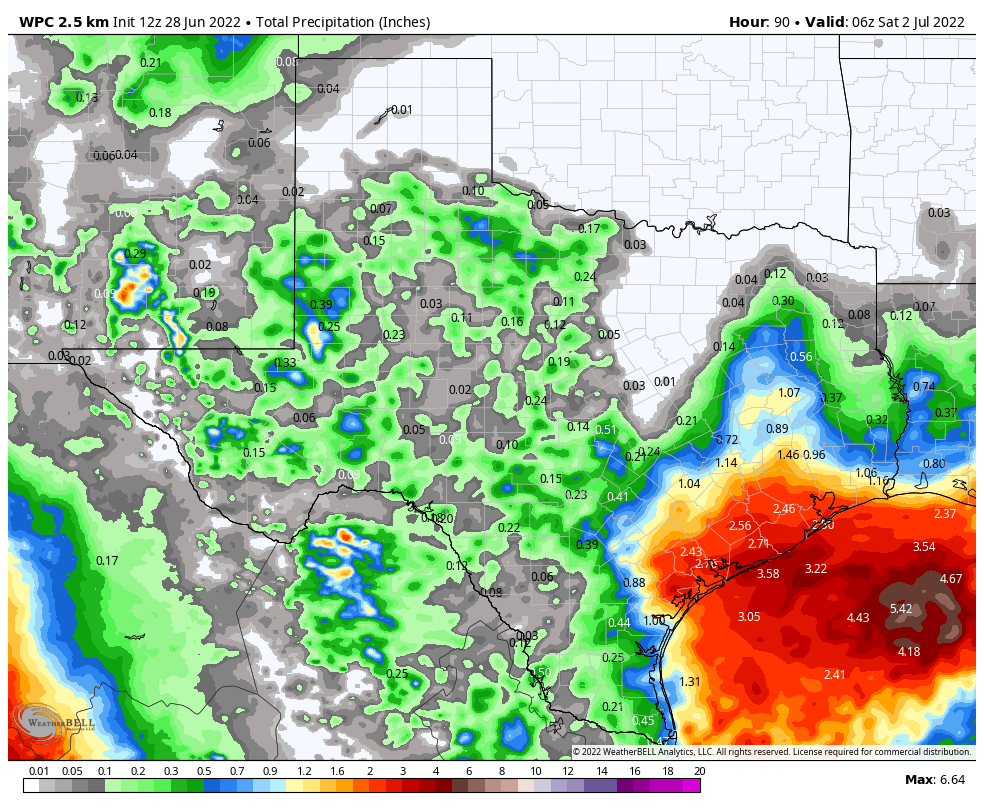
Good morning. Houston remains on track for a decidedly cooler and wetter week, with the major question facing us being how much rain the region will receive. For now, I’d expect most locations in the Houston metro area to pick up 1 to 3 inches between now and Friday. The higher end totals, generally, will come near the coast, with lower-end accumulations for inland areas north of Interstate 10.
But there remains a lot of uncertainty as a broad area of low pressure moves westward across the Gulf of Mexico, toward the Texas coast. Given this, the region could see quite a bit more rain, or rain totals could underperform. If you’re wondering about the holiday weekend, sunnier and hotter weather should return by Saturday or Sunday, ahead of the Fourth of July.
Tuesday
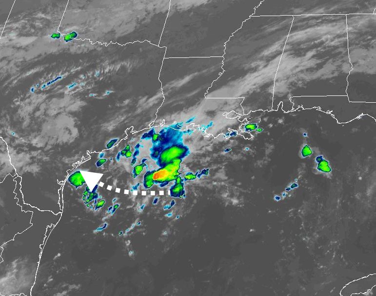
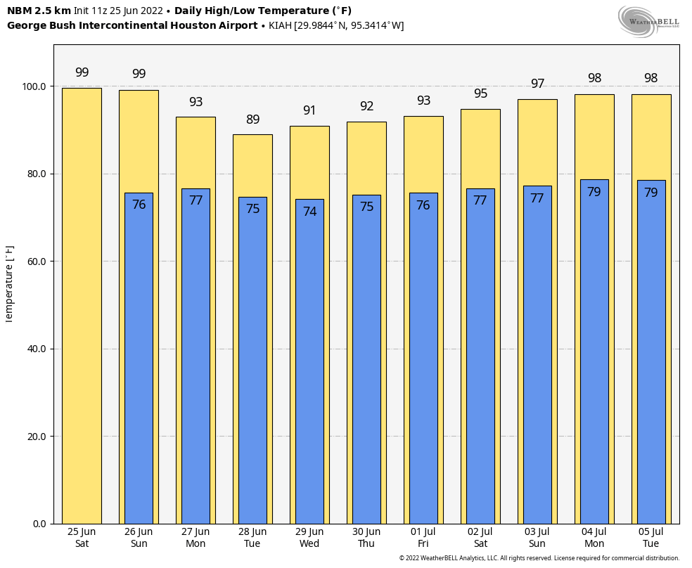
The cool front that moved through on Monday and generated showers and thunderstorms for parts of the metro area has moved offshore, and that’s where the bulk of the rain will fall today. I expect inland rain chances of only about 10 to 20 percent, with slightly higher chances right along the coast. Skies will be partly to mostly cloudy today with highs in the low- to mid-90s, and light northeast winds.
Wednesday
Rain chances start to tick upwards on Tuesday night into Wednesday as the aforementioned low-pressure system in the Gulf of Mexico starts to slowly approach the Texas coast. Still, I’d only peg rain chances at about 50 percent for the coast, with diminishing chances for inland areas on Wednesday. Again, the bulk of the rainfall should remain offshore. Look for high temperatures in the low 90s and mostly cloudy skies, with light northeasterly winds turning easterly.
Thursday and Friday
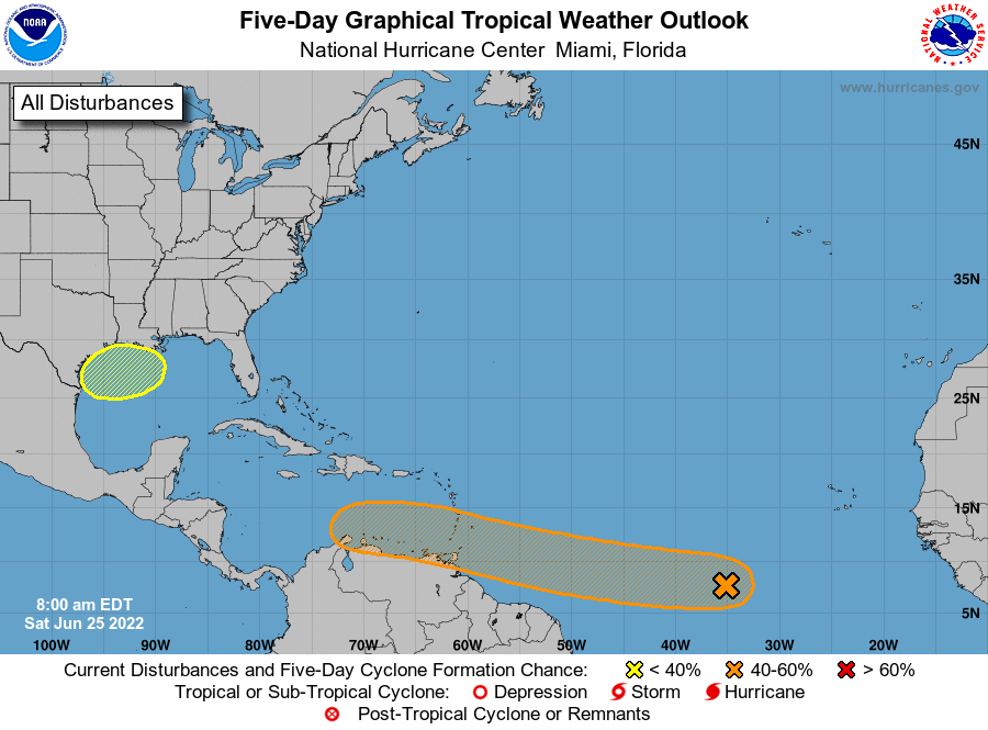
This is when the potential for heavy rainfall will peak. The key questions are where the tropical low pressure system goes, and whether it gets organized into a tropical depression. The low itself is likely bound for the south or central Texas coast. If it organizes sufficiently, this would tend to bring the heaviest bands of rainfall closer to the center of the storm, and south of Houston. If the low remains disorganized, the potential for heavy rainfall would cover much of the Texas coast, including the Houston metro region. As of this morning, the National Hurricane Center is giving the system a 30 percent chance of developing into a tropical depression or storm. Regardless of what happens, we do expect to see at least some precipitation as the upper Texas coast will fall on the eastern, or “wetter” side of the storm. The question, again, is how much.
High temperatures will depend on the extent of rain, so look for anything from the mid-80s to 90 degrees on both days, with mostly cloudy skies.
Saturday and Sunday
For now it appears as though the low and its attendant rainfall will be largely gone by the weekend, setting up a pair of partly to mostly sunny days with highs in the low- to mid-90s. I’m not ready to rule out rainfall, given the uncertainty over the next couple of days, but chances are probably in the 20 percent range, especially after Saturday morning.
Next week
By the Fourth of July, on Monday, I am reasonably confident that we’ll see mostly sunny skies and highs in the mid-90s. This is fairly typical weather for early July. Such conditions should prevail for most of next week.
Tropics
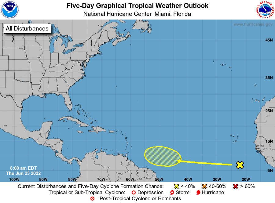
Beyond the Gulf of Mexico there is a lot going on in the tropics for late June, but none of this is a direct threat to Texas. Matt will have a full rundown for you in a tropics update later today.


