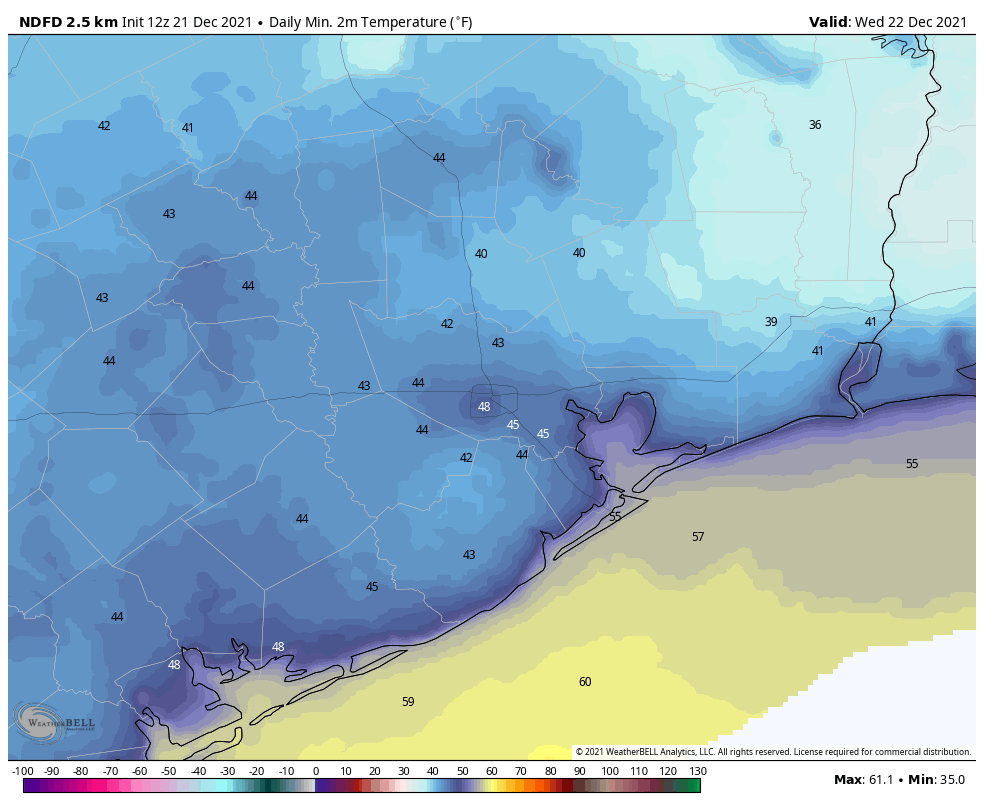
Good morning. Temperatures range from the mid-30s well north of Houston to about 50 degrees right along the coast. Overall, the forecast remains the same, with this being the nadir of temperatures for awhile, and the beginning of a warming trend that will last until … ? That is the question. Certainly we’ll be warm through Christmas Day and the weekend. Perhaps the next front comes by Tuesday or so of next week. More likely, it will be closer to New Year’s Day.
Tuesday
With clear skies and light winds, this morning offers ideal conditions for cold weather, and we’re seeing that across the region. Skies will be sunny today, and this will allow highs to reach about 60 degrees before another cool night. However, as light winds start to return from the south, temperatures will probably be 3 to 5 degrees warmer tonight than Monday night.
Your low temperatures for Wednesday morning. (Weather Bell)
Wednesday
Skies should still be mostly sunny on Wednesday, and highs will reach about 70 degrees. Winds will be out of the south at around 5 mph. Lows Wednesday night should be in the 50s across Houston, except for the coast which will be a bit warmer.
Thursday and Friday
The warming trend continues, with a pair of mostly sunny days and highs on Thursday in the mid-70s and approaching 80 degrees on Friday. Overnight lows will be solidly in the 60s.
Christmas Day
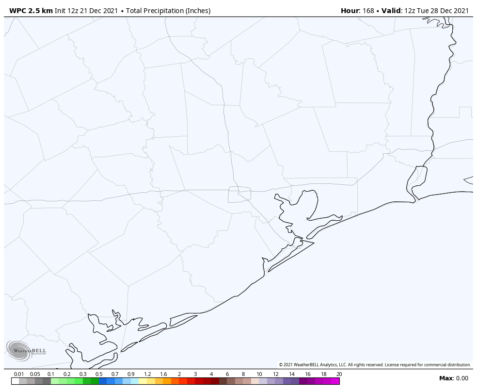
Expect more of the same: Saturday should see mostly sunny skies and high temperatures in the low 80s. Yule not need a log on the fire, that’s for sure. The good news is that rain chances are basically zero.
NOAA rain accumulation forecast for now through Monday. So yeah … dry. (Weather Bell)
Sunday and beyond
Sunday and Monday should see more warm conditions, with partly to mostly sunny skies and high temperatures in the vicinity of 80 degrees. I’d say there’s maybe about a one-in-three chance that a front makes it through around Tuesday, and if not then, a much higher chance a stronger front arrives on New Year’s Eve or New Year’s Day. This front has a chance to drive lows into the 30s in Houston, but since it’s 10 days away we’re basically in the arm-waving portion of the weather forecast.
Good morning. Low temperatures are generally in the 40s right now across the Houston metro area, and this is what a “normal” late-December day should feel like. (The 30-year average temperature for Houston is 44 degrees on December 20). The region will see two more winter-like mornings before we start a warming trend back toward something that is decidedly not normal. In fact, after the brief hiatus of winter-like weather to start this week, the remainder of 2021 looks exceptionally warm. More on this below, along with our Christmas Day forecast.
Monday
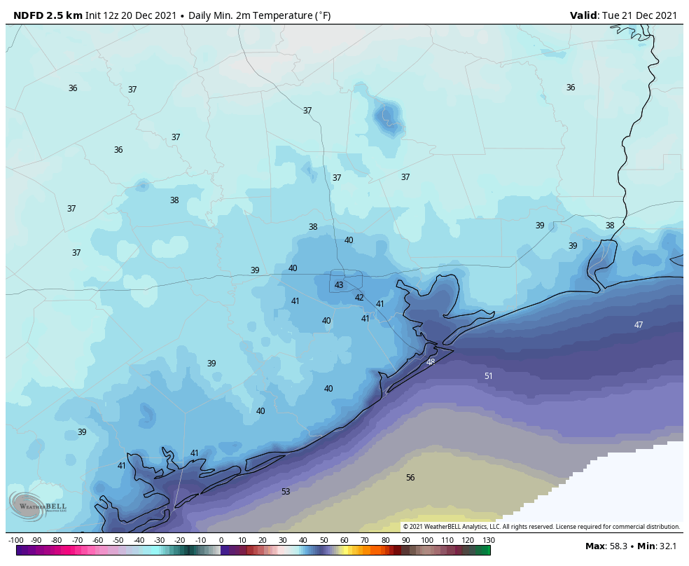
A light, misty rain moved through the region overnight, dropping about one-tenth of an inch or less. This system has now moved east of Houston, and we should see some breaks in the clouds later this afternoon. It’s still going to be chilly however, with highs likely topping out in the mid-50s for most areas. With clearing skies after sunset, this should be the coldest night for the rest of the year, with temperatures in the low 40s in Houston, and upper 30s for areas further inland.
It will be cold (for Houston) on Monday night. (Weather Bell)
Tuesday
This should be a clear, cool, and fine day with light northerly winds and sunny skies. Expect high temperatures to reach about 60 degrees. Overnight lows will probably be a few degrees warmer than Monday night, but still properly chilly for December in Houston. If you like winter-like weather, you would do well to soak up these conditions.
Wednesday, Thursday, and Friday
These should be partly to mostly sunny days, and will see a general warming trend. Expect upper 60s on Wednesday, mid-70s on Thursday, and highs of around 80 degrees on Christmas Eve. Overnight lows by Friday morning will be back into the 60s, with dewpoints to match. Rain chances are effectively zero during this period.
Christmas Day
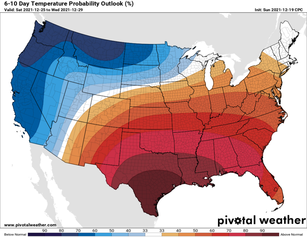
Our confidence in this period is reasonably high because as a light onshore flow returns during the latter half of this week, it will return us to a familiar pattern. Christmas morning should start out in the 60s, and fog will be a possibility—hence the need for Rudolph and his nose. High temperatures will probably get to about 80 degrees, with partly sunny skies, and then we’ll be in for another warm night. Rain chances are near zero. Yes, this forecast is still five days out, so things could always change. But the fact is, they’re unlikely to. And if you’ve been paying attention to our weather this month, except for the brief interregnums following cold fronts, you know what to expect.
The week after Christmas? Welcome to July-mas, Texas. (Pivotal Weather)
Sunday and beyond
At this point, by far the most likely scenario for next week is a continuation of our warm and muggy pattern, with highs around 80 degrees, and overnight lows in the 60s. Overall rain chances look low through at least the early part of next week. As for our next front, who knows? The next real signal in the medium-range models shows something perhaps around New Years Eve.
The bottom line: Wear your ugly Christmas sweaters today and Tuesday.
In what has quickly become a family tradition, our clan visited Space Center Houston on Sunday evening to take in Galaxy Lights, presented by Reliant at Space Center Houston. It was a lovely evening, with light winds, temperatures in the low 50s, and clear skies. As you might imagine, the space-themed holiday cheer was once again a hit with a website named after “Space City.”
It’s holiday lights—with a space twist.
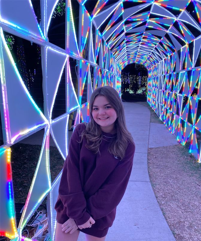
If you’ve not been before, Galaxy Lights features a mix of indoor and outdoor spectacles. You walk into and out of the museum, which is lit up with technologically advanced light displays. Many of the light displays are space-themed, from astronauts and rockets to planets. The highlight, for me, was walking through a 200-foot LED light tunnel composed of more than 250,000 lights synchronized to holiday music.
What’s nice about this exhibit is that you get both a sense of Christmas spirit as well as access to nearly all of the museum. So if you want to catch up on your space shuttle carrier aircraft history, or see a previously flown Falcon 9 rocket first stage, you’re more than welcome to do so. And if you’re just there for the s’mores, hot chocolate, and bright lights, that’s perfectly fine too. As my 14-year-old daughter can attest, there are plenty of great spots to grab a unique selfie.
Daughter: “Dad, would you take a picture of me?” Me: “Again?!?”
Galaxy Lights is open daily, except for Christmas Eve and Christmas Day, from now through January 2. The hours run from 6 pm to 10 pm CT, and it takes one to two hours to explore the holiday display. I’ve found that if you go during the latter two hours the crowds are significantly less—with little waiting to get inside, and more room to move about the many exhibits. As for weather, if you want mild conditions, this week of Dec. 13 is good. If you want a more winter-like chill in the air, the week of Dec. 20 will serve you better. For ticket information and more, click here. Enjoy the show!
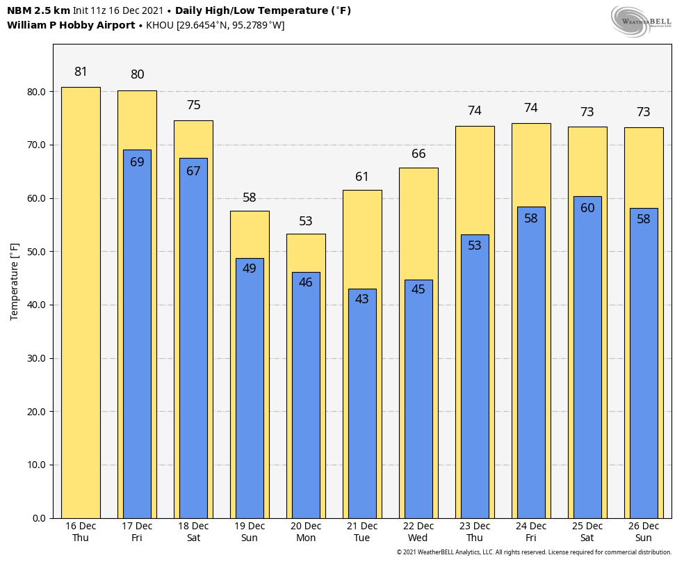
Good morning. The overall forecast for the next week is straightforward. We’ll see abormal heat for two days, and then about a five-day stretch of much more seasonable weather, with high temperatures in the 50s and 60s, and low temperatures in the 40s and 50s. By next Friday, or Christmas Eve, we’ll definitely be warming up, but the forecast for Christmas Day remains uncertain.
I’d like to note one interesting development before moving on to the daily forecast. The US Army Corps of Engineers has announced plans to study the development of a massive underground tunnel to carry floodwaters from inland parts of Houston to Galveston Bay. This is an ambitious plan that is potentially very helpful. But I think there are two important things to note. One, this is not a substitute for a coastal barrier, commonly known as the “Ike Dike.” The proposed tunnel would alleviate inland flooding, that is, heavy rainfall from tropical systems and other events. The coastal barrier would address storm surge flooding. Both inland rainfall and storm surge cause flooding, but they are very different mechanisms that require different solutions.
The US Army Corps of Engineers has already studied coastal flooding “defense” strategies. (USACE)
The other point is that 13 years have elapsed since Hurricane Ike and its storm surge, and Hurricane Harvey is now four years in the past. We simply cannot continue to “study” solutions to the problems highlighted by these storms, as the US Army Corps of Engineers has done with storm surge. We must actually build solutions to prevent their catastrophic effects. With all that said, I’m glad to see this idea get a full blown study.
Thursday and Friday
These will be a pair of warm and partly sunny days, much like we’ve experienced this week. Highs will likely reach the low 80s, and there is the slightest chance of a light shower. Mostly, however, it’s going to be warm and humid, with southerly winds blowing at 10 to 15 mph. Nights remain sticky, with lows dropping only to around 70 degrees in Houston. Both days have a chance to set record high temperatures. Not normal for December.
Saturday
Saturday morning will see more of the same before the arrival of a cold front in Houston brings some relief. The front’s timing has shifted somewhat. It now looks as though will arrive in northwest Houston during the late morning hours, and reach the coast during the afternoon. Showers and potentially a few thunderstorms will accompany and linger after the front, with overall accumulations likely on the order of 0.5 to 1.5 inches. Lows Saturday night will drop to about 50 degrees in the city of Houston, with cooler conditions inland, and a bit warmer near the coast.
Sunday and Monday
These will be a pair of partly to mostly cloudy days, with highs likely peaking in the 50s. Some spotty showers will be possible both days as the upper atmosphere remains somewhat perturbed. Things should finally begin to clear out later on Monday, or Monday evening. Lows will likely bottom out in the low 40s on Monday night, with the potential for upper 30s for some inland areas as skies clear.
Winter, finally. (Weather Bell)
The rest of Christmas week
Things stay dry and cool with mostly clear skies through Thursday morning, after which time we’re likely to see highs rebound into the 70s.
Unfortunately, I still don’t have much clarity for you after that time. I’d define Christmas morning as feeling at least somewhat “like Christmas” if the low temperature is 55 degrees or lower. Right now the odds of that are probably 40 percent, or less. But the forecast could still really go any way. At least things look pretty dry, in terms of rainfall. Perhaps Matt will have better answers for you in Friday’s post.
Speaking of the holidays, we’ll maintain a mostly normal schedule for the next two weeks, and in the unlikely event that there is inclement weather we’ll have full coverage. However, both Matt and I will be taking some time off from our regular jobs, and doing a bit of traveling. So if a post is published a little later on some days, that is why.