Good morning. The near term weather forecast for Houston will see more sunshine, and increasingly warm temperatures. Later this week our weather may, or may not, be affected to some extent by Hurricane Delta—which should become a major hurricane and move into the Gulf of Mexico. It will be discussed in depth.
Tuesday
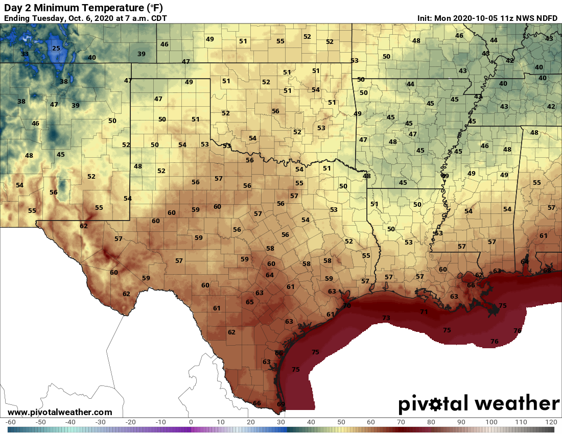
Under the influence of high pressure, Houston will see sunny skies, with highs rising into the mid-80s or so, along with a slight northeasterly wind. We should squeeze out one more reasonably cool evening on Tuesday night, with lows sliding down to around 60 degrees for inland areas, and increasingly warmer conditions toward the coast.
Wednesday
Expect temperatures to be a degree or two warmer on Wednesday, with more sunny skies. Lows Wednesday night will be several degrees warmer, possibly not falling below 70 degrees in the city and points southward.
Thursday, Friday, and beyond
Our weather for these days will be determined by the track of Hurricane Delta, which remains somewhat uncertain. For now we’d expect a modest increase in rain chances on Thursday and Friday before mostly sunny and warm conditions this weekend, with highs of around 90 degrees. But we need to see what Delta does.
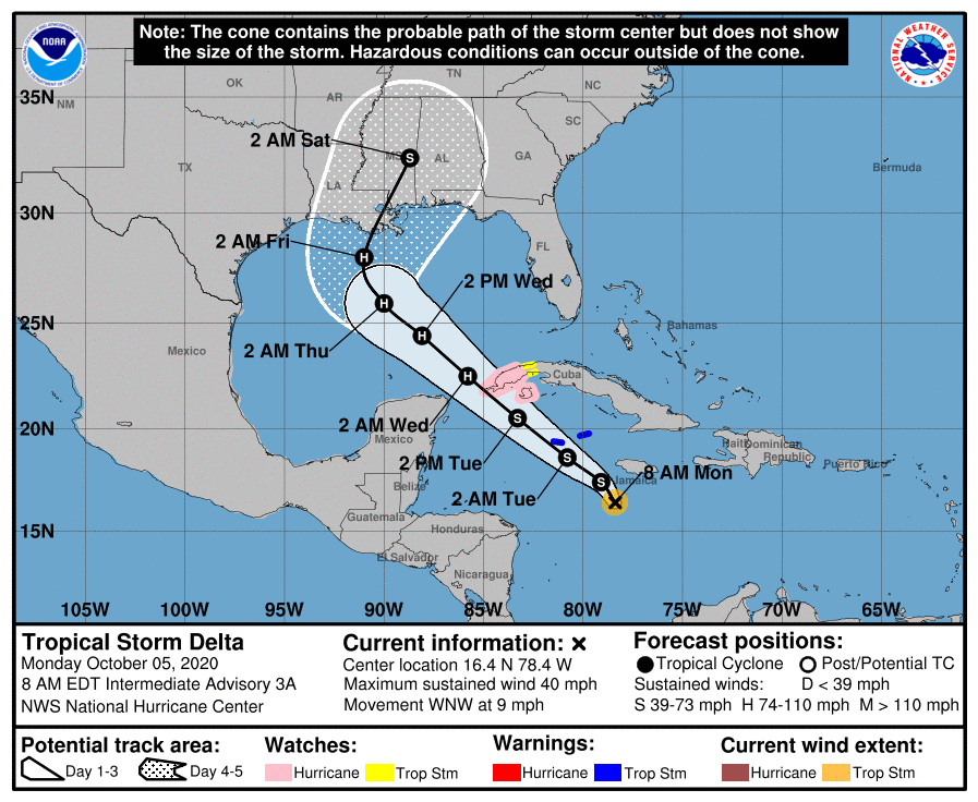
Hurricane Delta
Two things have happened during the last 24 hours that have moderately raised our concerns with regard to Delta and Houston. One, the storm has rapidly intensified, reaching sustained winds of 100 mph. It is expected to become a major hurricane before landfall. And two, there has been a westward drift in the forecast models that may bring the storm closer to Texas than anticipated. Let’s start with the track.
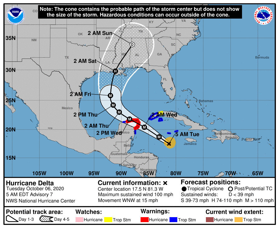
The National Hurricane Center track has shifted slightly west in response to the models, but remains centered on Louisiana. And in looking at the latest model guidance this morning, the general westward trend in the models seems to have stopped, so the current track seems reasonably on point.
Along this track we expect a major hurricane to come ashore the Yucatan Peninsula on Wednesday, with strong winds becoming a real problem for areas including Cancun. After this time the storm will move northwest across the Gulf of Mexico—toward Texas. The storm will be steered by high pressure over Florida and the Southeastern United States.
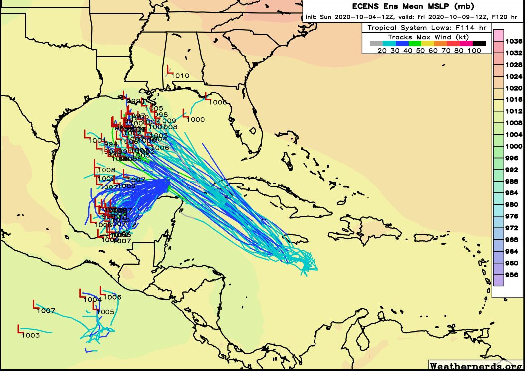
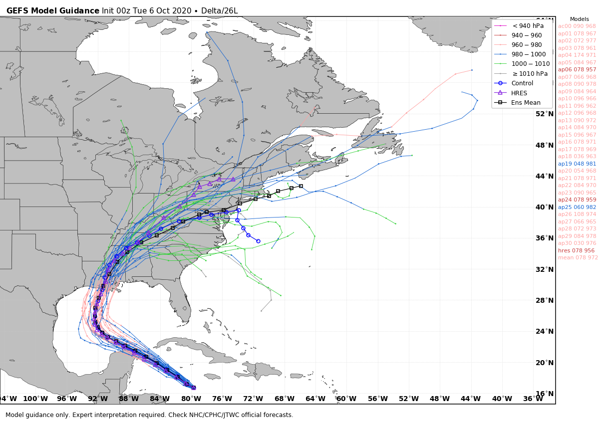
However, global models suggest this ridge will weaken this week, allowing Delta to being turning more toward the north by Thursday, bringing the hurricane to the northern Gulf coast by late Friday or early Saturday. Along this track, impacts from the storm will remain to the along the coast, in terms of swells, and to east of the greater Houston region. However, it’s going to be a fairly close thing as some models bring the storm pretty close to Texas before it turns. The National Hurricane Center track is in good agreement with the GFS model ensembles (shown below), which handled Hurricane Laura well earlier this year.
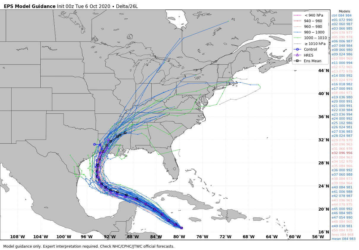
The National Hurricane Center forecasters suggest there may be a westward bias in the European model ensembles (shown below) that brings Delta the closest to Texas, like we saw with Hurricane Laura. This seems plausible, as the European model is west of most of the rest of the forecast models. For what it’s worth, I agree with this idea. The bottom line is that we’re going to need to keep close tabs on Delta to make sure it makes that turn, even if we’re reasonably confident it will turn. Needless to say, along the official forecast track, a strong hurricane coming to Louisiana after Hurricane Laura and other systems this year would make for an unwelcome mess.
Intensity
In terms of intensity, Delta has continued to deepen this morning in response to extremely warm waters and low shear. It will find similar conditions in the southern Gulf of Mexico before increasing wind shear later this week in the northern Gulf, and cooler waters closer to land, should lead to a weakening trend as it approaches land.
The bottom line is that we’re going to have to keep a close eye on Delta for a few days, as it is likely to be a fairly close call for Texas. Our next update will be posted no later than 2:30pm CT today.